25th Annual Black Diamond Fall Fundraising Party
Thursday, September 13; 6:00-10:00 PM; Black Diamond Parking Lot
25th Annual Black Diamond Fall Fundraising Party
Thursday, September 13; 6:00-10:00 PM; Black Diamond Parking Lot
| Advisory: Salt Lake Area Mountains | Issued by Mark Staples for Thursday - April 5, 2018 - 5:28am |
|---|

|
bottom line Avalanche conditions are generally safe and the danger is LOW. With minimal warming and light winds, the situation won't change much today; however, a disturbance tonight and another storm on Saturday should bring snow above 9000 feet.
|
 |
special announcement Lift tickets for Snowbasin and Powder Mountain remaining. The tickets are discounted almost 50%. Details and order information here. All proceeds from these go towards paying for avalanche forecasting and education! |
 |
current conditions Mountain temperatures this morning above 8000 feet are in the mid to upper 20's F with westerly winds averging 10 mph gusting to 15 mph. The snowpack is mostly hard and frozen with a few inches of softer snow on top. |
 |
recent activity No avalanche activity was reported yesterday. Heads up if you're considering skiing Timpanogos or other peaks further south this spring. The Provo area mountains have a very different and more dangerous snowpack. It's worth reviewing an avalanche cycle that occurred last week in that area. With more precipitation coming this weekend, we'll be watching the snowpack in that area to see how it responds and if more avalanches occur. |
| type | aspect/elevation | characteristics |
|---|

|
|
LIKELIHOOD
 LIKELY
UNLIKELY
SIZE
 LARGE
SMALL
TREND
 INCREASING DANGER
SAME
DECREASING DANGER
|
|
description
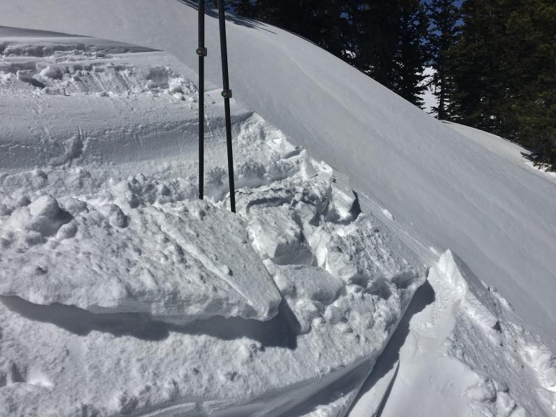
The snowpack is mostly stable but it is also hard and frozen. A few inches of snow plus strong winds Monday night created isolated wind drifts and wind slabs. These are mostly very small as seen in the photo below from Mt Tuscarora on Tuesday. Watch out for "slide for life" conditions in steep terrain where the hard icy snow means you may not be able to stop if you fall. Cloud cover today should limit warming and softening of the snowpack.
|
 |
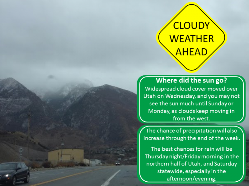
weather Today will be similar to yesterday with mostly cloudy skies that will limit much warming. High temperatures at 9000 feet should reach the mid 30's F or slightly warmer. Winds will remain light averging about 10 mph. Moisture will arrive tonight with a disturbance that will bring and inch or two of snow above 9000 feet and rain below that elevation. Cloudy skies will remain over the area Friday. A warm storm will arrive on Saturday. The rain/snow line will again be around 9000 feet and winds should increase. Above that elevation 3-6 inches of snow should fall. Sunday will have cooler temperatures and lingering snow showers.
|
| general announcements CLICK HERE FOR MORE GENERAL INFO AND FAQ The UAC has new support programs with Outdoor Research and Darn Tough. Support the UAC through your daily shopping. When you shop at Smith's, or online at Outdoor Research, REI, Backcountry.com, Darn Tough, Patagonia, NRS, Amazon, eBay a portion of your purchase will be donated to the FUAC. See our Donate Page for more details on how you can support the UAC when you shop. Benefit the Utah Avalanche Center when you buy or sell on eBay - set the Utah Avalanche Center as a favorite non-profit in your eBay account here and click on eBay gives when you buy or sell. You can choose to have your seller fees donated to the UAC, which doesn't cost you a penny This information does not apply to developed ski areas or highways where avalanche control is normally done. This advisory is from the U.S.D.A. Forest Service, which is solely responsible for its content. This advisory describes general avalanche conditions and local variations always occur. |