25th Annual Black Diamond Fall Fundraising Party
Thursday, September 13; 6:00-10:00 PM; Black Diamond Parking Lot
25th Annual Black Diamond Fall Fundraising Party
Thursday, September 13; 6:00-10:00 PM; Black Diamond Parking Lot
| Advisory: Salt Lake Area Mountains | Issued by Evelyn Lees for Sunday - March 26, 2017 - 6:23am |
|---|

|
bottom line The avalanche danger is mostly LOW this morning, but will increase to MODERATE with daytime sun and heating. It will become easy to trigger wet loose sluffs on steep slopes as the snow heats up. Continue to avoid travel below the large cornices and opening glide cracks and there is the isolated possibility of triggering a slab avalanche on an upper elevation, northerly facing slope.
|
 |
special announcement Be sure to check out the last installment of the The Little Things - habits that might keep you alive, a four part series of tricks and tidbits to help keep you on top picked up by one of our observers during years of mostly incident-free wandering in the backcountry by ski, foot, and boat. Support Wasatch Backcountry Rescue at the 3rd Annual Bow Wow fundraiser on Thursday, March 30th at 6pm at OP Rockwells in Park City. Details HERE. |
 |
current conditions Under mostly clear skies, it’s refreshingly cool this morning - in the mid teens to low 20s from the trailheads to the mountaintops. The northwesterly winds are almost calm at the mid elevations, and averaging only 10 to 15 mph along the ridgelines. Yesterday, the mountains got glazed with another small shot of 10% density snow. 3 to 6” in the Salt Lake and Park City mountains, with 1 to 4” in the Ogden and Provo area mountains. Snow totals since Thursday’s storm are 12 to 18” in the Salt Lake, Park City and Ogden area mountains. |
 |
recent activity Small dry loose sluffs were easily triggered in yesterday’s few inches of new snow at the upper elevations in the Cottonwoods. |
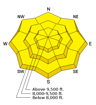
| type | aspect/elevation | characteristics |
|---|

|
|
LIKELIHOOD
 LIKELY
UNLIKELY
SIZE
 LARGE
SMALL
TREND
 INCREASING DANGER
SAME
DECREASING DANGER
|
|
description
The morning’s dry loose sluffs will turn to wet loose sluffs with sun and daytime heating. It’s amazing how quickly the snow surface heats and destabilizes once the sun comes out and temperatures warm, so be prepared for rapidly changing conditions. Wet loose sluffs will become possible on most aspects and elevations today, with the exception of upper elevation, northerly facing slopes. Reevaluate the snow often, and when it starts getting damp and loose, head to a different cooler aspect or a lower angle slope. |
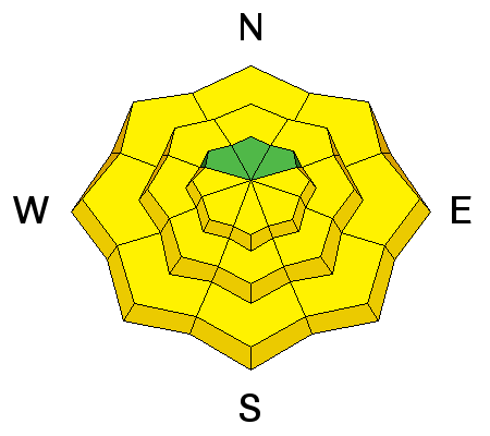
| type | aspect/elevation | characteristics |
|---|

|

|
LIKELIHOOD
 LIKELY
UNLIKELY
SIZE
LARGE
SMALL
TREND
 INCREASING DANGER
SAME
DECREASING DANGER
|
|
description
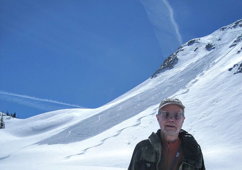
Storm Snow: In steep, upper elevation, northerly and easterly facing terrain, it may be possible to trigger a slab avalanche taking out the snow from the past 2 storms. It could be an old wind drift or snow failing on graupel pooled below a cliff. Cornices and Glide cracks: Avoidance is key for both of these. Minimize any travel beneath them, and be aware they can run long distances if they fail. With cornices, also stay well back from their edges as you travel along ridge lines. They tend to break back much further than expected, onto what looks like flat terrain. Lake Peak slide from Friday -
|
 |
weather A ridge of high pressure will bring a mostly sunny day to the mountains, with occasional high thin clouds moving over northern Utah today. Temperatures will warm into the low 40s at 8000’ and low 20s at 10,000’. The northwesterly winds will remain light, with only the high ridgelines averaging 10 to 20 mph, gusting to 30 at times. Increasing clouds tonight, as the next cool, wet storm moves into the area, with light snow starting tomorrow morning. 5 to 10” of snow is possible by Tuesday afternoon, with the rain/snow line eventually dropping to around 5,000’. Another smaller storm is possible near the end of the week. |
general announcements
|


