25th Annual Black Diamond Fall Fundraising Party
Thursday, September 13; 6:00-10:00 PM; Black Diamond Parking Lot
25th Annual Black Diamond Fall Fundraising Party
Thursday, September 13; 6:00-10:00 PM; Black Diamond Parking Lot
| Advisory: Salt Lake Area Mountains | Issued by Mark Staples for Saturday - March 25, 2017 - 5:56am |
|---|

|
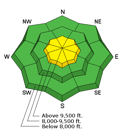
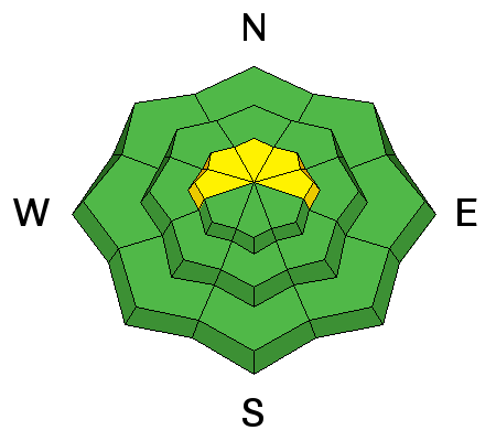
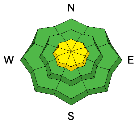
bottom line The avalanche danger is MODERATE on upper elevation slopes where you may find fresh wind slabs. By the end of the day depending on new snow amounts, you may find loose dry avalanches as well. At low and mid elevations, conditions are generally safe and the avalanche danger is LOW.
|
 |
special announcement Be sure to check out the last installment of the The Little Things - habits that might keep you alive, a four part series of tricks and tidbits to help keep you on top picked up by one of our observers during years of mostly incident-free wandering in the backcountry by ski, foot, and boat. Support Wasatch Backcountry Rescue at the 3rd Annual Bow Wow fundraiser on Thursday, March 30th at 6pm at OP Rockwells in Park City. Details HERE. |
 |
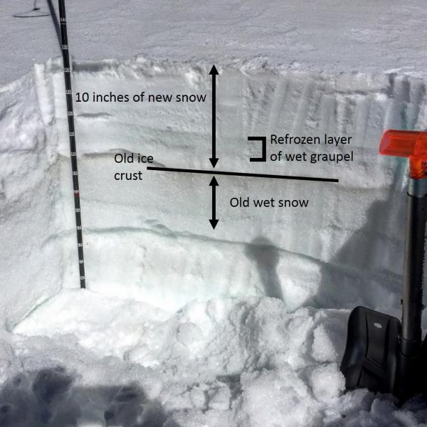
current conditions This morning: Temperatures are mostly below freezing above 8000 feet and in the upper 20's F above 10,000 feet. Overnight winds increased from the south and are blowing 10-15 mph with gusts of 30 mph. As of 5 a.m. no snow had fallen but radar showed moisture on our doorstep. Warm sunny skies yesterday caused Thursday's snow to become wet on most aspects which will have a crust of refrozen snow this morning. Due north aspects at upper elevations that did not see direct sun should still have soft dry snow. Summary of the Wednesday/Thursday storm: Thursday was the 6th wettest day ever recorded at the Salt Lake airport with 1.97 inches of water, and the wettest March day ever. (A lack of orographic lift also meant valley locations received higher water amounts than the mountains.) Wednesday brought a warm, moist storm system that deposited up to 5" of dense graupel, with 20% density. The rain/snow line was above 9500'. On Thursday a moist storm system arrived, bringing the first legitimate storm snow since March 6. The high rain/snow line from Wednesday dropped down to the benches by mid-day Thursday. Photo from yesterday on a south aspect at 9600 feet.
Total snow/water amounts were: Little Cottonwood 13.5"/1.86" |
 |
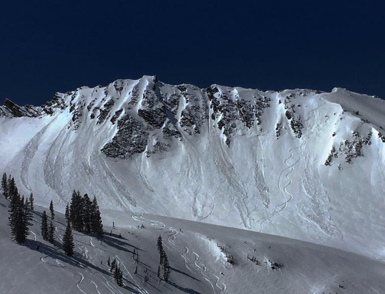
recent activity Shallow avalanches were easily triggered yesterday, both wet and dry slides occurred. I watched several riders easily trigger shallow slides on an east aspect of Clayton Peak (video). Shallow slides were also spotted in Cardiff (M. White photo below), Wolverine Cirque and Hogum/Maybird. Dry avalanches occurred in the morning and wet slides occurred as strong sunshine heated and melted the new snow.
|
| type | aspect/elevation | characteristics |
|---|

|
|
LIKELIHOOD
 LIKELY
UNLIKELY
SIZE
 LARGE
SMALL
TREND
 INCREASING DANGER
SAME
DECREASING DANGER
|
|
description
Winds increased from the south last night. I don't expect there to be widespread wind slab problems because winds will have a hard time transporting the refrozen snow but they will find some snow to move. With snowfall starting this morning, they will have more ammunition. Watching for and avoiding fresh wind slabs is always a good practice. |
| type | aspect/elevation | characteristics |
|---|

|
|
LIKELIHOOD
LIKELY
UNLIKELY
SIZE
 LARGE
SMALL
TREND
 INCREASING DANGER
SAME
DECREASING DANGER
|
|
description
By the end of today, the new snow may sluff easily. The loose dry avalanche problem will be dependent on how the new snow bonds to the Thursday's snow, and how it bonds to itself. The slightest changes in temperature, wind, snowfall rates, or the type of snow crystal can have a big effect. The interaction of these variables and sensitivity of this problem is hard to predict but easy to observe. Watch how the new snow reacts around you and if it wants to sluff easily in steep terrain. |
| type | aspect/elevation | characteristics |
|---|

|
|
LIKELIHOOD
LIKELY
UNLIKELY
SIZE
 LARGE
SMALL
TREND
INCREASING DANGER
SAME
DECREASING DANGER
|
|
description
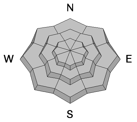
We typically worry about cornices and glide avalanches more during really warm weather, but these problems are unpredictable, and I'd watch for them today. Cornices: Avoidance is key – don’t travel beneath cornices and stay well back from the edges. They tend to break well back onto what looks like flat terrain. Glide Avalanches are possible in places where glide cracks have opened. They are most common where there are smooth rock slabs or grass beneath the snow. Try to avoid travel below these cracks, and stay out of their run out zones. Common locations include Broads Fork, Stairs Gulch and Mill B South in Big Cottonwood Canyon, and Raymond Slabs. |
 |
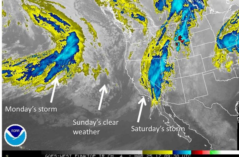
weather Snow fall amounts today will be about 3-6 inches with the rain/snow line at 7000 feet. Snowfall should end late today with clear sunny skies for Sunday. Temperatures today will rise into the mid 30's F at 9000 feet but a lack of sunshine and a passing cold front will keep it from feeling very warm. Today's winds will be gusty and shift from the SW to NW by late today. They will average 10 mph but gust 30-40 mph.
|
general announcements
|


