25th Annual Black Diamond Fall Fundraising Party
Thursday, September 13; 6:00-10:00 PM; Black Diamond Parking Lot
25th Annual Black Diamond Fall Fundraising Party
Thursday, September 13; 6:00-10:00 PM; Black Diamond Parking Lot
| Advisory: Salt Lake Area Mountains | Issued by Greg Gagne for Monday - March 6, 2017 - 5:11am |
|---|


|
bottom line It's a pretty simple recipe for today: the hazard is Considerable for wind drifts at the mid and upper elevations where you can expect to find sensitive fresh drifts on all aspects. Continued windy conditions maintain this hazard throughout the day. There is a Moderate hazard for triggering an avalanche within the storm snow, and although this hazard will decrease as the day progresses, localized snow showers may create isolated sensitive storm snow conditions during any period of high precipitation. The best and safest riding conditions today can be found in wind-sheltered terrain.
|
 |
special announcement Little Cottonwood Canyon road is closed this morning while UDOT performs control work, with a backcountry closure of the north side of Little Cottonwood canyon, Lisa falls - Grizzly Gulch. Expected opening is at 8 am. Click here to find the latest UDOT avalanche information. |
 |
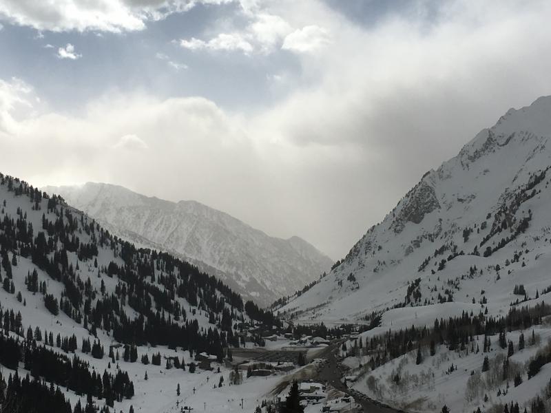
current conditions While battling the strong pre-frontal winds yesterday I kept muttering "we had better get snow out of this!" And yes, we did. As of 6 am overnight storm totals are roughly a foot in the Cottonwoods and Park City mountains, with upper Little Cottonwood topping the list with 13". Even low elevations have fared well with 11" reported at the Spruces lot at 7400' in Big Cottonwood Canyon. Temperatures have cooled significantly, and are now in the single digits and low teens at most mountain locations. However, although the winds have backed down from their very strong pre-frontal speeds, in a simple twist of fate they are still blowing moderate to strong. Many low and mid elevation stations are averaging in the teens and 20's mph, with gusts in the 30's mph. Upper elevation stations are averaging in the 20's, with gusts in the 40's mph.
|
 |
recent activity No avalanche activity was reported from the backcountry on Sunday. (Although precious few souls were out, you can always read what people were finding on our observations link.) |
| type | aspect/elevation | characteristics |
|---|

|
|
LIKELIHOOD
 LIKELY
UNLIKELY
SIZE
 LARGE
SMALL
TREND
 INCREASING DANGER
SAME
DECREASING DANGER
|
|
description
Although winds have mercifully backed down from their very strong pre-frontal speeds (11,000' stations were just under 100 mph prior to frontal passage last evening), moderate to strong winds are still blowing at the mid and upper elevations. These winds will continue to drift new snow into sensitive wind slabs. These drifts can be found mostly on north through southeast aspects, however wind speeds are strong enough to work around terrain features, so you can expect to find fresh drifts on any mid and upper elevation aspect. The following graphic shows conditions at 5am at 10,500' in Little Cottonwood Canyon, where you can see that although winds have diminished from yesterday's peak speeds, they are still blowing quite strong.
|
| type | aspect/elevation | characteristics |
|---|

|
|
LIKELIHOOD
 LIKELY
UNLIKELY
SIZE
LARGE
SMALL
TREND
 INCREASING DANGER
SAME
DECREASING DANGER
|
|
description
Although the bulk of the heaviest precipitation has passed, the storm snow may still be sensitive, particularly in the early morning. I am expecting the storm snow has bonded well to the old snow surface, and any weaknesses will be within the storm snow. Hit and miss snow showers today may create isolated and very localized conditions during any period of high precipitation intensity, so watch for fresh sensitive storm snow conditions. Any instabilities within the storm snow should rapidly settle out as the day progresses. |
| type | aspect/elevation | characteristics |
|---|

|
|
LIKELIHOOD
LIKELY
UNLIKELY
SIZE
 LARGE
SMALL
TREND
INCREASING DANGER
SAME
DECREASING DANGER
|
|
description
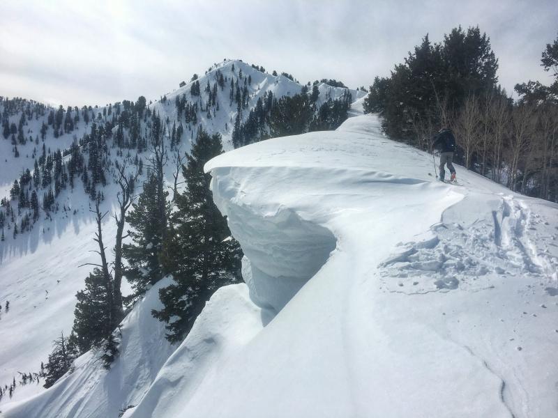
Our massive cornices will only grow larger with continued winds and fresh snow available for transport. Stay well back from the edges of corniced ridge-lines. Trent got a very nice photo of Drew from Saturday along the Alexander Basin Cornice Factory illustrating how to give a wide-enough berth to these cornices:
|
 |
weather Today will feel more like January 6, than March 6. Temperatures will rise into the low teens and winds will remain gusty at all elevations today and blowing from the west. At the low and mid elevations winds will average in the teens, with gusts in the 20's and 30's mph. At upper elevations winds will average in the 20's with gusts in the 40's mph. Hit or miss snow showers today may total 4-6" in localized areas. Continued windy conditions overnight with snow showers that may add a few more inches of snow. Enjoy the beautiful winter weather while you can as we unfortunately enter a period of warming beginning on Tuesday, and lasting through at least the end of the week. |
general announcements
|