25th Annual Black Diamond Fall Fundraising Party
Thursday, September 13; 6:00-10:00 PM; Black Diamond Parking Lot
25th Annual Black Diamond Fall Fundraising Party
Thursday, September 13; 6:00-10:00 PM; Black Diamond Parking Lot
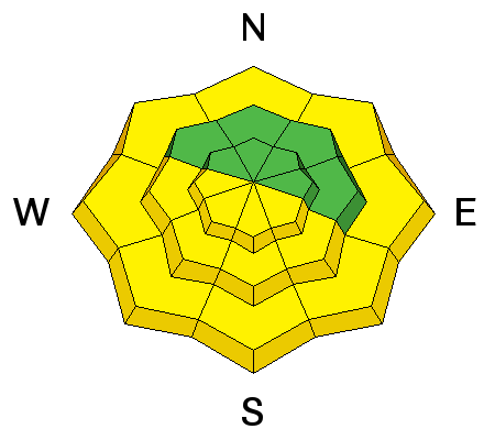
| Advisory: Salt Lake Area Mountains | Issued by Mark Staples for Monday - February 13, 2017 - 7:04am |
|---|

|
bottom line The avalanche danger today is MODERATE. On southerly aspects, expect loose wet snow avalanches as the day warms. On other aspects with good powder, there are several problems to watch for and produced many shallow avalanches yesterday. One problem that is not predictable is massive cornices found along ridgelines. Avoid being under or near these monsters which break in surprising places and further back that you'd expect.
|
 |
special announcement Wasatch Backcountry Skiing Weather: Friends of the UAC President Steve Achelis has done it again: check out his one-stop-shop page here. |
 |
current conditions Temperatures are in the mid to low 20's F this morning. At lower elevation trail heads, temperatures are in the teens F. Light winds are blowing 5-10 mph from the NE. Yesterday had gusty SE winds that drifted some snow, and high temperatures near 40 degrees F in many places. With clear skies overnight and below freezing air temperatures, snow on southerly aspects should have an ice crust on top this morning. Shaded slopes still have nice soft powder. |
 |
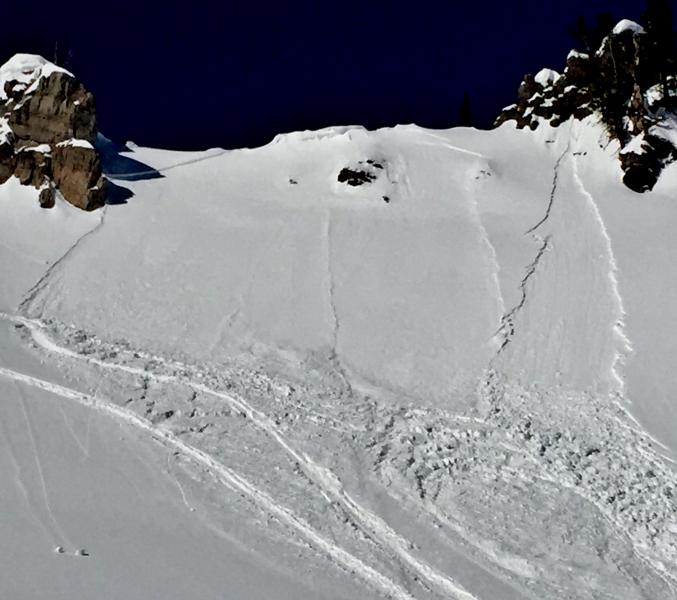
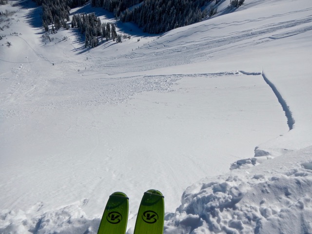
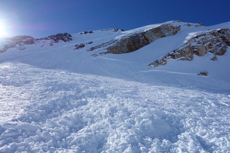
recent activity There were plenty of human triggered avalanches yesterday. Fortunately they were all less than a foot deep. Most were sluffs or point releases; however, some were soft slabs and wind slabs. Ski resorts also triggered shallow soft slab and wind slab avalanches. On southerly slopes there were natural, wet loose avalanches. A full list of avalanches is HERE. Photo below shows two natural slides, a point release and a shallow soft slab typically of many other slides triggered yesterday. 10,000 feet yesterday in the backcountry behind Alta in Dry Fork. Photo - UAC
A few shallow slabs broke over fairly wide areas but only 6-10 inches deep. Photo - Jim M.
|
| type | aspect/elevation | characteristics |
|---|

|
|
LIKELIHOOD
 LIKELY
UNLIKELY
SIZE
 LARGE
SMALL
TREND
 INCREASING DANGER
SAME
DECREASING DANGER
|
|
description
Wet loose slides occurred predictably with the first day of strong sunshine and warm temperatures yesterday. Overnight air temperatures in the 20's F and clear skies (which can cool the the snow even more than air temperatures) mean the snowpack should be refrozen this morning. The key to avoiding wet avalanches is timing. As the snow surface warms and melts, loose wet slides will start occurring but shouldn't be too big or surprising. Glide avalanches can be large and unpredictable. These can occur any time, and have been most active in Broads Fork this month. |
| type | aspect/elevation | characteristics |
|---|

|

|
LIKELIHOOD
LIKELY
UNLIKELY
SIZE
LARGE
SMALL
TREND
 INCREASING DANGER
SAME
DECREASING DANGER
|
|
description
Now is a great time to get into the mountains and enjoy beautiful sunny weather and calm winds. The avalanche problems are mostly predictable. I would be a little weary of going into extreme terrain today where the consequences of even a small slide can be severe. Given the avalanche activity yesterday, it is worth waiting another day or two before riding in such extreme terrain. Watch for these problems:
One skier was almost carried over a rock band by an avalanche yesterday. See the photo below and read more here.
|
 |
weather Today will be a repeat of yesterday with light winds, sunny skies, and temperatuers warming to near 40 degrees F. |
general announcements
|