25th Annual Black Diamond Fall Fundraising Party
Thursday, September 13; 6:00-10:00 PM; Black Diamond Parking Lot
25th Annual Black Diamond Fall Fundraising Party
Thursday, September 13; 6:00-10:00 PM; Black Diamond Parking Lot
| Advisory: Salt Lake Area Mountains | Issued by Mark Staples for Monday - January 30, 2017 - 5:45am |
|---|

|
bottom line Today the avalanche danger is MODERATE. The most dangerous problem at low and mid elevations is persistent slab avalanches but these are not an issue on all slopes. Where this problem exists, there's a good chance you can trigger a slide. At the highest elevations watch for wind slabs, and as the day heats, watch for wet loose avalanches on southerly slopes.
|
 |
special announcement Do you buy groceries at Smiths? Register your Smith’s rewards card with their Community Rewards program, and they will donate to the Utah Avalanche Center whenever you make a purchase. It's easy, only takes a minute, and doesn't cost you anything. Details |
 |
current conditions This morning temperatures range throughout the 20's F with some colder temperatures at lower elevations. West winds are blowing 10 mph gusting 15-20 mph. Late last night near 11,000 feet winds began blowing 30 mph gusting to 40 mph. Slopes on the southern half of the compass got wet yesterday and should have an ice crust on them this morning. For a short summary of last week's weather go HERE. |
 |
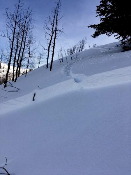
recent activity Yesterday at the head of Lambs Canyon, west of Murdock Peak, a skier unintentionally triggered an avalanche 2 ft deep and 125 ft wide (NE facing slope at 7600 ft). This avalanche broke on a buried layer of surface hoar. See photo below (M. Mooney) or click HERE for more photos. There was were similar avalanches on Thursday and Friday. These avalanches have mostly occurred on low to mid elevation slopes in seemingly benign terrain. As the snow got wet on southerly aspects there were some wet avalanches. Lastly, ski guides in Broads Fork yesterday spotted glide avalanches several days old on some of the rock slabs.
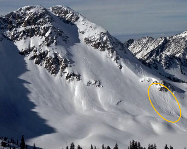
There has been little avalanche activity at higher elevations above treeline. One recent slide in White Pine Canyon was spotted yesterday (photo - S. Coffin) and a skier triggered a wind slab 2 ft deep by 15 feet wide on Saturday in Toledo Chute in upper Little Cottonwood
A full list of avalanches in the Salt Lake area is HERE. |
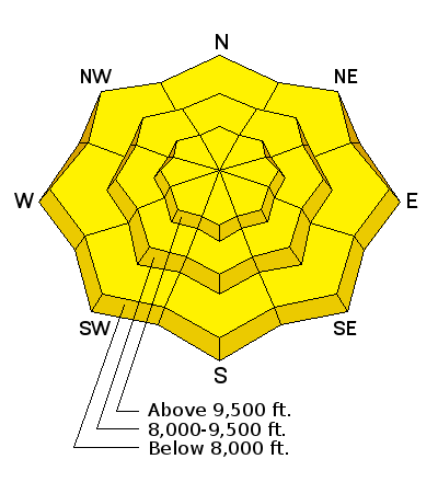
| type | aspect/elevation | characteristics |
|---|

|
|
LIKELIHOOD
 LIKELY
UNLIKELY
SIZE
 LARGE
SMALL
TREND
 INCREASING DANGER
SAME
DECREASING DANGER
|
|
description
A layer of surface hoar or small faceted crystals near on an ice crust can produce persistent slab avalanches today 2-4 feet deep and several hundred feet wide today in specific terrain. Where? Unfortunately, slopes that harbor these layers are wind sheltered slopes that are not obvious avalanche terrain. They seem benign but possibly conceal a deadly layer beneath your feet. The good news: Knowing if these layers exist on a slope is easy. Dig only 4 feet deep on a low angle slope at a similar aspect and elevation to one you hope to ski or ride. You may see an obvious stripe of surface hoar which is a bad sign. Or you may find an ice crust with small facets. Either way, doing a quick stability test like the ECT will help you find these layers because the column will cleanly fracture on them. What if you don't find these layers? These layers don't exist everywhere and many slopes are stable. If you don't find them, this avalanche problem probably isn't an issue BUT you'll have to dig more snowpits if you change location. Trent made a great video about one of Friday's slides that caught a skier who deployed his air bag just south of Murdock Peak on the Park City Ridgeline. |
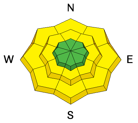
| type | aspect/elevation | characteristics |
|---|

|
|
LIKELIHOOD
LIKELY
UNLIKELY
SIZE
 LARGE
SMALL
TREND
 INCREASING DANGER
SAME
DECREASING DANGER
|
|
description
Watch for fresh wind slabs. Strong winds blew from the N Saturday night. Last night and this morning, strong winds blew from the W at the highest elevations. Today will be a great one to enjoy the sunshine and get into terrain at higher elevations, but in this terrain wind slabs will be your primary concern. As you ride back to the trailhead and lose elevation, your attention should shift to the persistent slab avalanche problem. |
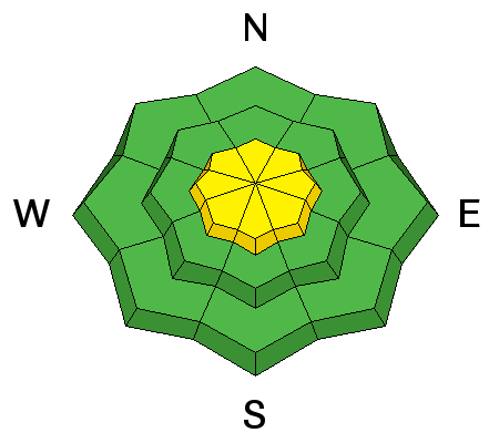
| type | aspect/elevation | characteristics |
|---|

|
|
LIKELIHOOD
LIKELY
UNLIKELY
SIZE
LARGE
SMALL
TREND
 INCREASING DANGER
SAME
DECREASING DANGER
|
|
description
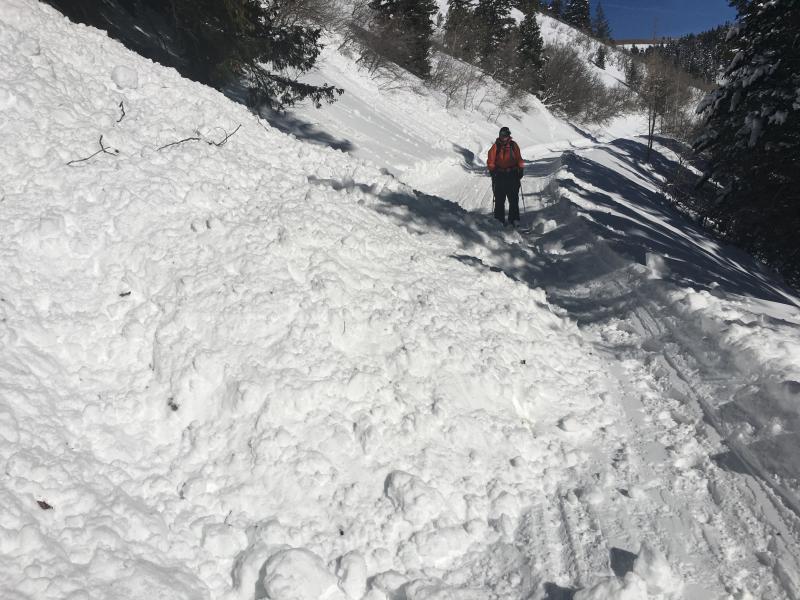
Strong sunshine should cause more wet loose avalanches today. You'll know danger for this problem is increasing because the snow will become wet, and small wet slides will start occurring. Skiers saw several wet, loose slides yesterday at low elevations near Mt. Timpanogos that were large enough to bury someone or cause serious injury being such dense, heavy snow. See photo below (E. Maginnn)
|
 |
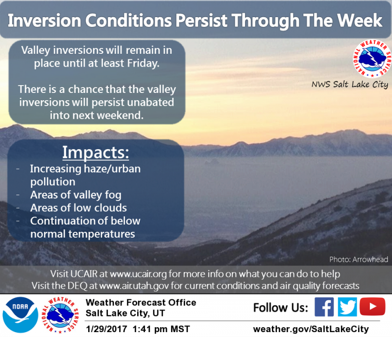
weather With a valley inversion, today is another great one to escape the haze and enjoy warm, sunny weather in the mountains if you are fortunate enough to have today off from work. Temperatures at 9000 ft should rise to near 40 degrees. Winds will blow from the WSW at 10-20 mph with some stronger gusts. Unfortunately, the inversion is supposed to be with us through at least Friday.
|
general announcements
|