25th Annual Black Diamond Fall Fundraising Party
Thursday, September 13; 6:00-10:00 PM; Black Diamond Parking Lot
25th Annual Black Diamond Fall Fundraising Party
Thursday, September 13; 6:00-10:00 PM; Black Diamond Parking Lot
| Advisory: Salt Lake Area Mountains | Issued by Drew Hardesty for Sunday - January 8, 2017 - 5:53am |
|---|

|
bottom line The danger will rise to CONSIDERABLE with wind and storm slabs up high and wet loose avalanches down low. It may reach HIGH by the afternoon/evening. It will be a day of rapidly changing conditions where caution needs to be the name of the game. Natural and human triggered wet sluffs are expected with rain on snow by the early afternoon. Roof slides, avalanches above the ice climbing gullies, and good debris piles of wet debris in creek beds and other terrain traps are expected.
|
 |
avalanche warning THE FOREST SERVICE UTAH AVALANCHE CENTER IN SALT LAKE CITY HAS ISSUED A BACKCOUNTRY AVALANCHE WARNING. * TIMING…IN EFFECT TO 6 PM MST WEDNESDAY * AFFECTED AREA…FOR THE MOUNTAINS OF NORTHERN UTAH INCLUDING THE WASATCH RANGE...BEAR RIVER RANGE...SOUTHEAST IDAHO...UINTA MOUNTAINS...MANTI-SKYLINE PLATEAU. * AVALANCHE DANGER…THE AVALANCHE DANGER FOR THE WARNING AREA WILL RISE TOWARD HIGH BY MONDAY. * IMPACTS…EXPECTED HEAVY SNOWFALL AND STRONG WINDS, COMBINED WITH RAIN ON SNOW AT THE LOWER ELEVATIONS WILL CREATE WIDESPREAD DANGEROUS AVALANCHE CONDITIONS ON MANY ASPECTS AND ELEVATIONS. NATURAL AND HUMAN TRIGGERED AVALANCHES ARE CERTAIN. THOSE WITHOUT EXCELLENT AVALANCHE SKILLS SHOULD AVOID BEING ON OR UNDERNEATH STEEP SLOPES. EVEN AVALANCHES RELEASING OFF STEEP ROOFS MAY BE DANGEROUS IN THE URBAN AND MOUNTAIN VALLEYS. |
 |
special announcement The Salt Lake City premier of The Fourth Phase from the creators of The Art of Flight will at Brewvies at 7 pm on Monday, Jan 9 as a fundraiser for the Utah Avalanche Center. For tickets and details, go to https://utahavalanchecenter.org/event/fourth-phase What happens if something goes wrong? Backcountry Emergencies - It outlines your step-by-step method in the event of a winter backcountry incident. |
 |
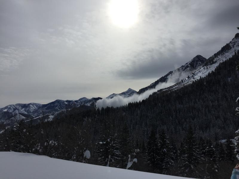
current conditions The warm front is upon us. As of 5am, snow numbers are 2-4" (0.35") in the Cottonwoods and Park City ridgeline with 3-4" (0.5") in Ogden and 6-8" (0.97") in Provo. Mountain temperatures continue their upward march into the upper 20s (in many cases, 30°F warmer than they were 48 hours ago). The west to southwesterlies hum at 15-20mph, gusting to 30. Week in Review by Greg Gagne The New Years holiday weekend featured clear skies and Low avalanche hazard. Beginning late Sunday night, a storm system came in that lasted through Tuesday morning. Storm totals in the Cottonwoods and Park City mountains were upwards of 2' with close to 2" of water (SWE). This low density snow fell on a preserved layer of near surface facets and surface hoar. Although there was one skier-triggered slide reported on Monday that failed on this layer, most avalanche activity through Tuesday was only sluffing within the storm snow as the low density snow was not acting as a cohesive slab. On Wednesday and Thursday the UAC issued an avalanche warning with the arrival of a storm system that brought dense snow and strong winds. The Ogden mountains northward received the brunt of the snowfall with over 2' of snow and widespread avalanche activity. The Cottonwoods and Park City mountains received 12-18". The Provo mountains received 29" with 4.5" of water, and went through a significant natural avalanche cycle on all aspects and elevations Wednesday and overnight into Thursday. There are several excellent observations from this past week that provide useful information as you prepare for your weekend plans. |
 |
recent activity No reports of activity in the backcountry in the central and northern Wasatch. A natural avalanche ran in the east chute of Elk Point in the Provo mountains yesterday that had an impressive powder cloud but not much debris. The starting zone is roughly 10,200' with the powder cloud running 3000'. (Johanna photo/Turley-Keeler video below)
|
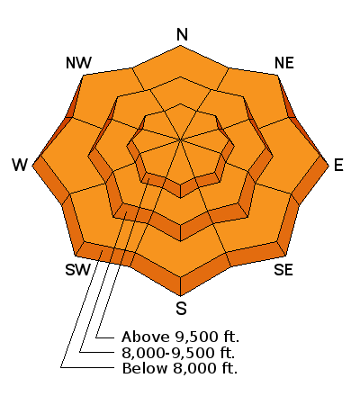
| type | aspect/elevation | characteristics |
|---|

|
|
LIKELIHOOD
 LIKELY
UNLIKELY
SIZE
 LARGE
SMALL
TREND
 INCREASING DANGER
SAME
DECREASING DANGER
|
description
|
| type | aspect/elevation | characteristics |
|---|

|
|
LIKELIHOOD
 LIKELY
UNLIKELY
SIZE
LARGE
SMALL
TREND
INCREASING DANGER
SAME
DECREASING DANGER
|
|
description
With the warming trend, I expect to see snow changing to rain over the course of the day with the rain/snow line rising to 8500'. Rain on cold dry snow is never a good thing and wet loose slides should run like clockwork around the compass up to these elevations. There is uncertainty of how much rain, but suffice it to say, natural and human triggered wet loose slides will be likely by the afternoon. Our Logan forecaster Toby Weed has a public safety briefing below. Link here. Roof slides, wet sluffs above many of the ice-climbing gullies, even sluffs coming down and piling up deeply in creek-beds and other terrain traps are all likely and cause for concern for user groups other than backcountry skiers and riders - give a hint to friends/family. |
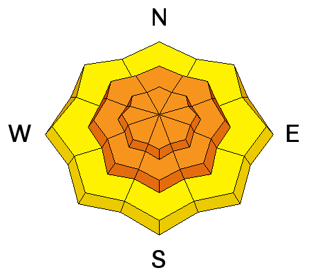
| type | aspect/elevation | characteristics |
|---|

|
|
LIKELIHOOD
 LIKELY
UNLIKELY
SIZE
LARGE
SMALL
TREND
 INCREASING DANGER
SAME
DECREASING DANGER
|
|
description
An outlier - the mid to low elevations have the poorest snow structure, owing to the mid-December storm. On many aspects up to 7500', a currently dormant structure of 12-18" of snow sit above a thin layer of facets above the December 16th rain crust. With enough stress through wind and precipitation, this layer may become active (as it has in the Provo area mountains). |
 |
weather A tough one. Snow should change to rain today with a rain/snow line rising to 8500' with 4-8" of dense, upside-down (trending heavier) new snow expected at the higher elevations. West-southwest winds should ramp up toward 40mph by the afternoon. Temps will rise to near 30 at 10,000' and near 40 at 8000'. Moderate snow will continue overnight into tomorrow, with heavier snowfall rates associated with frontal passage in the afternoon. Continued ripples of warm and cold air advection with a moisture tap should keep precip going through Thursday. Bottom line, we could see 2-3' of snow and moderate to strong winds over the next several days. |
general announcements
|