25th Annual Black Diamond Fall Fundraising Party
Thursday, September 13; 6:00-10:00 PM; Black Diamond Parking Lot
25th Annual Black Diamond Fall Fundraising Party
Thursday, September 13; 6:00-10:00 PM; Black Diamond Parking Lot
| Advisory: Salt Lake Area Mountains | Issued by Evelyn Lees for Tuesday - December 20, 2016 - 6:47am |
|---|

|
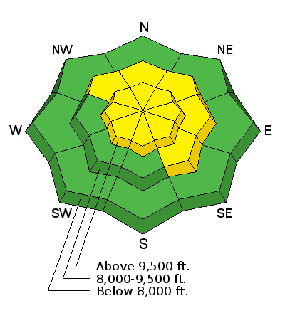
bottom line There is a widespread MODERATE avalanche danger today at the upper and mid elevations. Hard wind slabs can be triggered along the ridgelines or in open bowls and long running sluffs can be triggered on steep slopes. There is an isolated chance of triggering a deep slide of all the storm snow on an upper elevation, rocky northerly facing slope.
|
 |
special announcement Once again this winter, our partners at the Wasatch Mountain Club are matching WMC member donations to the Utah Avalanche Center. If you are a WMC member and value avalanche forecasting and education, please send a check made out to the Utah Avalanche Center to the WMC at 1390 South 1100 East #103, Salt Lake City, UT 84105 |
 |
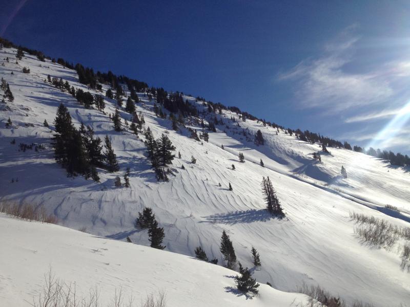
current conditions Skies are partly cloudy this morning and temperatures mild – in the mid 20s to mid 30s. The southwesterly winds have decreased since yesterday afternoon – most stations are averaging 10 to 15 mph, with the highest peaks 20 to 30 mph. Between the wind hammered ridgelines and open bowls to the sun crusted southerly facing slopes, the best bet for excellent powder is on shady wind sheltered slopes. Wind affected open bowl. Greg Gavin photo
|
 |
recent activity Yesterday, dry sluffs large enough to carry a person were easy to trigger in steep terrain. People avoided the new hard wind slabs. Explosive work in the Cottonwoods and Ogden area mountains triggered wind slabs and several larger slab avalanches taking out the storm snow, failing on a shallow layer of facets. There were also a few small wet loose sluffs. |
| type | aspect/elevation | characteristics |
|---|

|

|
LIKELIHOOD
 LIKELY
UNLIKELY
SIZE
 LARGE
SMALL
TREND
 INCREASING DANGER
SAME
DECREASING DANGER
|
|
description
Yesterday’s wind slabs are still sensitive to the weight of a person. Scattered along ridgelines and in open bowls, most of these are hard slabs – a slab avalanche that will break above you, not at your feet. Slope cuts are NOT effective on these. If winds increase again this afternoon where you are, expect additional drifting of the snow and a new sensitive wind slabs. |
| type | aspect/elevation | characteristics |
|---|

|

|
LIKELIHOOD
LIKELY
UNLIKELY
SIZE
 LARGE
SMALL
TREND
 INCREASING DANGER
SAME
DECREASING DANGER
|
|
description
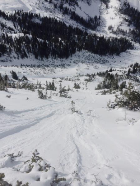
On wind sheltered, steep slopes you can trigger a loose sluff just large enough to catch and carry a person. Terrain matters here – it would be bad news if you got carried off a cliff or into a tree. I don’t expect any wet sluffs today, with afternoon clouds and winds keeping the snow surface cooler. Long running sluff. Tom Diegel photo
|
| type | aspect/elevation | characteristics |
|---|

|
|
LIKELIHOOD
 LIKELY
UNLIKELY
SIZE
 LARGE
SMALL
TREND
INCREASING DANGER
SAME
DECREASING DANGER
|
|
description
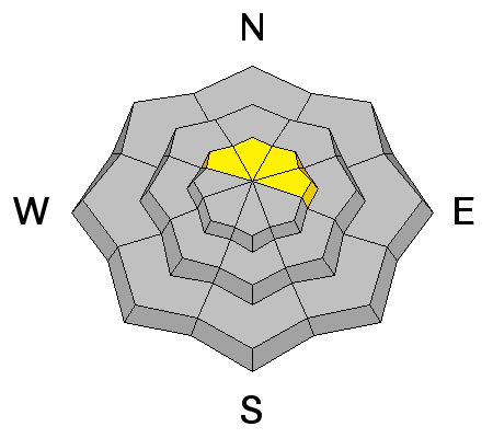
The two deeper slides in the Cottonwoods indicate there are still a few places where a larger slide could be triggered, taking out all the snow from last weekend’s storm. This would be most likely on an upper elevation, northerly facing slope, in shallow rocky terrain, probably failing on a thin layer of facets. |
 |
weather Both the wind and clouds will increase this afternoon ahead of a very weak cold front slated to cross northern Utah late tonight. The southwesterly winds will increase this afternoon to 20 mph averages, with 35 mph averages along the higher ridge lines and gusts in the 40s. Temperatures will warm into the mid 30s at 8,000’ and to near freezing at 10,000’. A trace to a few inches of snow is possible tonight, mostly north of I-80. The next chance for snow looks to be around Christmas Day |
general announcements
|


 This information does not apply to developed ski areas or highways where avalanche control is normally done. This advisory is from the U.S.D.A. Forest Service, which is solely responsible for its content. This advisory describes general avalanche conditions and local variations always exist.