25th Annual Black Diamond Fall Fundraising Party
Thursday, September 13; 6:00-10:00 PM; Black Diamond Parking Lot
25th Annual Black Diamond Fall Fundraising Party
Thursday, September 13; 6:00-10:00 PM; Black Diamond Parking Lot
| Advisory: Salt Lake Area Mountains | Issued by Trent Meisenheimer for Saturday - December 10, 2016 - 5:02am |
|---|

|
bottom line If the winds continue and snow falls, you can expect a CONSIDERABLE avalanche danger around the compass at upper elevations. This morning, the avalanche danger is MODERATE on all low to mid and upper elevation slopes, with fresh drifts of wind blown snow. As you're out today be mindful if the snow starts stacking up - be on the lookout for changing avalanche conditions as the day wears on. Warm temperatures have made the snow heavy and snow sliding off of roofs is a possibility - these slides create deep piles of snow very quickly. Have the kids play away from structures and keep your head up if you're shoveling.
|
 |
current conditions Under cloudy skies this morning, we should start seeing some snow flakes by first light. Overnight temperatures remained warm with 7,000' temperatures above freezing and 10,000' temps in the upper 20's. Late in the day yesterday the west southwest winds picked up around 5:00 pm and most stations had a 10 mph increase in wind speeds. Winds at upper elevations this morning are cruising along from the west at 15-25 mph with gusts into the upper 30's. At 9,000' winds are a little more tame with speeds in the 15-20 mph range with gusts into the upper 20's. Many different words were used to describe the snow surface yesterday - surfy, floaty, crusted, heavy, windblown - take your pick; it's all out there. Best riding conditions will be found above 8,000 ft in elevation were the snow surface remains cold. |
 |
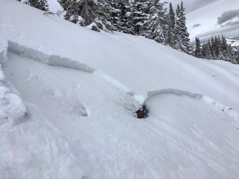
recent activity Yesterday a group of skiers triggered a shallow soft slab avalanche in No Name Bowl along the Park City ridge line. The avalanche was about a foot deep and 50 feet wide running 250' downslope. It failed on small grained faceted snow that was buried this past week. Mark White has a great observation and more pictures found here
|
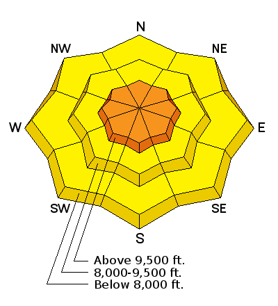
| type | aspect/elevation | characteristics |
|---|

|

|
LIKELIHOOD
 LIKELY
UNLIKELY
SIZE
 LARGE
SMALL
TREND
 INCREASING DANGER
SAME
DECREASING DANGER
|
|
description
The biggest concern today will be the wind effected snow along upper elevation ridges and steep break-overs. Both natural and human triggered avalanche will be likely today on steep, wind-drifted slopes. Drifts up to 1-2' deep have formed, and will be most widespread along ridge lines facing northwest through southeast. As you travel through the backcountry, use small test slopes to check the sensitivity and depth of the cracking drifts. |
| type | aspect/elevation | characteristics |
|---|

|
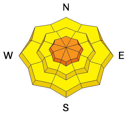
|
LIKELIHOOD
 LIKELY
UNLIKELY
SIZE
LARGE
SMALL
TREND
INCREASING DANGER
SAME
DECREASING DANGER
|
|
description
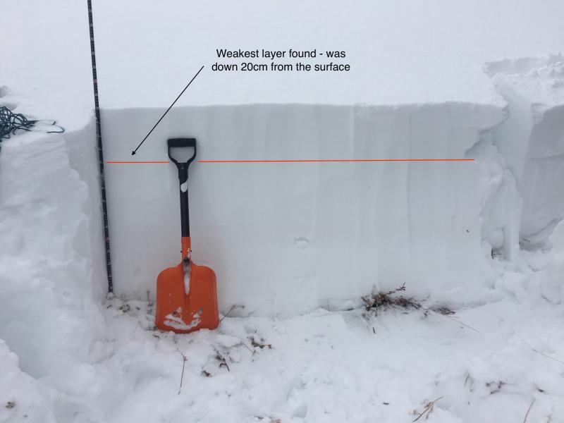
Last weeks cold temperatures took their toll to the surface snow. On almost all aspects I was able to find facted snow in the snowpack yesterday. This included south facing terrain where we found a thin crust with facted snow underneath. The problem child however, is a thin layer of facted snow that is now buried 8-10 inches deep. Yesterday we found this layer to be unreactive in most snowpits tests. We believe this is due to the lack of slab (strong snow) over the weaker snow. As we start to stack storm snow on top of this weak layer throughout the weekend, I would expect to start seeing avalanches down off ridge lines, mid slope and in any steep terrain that approaches 35 degrees or steeper.
|
 |
weather The westerly flow continues today bringing tropical moisture into the state of Utah. West winds are expected to blow throughout the day with speeds of 20-25 mph gusting into the 40's at 10,000'. Temperatures will remain on the warmer side, with the rain/snow line hovering around 7,000'. Storm totals are hard to predict as this narrow stream of moisture can shift a little north or south and leave us wet or dry. 5-9" of dense heavy snow is a good bet by 5pm. By this evening colder air pushes into Utah and we should see temperatures start to drop. The storm continues off and on through the weekend and we will hopefully have 10-18" (1-2" h20) of new snow by Monday morning. |
| general announcements Remember your information can save lives. If you see anything we should know about, please help us out by submitting snow and avalanche conditions. You can also call us at 801-524-5304, email by clicking HERE, or include #utavy in your tweet or Instagram. To get help in an emergency (to request a rescue) in the Wasatch, call 911. Be prepared to give your GPS coordinates or the run name. Dispatchers have a copy of the Wasatch Backcountry Ski map. Backcountry Emergencies. It outlines your step-by-step method in the event of a winter backcountry incident. If you trigger an avalanche in the backcountry, but no one is hurt and you do not need assistance, please notify the nearest ski area dispatch to avoid a needless response by rescue teams. Thanks.
EMAIL ADVISORY If you would like to get the daily advisory by email you will need to subscribe here. DAWN PATROL Hotline updated daily by 5-530am - 888-999-4019 option 8. TWITTER Updates for your mobile phone - DETAILS UDOT canyon closures: LINK TO UDOT, or on Twitter, follow @UDOTavy, @CanyonAlerts or @AltaCentral Utah Avalanche Center mobile app - Get your advisory on your iPhone along with great navigation and rescue tools. Powderbird Helicopter Skiing - Blog/itinerary for the day Lost or Found something in the backcountry? - http://nolofo.com/ To those skinning uphill at resorts: it is critical to know the resort policy on uphill travel. You can see the uphill travel policy for each resort here. Benefit the Utah Avalanche Center when you shop from Backcountry.com or REI: Click this link for Backcountry.com or this link to REI, shop, and they will donate a percent of your purchase price to the UAC. Both offer free shipping (with some conditions) so this costs you nothing! Benefit the Utah Avalanche Center when you buy or sell on ebay - set the Utah Avalanche Center as a favorite non-profit in your ebay account here and click on ebay gives when you buy or sell. You can choose to have your seller fees donated to the UAC, which doesn't cost you a penny.
|


 This information does not apply to developed ski areas or highways where avalanche control is normally done. This advisory is from the U.S.D.A. Forest Service, which is solely responsible for its content. This advisory describes general avalanche conditions and local variations always exist.