25th Annual Black Diamond Fall Fundraising Party
Thursday, September 13; 6:00-10:00 PM; Black Diamond Parking Lot
25th Annual Black Diamond Fall Fundraising Party
Thursday, September 13; 6:00-10:00 PM; Black Diamond Parking Lot
| Advisory: Salt Lake Area Mountains | Issued by Drew Hardesty for Thursday - December 8, 2016 - 5:40am |
|---|

|
bottom line The avalanche danger is LOW this morning but may rise toward MODERATE this afternoon with the onset of snow and wind. Remember, Low danger doesn't mean No danger and shallow wind drifts and sluffs are possible in isolated terrain. I anticipate the danger to rise exponentially over the next several days.
|
 |
special announcement The Park City Ski Patrol will be doing avalanche mitigation work in the Jupiter area for the remainder of the week. Please avoid this area. Help out my pal Jay Whitacre - he's getting his PhD on risk, decision-making and technology - and take his simple survey here. Thanks - |
 |
current conditions Skies are mostly cloudy to overcast across the range. Temperatures are still in the icebox, but not for long. Ridgeline temps are in the upper single digits while many trailheads are struggling to get above zero. Southwest winds remained on good behavior overnight but have slowly started to creep up into the 10-15mph range. A few inches of 3-5% density cold smoke sit above various and myriad snow surfaces: wind and sun crusts...soft settled snow - it's all out there. Total snow depths are 1-2' at the mid-elevations and 2-3' up high. Yawn. But for more excitement, skip down to Mountain Weather. |
 |
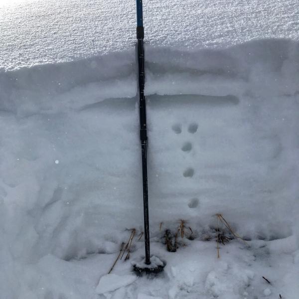
recent activity Ski area control efforts elicited a couple very shallow sluffs and soft wind slabs roughly 4-8" deep and 30' wide. These issues are generally benign, though, unless you're in unforgiving terrain such as above cliff-bands or even carried into thinly veiled rocks, stumps, or deadfall. Ahead of this wet, warm, and windy storm, we've been gauging the extent of the weaknesses along the snow surface and within the thinner snowpack areas. Greg Gagne in Neff's canyon and Mark White in mid-Big Cottonwood both have good insight from their outings yesterday. One can see potentially weak surface snow along with weak snow beneath a thin wind crust in Mark's photo below. Check them out under Detailed Information in the Menu bar above.
|
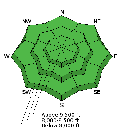
| type | aspect/elevation | characteristics |
|---|

|
|
LIKELIHOOD
 LIKELY
UNLIKELY
SIZE
 LARGE
SMALL
TREND
 INCREASING DANGER
SAME
DECREASING DANGER
|
|
description
Remember that risk is always inherent in mountain travel. Out of wind affected terrain, one might encounter minor sluffing in the very low density snow from this week. It shouldn't run fast or pack a punch, but worth a mention. In the wind affected terrain, isolated lingering wind drifts of the same nature as yesterday may still be present in steeper encatchment areas. |
 |
weather Buckle your seat belt. A long duration, complicated, wet, warm, and windy system is on the doorstep. Precipitation should begin by midday into the early afternoon and continue with various alternating periods of ferocity and lull through the weekend. This isn't our classic bread and butter "right-side-up" Goldilocks storm as head Wasatch Weather Weenie prof. Jim Steenburgh prefers, but rather Sierra cement with increasing densities over time. At least the westerly winds will crank into the 30s tonight and into the 40s+ Friday night. Rain/snow lines may reach 8000' by Friday night into Saturday, then drop back to the benches by Saturday. All told, we may see upwards of 2' of heavy dense foundation-building material. The Logan and Ogden mountains should do well with precipitation, although much of it may be initially be in the form of white rain. The weather models diverge a bit on the details, but generally imply that storms continue into next week. |
| general announcements Remember your information can save lives. If you see anything we should know about, please help us out by submitting snow and avalanche conditions. You can also call us at 801-524-5304, email by clicking HERE, or include #utavy in your tweet or Instagram. To get help in an emergency (to request a rescue) in the Wasatch, call 911. Be prepared to give your GPS coordinates or the run name. Dispatchers have a copy of the Wasatch Backcountry Ski map. Backcountry Emergencies. It outlines your step-by-step method in the event of a winter backcountry incident. If you trigger an avalanche in the backcountry, but no one is hurt and you do not need assistance, please notify the nearest ski area dispatch to avoid a needless response by rescue teams. Thanks.
EMAIL ADVISORY If you would like to get the daily advisory by email you will need to subscribe here. DAWN PATROL Hotline updated daily by 5-530am - 888-999-4019 option 8. TWITTER Updates for your mobile phone - DETAILS UDOT canyon closures: LINK TO UDOT, or on Twitter, follow @UDOTavy, @CanyonAlerts or @AltaCentral Utah Avalanche Center mobile app - Get your advisory on your iPhone along with great navigation and rescue tools. Powderbird Helicopter Skiing - Blog/itinerary for the day Lost or Found something in the backcountry? - http://nolofo.com/ To those skinning uphill at resorts: it is critical to know the resort policy on uphill travel. You can see the uphill travel policy for each resort here. Benefit the Utah Avalanche Center when you shop from Backcountry.com or REI: Click this link for Backcountry.com or this link to REI, shop, and they will donate a percent of your purchase price to the UAC. Both offer free shipping (with some conditions) so this costs you nothing! Benefit the Utah Avalanche Center when you buy or sell on ebay - set the Utah Avalanche Center as a favorite non-profit in your ebay account here and click on ebay gives when you buy or sell. You can choose to have your seller fees donated to the UAC, which doesn't cost you a penny.
|


 This information does not apply to developed ski areas or highways where avalanche control is normally done. This advisory is from the U.S.D.A. Forest Service, which is solely responsible for its content. This advisory describes general avalanche conditions and local variations always exist.