25th Annual Black Diamond Fall Fundraising Party
Thursday, September 13; 6:00-10:00 PM; Black Diamond Parking Lot
25th Annual Black Diamond Fall Fundraising Party
Thursday, September 13; 6:00-10:00 PM; Black Diamond Parking Lot
| Advisory: Ogden Area Mountains | Issued by Mark Staples for Tuesday - February 20, 2018 - 7:21am |
|---|

|
bottom line The avalanche danger in the Ogden area mountains is CONSIDERABLE today on upper elevation slopes facing north through east, for triggering wind slabs and persistent slab avalanches.
|
 |
special announcement We have discount lift tickets for Alta, Snowbird, Brighton, Solitude, Snowbasin,and Beaver Mountain. Details and order information here. All proceeds from these go towards paying for avalanche forecasting and education! |
 |
current conditions Winter continues and it's great to see. Overnight a trace to 1 inch of snow fell. A little more likely fell near Farmington due to lake effect this morning. Storm totals are 10-17 inches of snow (1-1.3 inches of snow water equivalent). Yesterday this snow was reportedly a little bit upside down meaning that it was slightly denser on top and lighter underneath. The storm snow has probably settled a bit since yesterday and should be fairly consistent today with a few inches of fluff on top. Temperatures are generally in the single digits F. They are a few degrees below zero above 9000 feet. Winds at ridgetops are averging 5-10 mph and gusting 15 mph. They blew from the NW yesterday and are westerly this morning. There has been some wind transport and wind drifting of the new snow which is easy because the snow is so light; however, this wind transport has mostly been confined to ridgetops and hasn't been too significant. |
 |
recent activity Soft, storm snow avalanches were easily triggered yesterday by ski patrols. Also of note on Sunday was one explosive triggered avalanche 200' wide, 2-3' feet deep and ran 200' feet down slope. |
| type | aspect/elevation | characteristics |
|---|

|

|
LIKELIHOOD
 LIKELY
UNLIKELY
SIZE
 LARGE
SMALL
TREND
 INCREASING DANGER
SAME
DECREASING DANGER
|
|
description
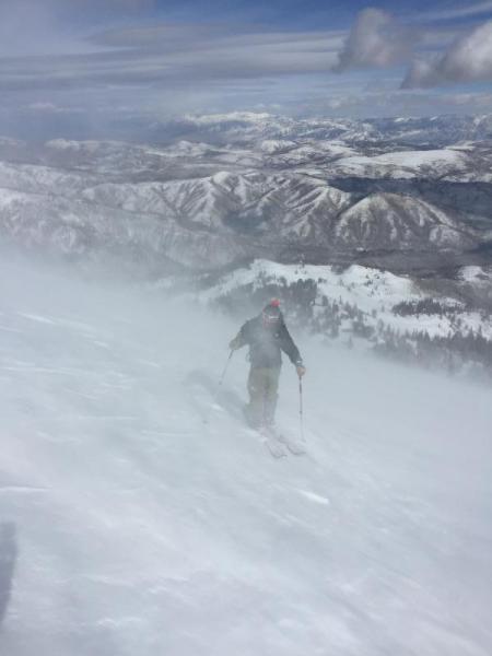
Stong, southerly winds blew this weekend. Winds blew from the NW yesterday and have switched to the W today. Because the new snow is so light, winds can easily transport it. The slightest wind loading will make avalanches in the new snow more likely. Don't let your guard down on non-wind loaded slopes. The potential for storm slabs and dry loose avalanches is much less compared to yesterday, but they remain a possibility. Photo below shows wind transport of snow from strong south winds on Saturday (B. Brandt photo).
|
| type | aspect/elevation | characteristics |
|---|

|

|
LIKELIHOOD
LIKELY
UNLIKELY
SIZE
LARGE
SMALL
TREND
INCREASING DANGER
SAME
DECREASING DANGER
|
|
description
There are huge differences in the snowpack as you go up in elevation. Northerly facing slopes at upper elevations that held the most snow prior to yesterday's storm also are the ones that harbor old faceted snow. With a snowfall containing about 1.2 inches of snow water equivalent near Monte Cristo and Powder Mountain, these upper elevation slopes are prime spots to trigger a persistent slab avalanche. Near Snowbasin, less snow fell, but it still may be enough to activate these faceted layers, especially with just a little wind loading. The avalanche triggerd by snow safety teams on Sunday, prior to recent snowfall is a good indication that this avalanche problem exists. With the additional loading from yesterday's storm, it will be easier to trigger similar avalanches. Fortunately it's easy to avoid this problem by losing elevation or switching to a more southerly aspect. With cold temperatures and mostly cloudy skies, the snow in these places will remain great. |
 |
weather Snowfall has mostly ended, but there should be some snowflakes in the air today. Skies will be mostly cloudy this morning and slowly breaking up this afternoon when some sunshine may appear. Overall conditions will remain cold, with mountain temperatures struggling to get above 10 degrees F. Winds at ridgetops will remain westerly and blow 5-15 mph with gusts of 25 mph. |
| general announcements CLICK HERE FOR MORE GENERAL INFO AND FAQ The UAC has new support programs with Outdoor Research and Darn Tough. Support the UAC through your daily shopping. When you shop at Smith's, or online at Outdoor Research, REI, Backcountry.com, Darn Tough, Patagonia, NRS, Amazon, eBay a portion of your purchase will be donated to the FUAC. See our Donate Page for more details on how you can support the UAC when you shop. Benefit the Utah Avalanche Center when you buy or sell on eBay - set the Utah Avalanche Center as a favorite non-profit in your eBay account here and click on eBay gives when you buy or sell. You can choose to have your seller fees donated to the UAC, which doesn't cost you a penny This information does not apply to developed ski areas or highways where avalanche control is normally done. This advisory is from the U.S.D.A. Forest Service, which is solely responsible for its content. This advisory describes general avalanche conditions and local variations always occur. |