25th Annual Black Diamond Fall Fundraising Party
Thursday, September 13; 6:00-10:00 PM; Black Diamond Parking Lot
25th Annual Black Diamond Fall Fundraising Party
Thursday, September 13; 6:00-10:00 PM; Black Diamond Parking Lot
| Advisory: Ogden Area Mountains | Issued by Paige Pagnucco for Friday - February 16, 2018 - 6:52am |
|---|

|
bottom line The avalanche danger is Moderate. Heighterend avalanche conditions exist at upper elevations for storm snow (wind drifts and sluffing) avalanches. Evaluate snow and terrain carefully. Avoid cornices along ridgelines and in exposed terrain. Deeper avalanches stepping into old snow are possible in isolated steep terrain with poor snow structure on steep, wind drifted north and northeast facing slopes at the upper elevations.
|
 |
special announcement It could be worth the drive...At 6PM on February 17 at Alpine Distilling in Park City, join a presentation on the UAC's Avalanche Awareness Know Before You Go Program then learn about how we perceive aroma and taste through whiskey while seeing how Alpine Distilling crafts local, award winning spirits. The evening will feature a specialty cocktail made with Alpine Distilling's Persistent (Weak Layer) Vodka and include a raffle for a backcountry kit (beacon, shovel, and probe) donated by Backcountry.com. Contact [email protected] for details and reservations. |
 |
current conditions Winter has returned complete with cold temperatures and a decent shot of snow. Mountain temps are in the teens, though some locations read single digits, and a southwest wind is blowing 10-15 mph with gusts nearing 20 mph. Riding conditions have improved quite a bit especially on low angle, higher elevation slopes. Approximate local storm totals: Ben Lomond: 4" |
 |
recent activity Ski resort snow safety teams reported small soft slab activity as well as some cornice buildup yesterday. |
| type | aspect/elevation | characteristics |
|---|

|
|
LIKELIHOOD
 LIKELY
UNLIKELY
SIZE
 LARGE
SMALL
TREND
 INCREASING DANGER
SAME
DECREASING DANGER
|
|
description
There was minor wind slab activity in exposed high elevation terrain yesterday though the slabs were somewhat soft. With a cold night and time to settle, wind slabs will be stiffer today and may be a bit more stubborn to trigger. New ones may develop as moderate southwest winds are expected. Avoid steep slopes with freshly wind drifted snow to avoid this problem. With fresh snow for the wind to move around, expect cornices to build along exposed ridgelines and terrain features today. These should be fairly sensitive and may break back further than you think they will. Give them a wide berth to avoid this problem. If you plan on riding in the Monte Cristo area, where snow totals are higher, keep a sharp eye out for red flags like cracking or collapsing and avoid wind loaded steep slopes as buried weak layers may be more reactive to the increased load. |
| type | aspect/elevation | characteristics |
|---|

|

|
LIKELIHOOD
 LIKELY
UNLIKELY
SIZE
LARGE
SMALL
TREND
 INCREASING DANGER
SAME
DECREASING DANGER
|
|
description
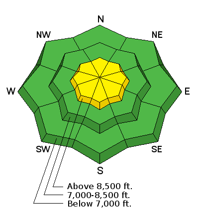
Buried faceted layers in the Ogden area snowpack are mostly dormant but, unfortunately, with faceted snow pesisting in the snowpack, mainly on NW, N, and NE facing slopes above 8500 feet, a small chance remains of triggering an avalanche into older snow. We didn't get quite enough snow water equivalent yesterday to awaken these weaknesses, but the weight of a sled or a skier may tip the balance. The buried surface hoar from 25 February is still on the radar for us and found more prominently on the east side of the Ogden mountain valleys, i.e. Monte Cristo. Collapsing and cracking are easy, but not always present, signs of instability; snowpit tests remain warranted, especially with recent loading. There is a lot of variability in the snowpack strength and depth. Slopes with a shallower snowpack, especially those that are rocky, tend to have weaker snow. Spatial variabitlity is what we call the differences from one slope to another, hence the importance of digging a pit to verify buried weak layers or of simply choosing to travel on low angle terrain. See a short discussion in this video. |
 |
weather It'll be a cold and breezy day in the Ogden area mountains with temperatures in the 20's F and steady SW winds blowing 15-25 mph. Gusts could reach 35+ mph starting late morning through the afternoon. Weather will remain unsettled for the next few days ahead of what looks to be another good shot of snow Sunday into Monday. Moderate to strong winds, unfortunately, are expected to continue to play a major role today through the rest of the weekend. Hopefully what new snow we do have won't end up in Colorado! |
| general announcements CLICK HERE FOR MORE GENERAL INFO AND FAQ The UAC has new support programs with Outdoor Research and Darn Tough. Support the UAC through your daily shopping. When you shop at Smith's, or online at Outdoor Research, REI, Backcountry.com, Darn Tough, Patagonia, NRS, Amazon, eBay a portion of your purchase will be donated to the FUAC. See our Donate Page for more details on how you can support the UAC when you shop. Benefit the Utah Avalanche Center when you buy or sell on eBay - set the Utah Avalanche Center as a favorite non-profit in your eBay account here and click on eBay gives when you buy or sell. You can choose to have your seller fees donated to the UAC, which doesn't cost you a penny This information does not apply to developed ski areas or highways where avalanche control is normally done. This advisory is from the U.S.D.A. Forest Service, which is solely responsible for its content. This advisory describes general avalanche conditions and local variations always occur. |


