25th Annual Black Diamond Fall Fundraising Party
Thursday, September 13; 6:00-10:00 PM; Black Diamond Parking Lot
25th Annual Black Diamond Fall Fundraising Party
Thursday, September 13; 6:00-10:00 PM; Black Diamond Parking Lot
| Advisory: Ogden Area Mountains | Issued by Paige Pagnucco for Thursday - February 1, 2018 - 6:27am |
|---|

|
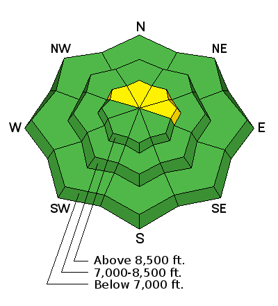
bottom line The avalanche danger is MODERATE on steep, upper elevation slopes facing northwest through east. Large, human triggered avalanches are possible in isolated places, failing on weak, faceted snow grains. There is also a MODERATE danger of triggering a fresh wind slab on upper elevation north through east facing slopes. Heightened avalanche danger exists so evaluate snow and terrain carefully. There is a LOW danger for avalanches on all other slopes.
|
 |
special announcement The UAC Marketplace is online with deals on skis, packs, airbag packs, beacons, snowshoes, soft goods and much more.
|
 |
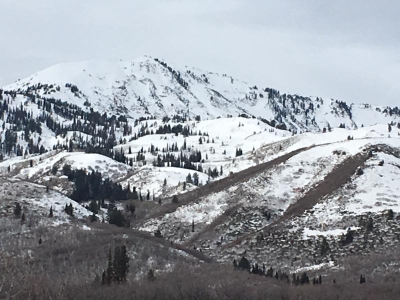
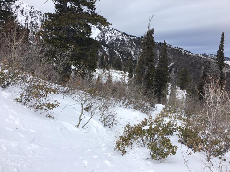
current conditions Temperatures have cooled a bit this morning - Ben Lomond Peak reads 31F while James Peak has dropped to 18F. Westerly winds are blowing 10-15 mph with gusts in the 20's to 30's mph. Skies are cloudy. We found some soft snow turning conditions on sheltered N facing slopes above 7000'. Though conditions overall are variable and approaches/exits a tad "sporty", there's still enough snow to have some fun on or, at a minimum, go for a scenic tour. We found only small patches of Sunday's rime crust. No evidence either of the buried surface hoar that Mark found at Monte Cristo, at least in the Cutler Ridge zone. Snowmobilers can still find soft snow conditions in the Monte Cristo area though the warm temps have begun to take a toll there too. There is snow up high at least on N and E aspects.
The S face of Ben Lomond is looking a bit thin.
Bushes on Cutler Ridge made for an interesting descent - got a pair of 160's? |
 |
recent activity There has been no recent avalanche activity reported in the Ogden zone. The Colorado Avalanche Information Center completed their report from a fatal avalanche about a week ago and is worth reading because conditions there are similar to conditions in Utah. Full report HERE. |
| type | aspect/elevation | characteristics |
|---|

|
|
LIKELIHOOD
 LIKELY
UNLIKELY
SIZE
 LARGE
SMALL
TREND
 INCREASING DANGER
SAME
DECREASING DANGER
|
|
description
Is it better to be smart or to be lucky? It all depends on your comfort level with the odds really. We know we have a poor snowpack structure with weak, sugary faceted snow living deep within, but otherwise there are no other red flags for this problem. I agree with Evelyn that the game is rigged and if we play it enough (jump on one too many steep, northwest through east facing upper elevation slopes), we'll eventually lose. We are in a period of low probability - high consequence in terms of triggering a persistent slab avalanche. The odds may look like they are in your favor but, if you happen to hit the sweet spot and release one of these beasts, your luck will have run out. My advice is to be smart - there's no reason to head into dangerous terrain when, actually, the best riding conditions are found in sheltered, low angle terrain facing the northern part of the compass. It's hard to do in the Ogden zone as it's all mostly shallow, but avoid areas where the snowpack is thin and it's easier to trigger an avalanche - such as rocky rollovers. |
| type | aspect/elevation | characteristics |
|---|

|

|
LIKELIHOOD
LIKELY
UNLIKELY
SIZE
 LARGE
SMALL
TREND
INCREASING DANGER
SAME
DECREASING DANGER
|
|
description
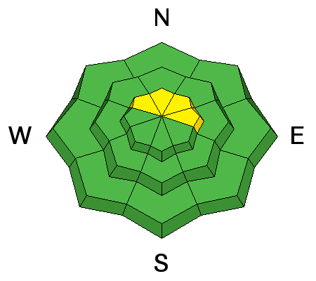
Little snow is available for transport due to the recent warm temps, but a few new wind slabs have likely formed at the highest elevations, especially on northerly through easterly facing slopes. The drifts are likely sitting on dry snow and thin rime crusts and can be triggered by a person on steep slopes. Moderate westerly/southwesterly winds are expected to continue throughout the day so keep an eye out for areas with consistent transport, especially near ridgelines. Avoid steep slopes with freshly wind drifted snow. |
 |
weather Well, here we are in February and it seriously feels like March. So goes the season. Today will be cloudy in the mountains with temps reaching the mid 30's F, southwest winds blowing 10-15 mph, and a small chance of snow starting midday. No significant weather changes appear until late Friday night where the chance of precipitation goes up. If we're lucky, the Ogden area mountains will wake up Saturday morning with 1-3" of new snow. We'll take what we can get. Long term forecast shows an unsettled pattern favoring the northern mountains. |
| general announcements CLICK HERE FOR MORE GENERAL INFO AND FAQ The UAC has new support programs with Outdoor Research and Darn Tough. Support the UAC through your daily shopping. When you shop at Smith's, or online at Outdoor Research, REI, Backcountry.com, Darn Tough, Patagonia, NRS, Amazon, eBay a portion of your purchase will be donated to the FUAC. See our Donate Page for more details on how you can support the UAC when you shop. Benefit the Utah Avalanche Center when you buy or sell on eBay - set the Utah Avalanche Center as a favorite non-profit in your eBay account here and click on eBay gives when you buy or sell. You can choose to have your seller fees donated to the UAC, which doesn't cost you a penny This information does not apply to developed ski areas or highways where avalanche control is normally done. This advisory is from the U.S.D.A. Forest Service, which is solely responsible for its content. This advisory describes general avalanche conditions and local variations always occur. |