25th Annual Black Diamond Fall Fundraising Party
Thursday, September 13; 6:00-10:00 PM; Black Diamond Parking Lot
25th Annual Black Diamond Fall Fundraising Party
Thursday, September 13; 6:00-10:00 PM; Black Diamond Parking Lot
| Advisory: Ogden Area Mountains | Issued by Evelyn Lees for Monday - December 25, 2017 - 7:22am |
|---|

|
bottom line AVALANCHE WARNING - The avalanche danger is HIGH today – backcountry travel in avalanche terrain is not recommended. Natural and human triggered avalanches are likely. Avalanches can be triggered remotely from a distance and from below. Avoid travel on and below all steep slopes, including even the smaller, steep gullies, creek beds and road banks at the lower elevations.
|
 |
avalanche warning THE FOREST SERVICE UTAH AVALANCHE CENTER IN SALT LAKE CITY HAS ISSUED A BACKCOUNTRY AVALANCHE WARNING. * TIMING…IN EFFECT FROM 6 AM MST THIS MORNING TO 6 AM MST TUESDAY MORNING * AFFECTED AREA…FOR THE MOUNTAINS OF NORTHERN UTAH INCLUDING THE BEAR RIVER RANGE, WESTERN UINTAS, AND ALL THE WASATCH RANGE...THE OGDEN, PROVO, SALT LAKE AND PARK CITY AREA MOUNTAINS. * AVALANCHE DANGER…THE AVALANCHE DANGER FOR THE WARNING AREA IS HIGH TODAY. * IMPACTS…RECENT SNOW AND WIND HAS CREATED WIDESPREAD AREAS OF UNSTABLE SNOW. BOTH HUMAN TRIGGERED AND NATURAL AVALANCHES ARE LIKELY. STAY OFF OF AND OUT FROM UNDER SLOPES STEEPER THAN 30 DEGREES. AVALANCHES CAN BE TRIGGERED REMOTELY FROM A DISTANCE AND FROM BELOW. THIS WARNING DOES NOT APPLY TO SKI AREAS WHERE AVALANCHE HAZARD REDUCTION MEASURES ARE PERFORMED. |
 |
special announcement We're excited to introduce for the 2017/2018 winter the Utah Avalanche Center podcast, hosted by forecaster Drew Hardesty and produced by KUER's Benjamin Bombard. The podcast will include engaging stories, interviews, and lessons learned - all things avalanche to help keep people on top of the snow instead of buried beneath it - and easily found on iTunes, Stitcher, the UAC blog, or wherever you get your podcasts. |
 |
current conditions A warm storm moved in overnight, and snow is still falling in the mountains. With the warmer temperatures, snow densities are about 8%. Snow totals in the Ogden area mountains are in the 4 to 6” range. Temperatures are 15 to 20 degrees warmer than they were yesterday morning – in the teens to upper 20s. Many wind sites in the Ogden area mountains are down, but the winds are westerly – anywhere from southwest to northwest, averaging 20 to 25 mph, and gusting into the 30s, at the stations that are working. |
 |
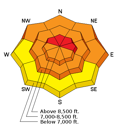
recent activity With better visibility, there was a lot more evidence of the December 23rd Ogden avalanche cycle, that included lower elevation slopes. Natural avalanches that ran the 23rd were observed on steep, northerly facing backcountry slopes, between 8,000' and 9500', in addition to slides at the lower elevations. Evidence of an avalanche that ran earlier in the storm in the Ogden area.
Other info: Early morning reports include avalanches 1½ feet deep being triggered by snow cats at 8,500’ in the Salt Lake mountains. Yesterday, avalanche activity included a slide triggered remotely on the Park City ridge line by a backcountry skier, 15” deep and 150 feet wide and numerous slides from explosive control work in the SL and Park City area mountains, both new snow and some breaking into the deeper weak, faceted layers. Several patrollers were caught and carried, and we’re glad to report all uninjured. |
| type | aspect/elevation | characteristics |
|---|

|

|
LIKELIHOOD
 LIKELY
UNLIKELY
SIZE
 LARGE
SMALL
TREND
 INCREASING DANGER
SAME
DECREASING DANGER
|
|
description
Collapsing, cracking and avalanches. All bulls eye clues that the snow is dangerously unstable. When experienced people get caught in avalanches, you know it’s hazardous and unpredictable out there. With two storms this week, the avalanche starting zones are now more connected – and slides today will be wider and deeper. There are an alarming number of weak, faceted layers in the snowpack – variable from slope to slope, any of which could fail. Avoid all travel on, below and adjacent to steep slopes facing northwesterly through easterly. |
| type | aspect/elevation | characteristics |
|---|

|

|
LIKELIHOOD
LIKELY
UNLIKELY
SIZE
 LARGE
SMALL
TREND
 INCREASING DANGER
SAME
DECREASING DANGER
|
|
description
The new, overnight dense snow will be easy to trigger steep slopes, both wind loaded and wind sheltered. The light, low-density snow that was on the surface yesterday will be the weak layer. Cracking, collapsing and punchy, dense “upside down” snow are all indicators of this avalanche problem. A slide triggered in the new snow could step down to one of the deeper weak layers, resulting in a much larger avalanche. |
 |
weather North of I-80, the storm is about over, though another inch or two of snow could fall. Temperatures will warm to near freezing at the mid elevations, and into the 20s along the high ridge lines. The west to southwesterly winds will average 10 to 20 mph, stronger at the higher elevations, where averages 30 to 40 mph, with gusts to 50 are possible. Mostly sunny tomorrow, with temperatures again warming into the 20s. |
| general announcements FOR MORE GENERAL INFORMATION AND FAQ, CLICK HERE Support the UAC through your daily shopping. When you shop at Smith's, or online at REI, Backcountry.com, Patagonia, NRS, Amazon, eBay a portion of your purchase will be donated to the FUAC. See our Donate Page for more details on how you can support the UAC when you shop. Benefit the Utah Avalanche Center when you buy or sell on eBay - set the Utah Avalanche Center as a favorite non-profit in your eBay account here and click on eBay gives when you buy or sell. You can choose to have your seller fees donated to the UAC, which doesn't cost you a penny This information does not apply to developed ski areas or highways where avalanche control is normally done. This advisory is from the U.S.D.A. Forest Service, which is solely responsible for its content. This advisory describes general avalanche conditions and local variations always occur. |


