25th Annual Black Diamond Fall Fundraising Party
Thursday, September 13; 6:00-10:00 PM; Black Diamond Parking Lot
25th Annual Black Diamond Fall Fundraising Party
Thursday, September 13; 6:00-10:00 PM; Black Diamond Parking Lot
| Advisory: Ogden Area Mountains | Issued by Trent Meisenheimer for Sunday - December 3, 2017 - 6:27am |
|---|


|
bottom line AVALANCHE DANGER MAY RISE SIGNIFICANTLY LATER TODAY AND MONDAY AS A STRONG COLD FRONT APPROACHES NORTHERN UTAH. This morning we have a LOW avalanche danger quickly rising to MODERATE by later this afternoon for wind slab avalanches. HUMAN TRIGGERED AVALANCHES ARE POSSIBLE. The greatest danger will be on upper elevation north through southeast facing slopes. Avoid being on or underneath slopes that are steeper than 35 degrees in slope steepness.
|
 |
special announcement Unopened ski area terrain is considered backcountry as avalanche mitigation has not been performed. As resorts prepare to open as soon as possible, please be mindful of their unique uphill travel policies - abide by signage and, if in doubt, check in with the ski patrol. On a bright note, the first annual Ogden Backcountry Bash at The Front Climbing Gym was a GIANT SUCCESS! Thank you to everyone that came to support the Utah Avalanche Center and it's mission to keep everyone on top. A big shout out to all the businesses that made donations, volunteers that helped setup, as well as Lucky Slice for the delicious pizza and Talisman Brewery and Ogden's Own for the beverages. We appreciate all the support and look forward to making this an annual event. Lastly, we want to say a massive thank you to Kory Davis who has been working for months and months to make this party happen. Well done, Kory!
|
 |
current conditions The southery winds this morning are having there way with the upper elevation anemometers with wind speeds in the 30 to 40 mph range gusting into the 70's as a strong cold front approaches northern Utah. Ogden peak (9570') is the winner with strong southerly averages in the 50's. Temperatures are balmy with even the highest elevations just barly below freezing. Powder snow??? ha, drive north. Our current snowpack and riding condidtions are pretty grim. Even the highest elevation northerly facing slopes support a crust that make turning and riding a challenge. Lower elevations, you'll be in the bushes and rocks. The good news - we have a much needed storm coming. However, keep in mind that our snowpack is shallow and made up of weak and faceted (sugary) snow. AVALANCHE DANGER MAY RISE SIGNIFICANTLY LATER TODAY AND MONDAY. |
 |
recent activity There has been no reported recent avalanche activity in the Ogden area mountains. |
| type | aspect/elevation | characteristics |
|---|

|

|
LIKELIHOOD
 LIKELY
UNLIKELY
SIZE
 LARGE
SMALL
TREND
 INCREASING DANGER
SAME
DECREASING DANGER
|
|
description
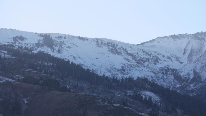
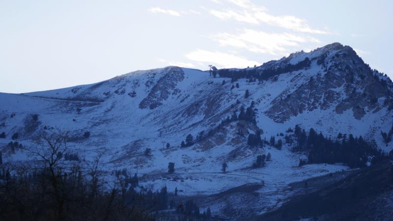
The snowpack is a mix of hard as well as breakable crusts, large melt-freeze crystals and weak faceted snow. Winds from the northwest will create wind slabs mainly on the north - northeast - east - and southeast facing aspects as the snow begins to fall. This storm snow will land on a wide variety of snow surfaces and will need time to bond and adjust to the new load. Avoid being on steep (35 degree) and steeper terrain later today as the snow starts to stack up. THE GOOD NEWS: Many of the southerly facing slopes and lower elevations (9000' and below) are free of snow and will be a great choice for riding and turning once the storm snow accumulates. Here are a few pictures of the Ben Lomond zone and Snowbasin showing our desperately thin coverage.
|
 |
weather Winds will remain strong and gusty out of the southwest this morning and early afternoon with speeds averaging 30-40 mph gusting into the 70's at the highest elevations as a highly anticipated storm approaches northern Utah. The airmass will continue to become more unstable throughout the afternoon and evening hours which will result in good shot of snow into Monday morning. Snow levels will drop from 7,000 feet this morning to the valley by this evening as cold air is ushers in. By the dinner hour we could see 5" to 7" inches of snow (0.3" - 0.4" H20). By Monday afternoon places that are favored by a northwest flow could see 10" to 15" of snow with (0.5" - 0.8" H20). Bring it on - fingers crossed. |
general announcements
|