25th Annual Black Diamond Fall Fundraising Party
Thursday, September 13; 6:00-10:00 PM; Black Diamond Parking Lot
25th Annual Black Diamond Fall Fundraising Party
Thursday, September 13; 6:00-10:00 PM; Black Diamond Parking Lot
| Advisory: Ogden Area Mountains | Issued by Paige Pagnucco for Friday - December 1, 2017 - 7:59am |
|---|

|
bottom line The avalanche danger is LOW at upper elevations that hold old, hard snow. You are more likely to get injured in a "slide for life" as the snow surface is firm and slick. Consider carrying an ice axe if you plan to travel on steep, snow covered terrain. Low danger does not mean no danger - carry your beacon, shovel and probe and practice safe travel protocols. We will continue with intermittent advisories until we begin to receive more snow.
|
 |
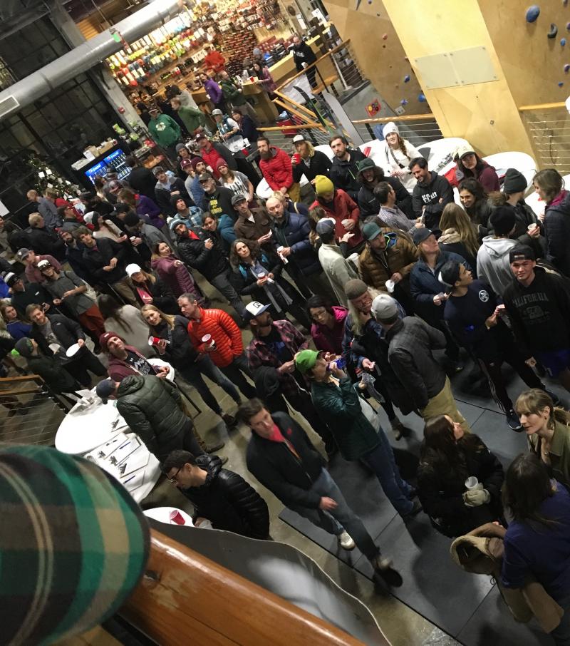
special announcement Unopened ski area terrain is considered backcountry as avalanche mitigation has not been performed. As resorts prepare to open as soon as possible, please be mindful of their unique uphill travel policies - abide by signage and, if in doubt, check in with the ski patrol. On a bright note, last night's first annual Ogden Backcountry Bash at The Front Climbing Gym was a GIANT SUCCESS! Thank you to everyone that came to support the Utah Avalanche Center and it's mission to keep everyone on top. A big shout out to all the businesses that made donations, volunteers that helped setup, as well as Lucky Slice for the delicious pizza and Talisman Brewery and Ogden's Own for the beverages. We appreciate all the support and look forward to making this an annual event. Lastly, we want to say a massive thank you to Kory Davis who has been working for months and months to make this party happen. Well done, Kory!
|
 |
current conditions It is lightly snowing this morning in the mountains with temps in the mid 20's F and winds blowing out of the southwest at 10-15 mph. The Ben Lomond 7688' weather station reports 1" of new snow - a little dusting that won't better conditions any. |
 |
recent activity There has been no reported recent avalanche activity in the Ogden area mountains. |
| type | aspect/elevation | characteristics |
|---|

|
|
LIKELIHOOD
 LIKELY
UNLIKELY
SIZE
 LARGE
SMALL
TREND
 INCREASING DANGER
SAME
DECREASING DANGER
|
|
description
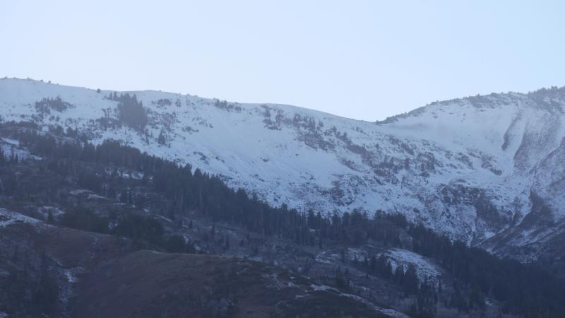
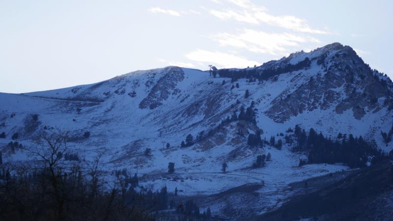
The snowpack is currently stable and avalanches are unlikely. The snowpack is a mix of hard as well as breakable crusts, large melt-freeze crystals and facets. Not much to celebrate in terms of turning or riding conditions as coverage is thin even at the highest elevations. Here are a few pictures of the Ben Lomond zone and Snowbasin showing our desperately thin coverage. The snow surface is both slick and breakable across high elevations so take caution if you travel in steep terrain and consider carrying an ice axe.
|
 |
weather A westerly flow will prevail today through tonight. A warmer southwesterly flow will develop Saturday, followed by a colder storm system for Sunday into Monday. We'll hopefully pick up 4-8" but, unfortunately after that, there's not much happening in the long range forecast except for high pressure. Today - A 20 percent chance of snow showers before 11am. Partly sunny, with a high near 37. West northwest wind around 6 mph becoming light and variable. Tonight - Partly cloudy, with a low around 32. South southwest wind 5 to 11 mph. Saturday - Mostly sunny, with a high near 42. South southwest wind 10 to 13 mph. Saturday Night - A 20 percent chance of snow after 11pm. Mostly cloudy, with a low around 31. South southwest wind 14 to 20 mph. Sunday - Snow. High near 34. West wind around 18 mph. Chance of precipitation is 80%. New snow accumulation of 2 to 4 inches possible. Sunday Night - Snow likely. Cloudy, with a low around 15. Chance of precipitation is 70%. New snow accumulation of 2 to 4 inches possible. |
general announcements
|