25th Annual Black Diamond Fall Fundraising Party
Thursday, September 13; 6:00-10:00 PM; Black Diamond Parking Lot
25th Annual Black Diamond Fall Fundraising Party
Thursday, September 13; 6:00-10:00 PM; Black Diamond Parking Lot
| Advisory: Ogden Area Mountains | Issued by Paige Pagnucco for Friday - April 7, 2017 - 5:34am |
|---|

|
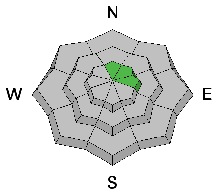
bottom line The avalanche danger is LOW. Loose wet and isolated wind slab avalanches are possible in steep terrain. Continue to avoid being on or beneath cornices.
|
 |
special announcement Who is up for some golf to benefit the Utah Avalanche Center? We have a donated gift certificate for four guest rounds and cart fees at Jeremy Ranch. We are asking $500 for this unique experience to golf for avalanche safety. See the certificate for conditions. Contact us if you are interested. |
 |
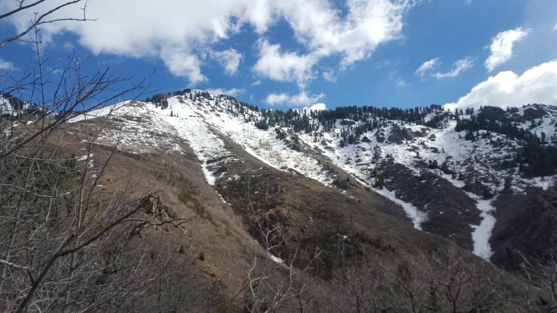
current conditions The winds have been howling all night and are currently blowing 30-40 mph out of the south southwest with gusts reaching over 70mph on the ridgetops. It is 47 F at the 8000' Ben Lomond weather station. With warm overnight temperatures the snow surface we've been enjoying fine spring conditions on did not refreeze. You'll likely find less than desirable riding conditions today with very warm mountain temps and wind speeds expected to increase as a cold winter-like storm approaches for the weekend. Your biggest concern will be standing upright if you travel in exposed terrain, especially on ridgetops. Here's a recent observation from Taylor Canyon.
Low elevation snow is about gone. (pc: Diehard Ogden skiers) |
 |
recent activity No avalanche activity reported from yesterday. |
| type | aspect/elevation | characteristics |
|---|

|
|
LIKELIHOOD
 LIKELY
UNLIKELY
SIZE
 LARGE
SMALL
TREND
 INCREASING DANGER
SAME
DECREASING DANGER
|
|
description
Unlike during the past week's melt-freeze cycle, the snow surface is not frozen this morning. With very warm temperatures forecast for today you'll want to avoid steep slopes with saturated, unsupportable snow. If you see rollerballs or pinwheels, it's time to move to lower angle terrain. I imagine that turning conditions today will be challenging, if not less than stellar. |
| type | aspect/elevation | characteristics |
|---|

|
|
LIKELIHOOD
LIKELY
UNLIKELY
SIZE
 LARGE
SMALL
TREND
INCREASING DANGER
SAME
DECREASING DANGER
|
|
description
There are still huge cornices waiting to fail with the additional weight of a person and/or snowmobile. Stay well back from their edges and avoid travel below them. |
| type | aspect/elevation | characteristics |
|---|

|
|
LIKELIHOOD
 LIKELY
UNLIKELY
SIZE
LARGE
SMALL
TREND
 INCREASING DANGER
SAME
DECREASING DANGER
|
|
description
With howling winds forecast today, we might see shallow wind slabs form on upper elevation leeward slopes. Though there is very limited snow available for transport, whatever can be moved will be. Avoid fresh wind drifts on steep slopes as even a short ride in a small avalanche would be a bad way to end the season. |
 |
weather It's a transition day as a cold, snow producing storm is headed our way. It will be very windy today with southwesterly winds blowing 30-40 mph and gusts closer to 50-60 mph. Mountain temperatures will be in the mid to high 40's F. Under cloudy skies we'll see a chance for rain and snow showers before noon, then a chance of rain showers. Some thunder is also possible. Rain should change to snow overnight as temperatures fall. Saturday looks to be a throwback to winter with cooler temps and snow. If the storm doesn't fall apart or dive to the south, the Ogden area mountains could see up to a foot of snow by Sunday. Enjoy winter's last (?) breath as high pressure rolls back in next week. |
general announcements
|