25th Annual Black Diamond Fall Fundraising Party
Thursday, September 13; 6:00-10:00 PM; Black Diamond Parking Lot
25th Annual Black Diamond Fall Fundraising Party
Thursday, September 13; 6:00-10:00 PM; Black Diamond Parking Lot
| Advisory: Ogden Area Mountains | Issued by Drew Hardesty for Monday - March 13, 2017 - 7:02am |
|---|


|
bottom line This morning's LOW danger will rapidly rise to at least MODERATE with direct sun and daytime highs reaching toward 50°F at 8500'. All elevation sunny aspects and low elevation northerly aspects will be most susceptible to natural and human-triggered wet activity. If and when the snow becomes wet and unsupportable, it's time to move to a cooler aspect or low angle slopes.
|
 |
special announcement Spring Special: We have a few donated Snowbird, Snowbasin, Solitude, and Brighton discount lift tickets left and have just lowered the price. Ski a day and benefit the Utah Avalanche Center! Order here. SL Tribune reporter Erin Alberty had an "above the fold" front page article yesterday about the Birthday Chutes avalanche involvement from late December. It's a good read - Unlikely Survivors - What a Violent Avalanche Says About Risk in the Backcountry. |
 |
current conditions Under the full moon, skies are clear as the snowpack radiates its heat out into the universe. Mountain temperatures are in the mid to upper 20s along the ridgelines, but the low and mid-elevation temps are in the mid to upper 30s. Winds are westerly, blowing 15, gusting to 30. All but the high due northerlies will host varying degrees of supportable to breakable melt-freeze crusts this morning. It's a good refreeze. That remaining piece of terrain - the high true north - holds chalky-to-decomposing wind damage. Still, travel is easy and views are 5-star. |
 |
recent activity Some cloud cover, cooler air, and gusty winds held the wet activity at bay for as long as it could...which was until 4pm yesterday - at least in the central Wasatch. A sizable wet loose point release spilled out out one of the White Pine Chutes, a steep south facing couloir in Little Cottonwood Canyon. It's a sign of things to come. |
| type | aspect/elevation | characteristics |
|---|

|
|
LIKELIHOOD
 LIKELY
UNLIKELY
SIZE
 LARGE
SMALL
TREND
 INCREASING DANGER
SAME
DECREASING DANGER
|
|
description
Just like clockwork, today's sunny aspects will transition from rock-hard coral to soft, damp, and supportable to wet and unstable. Play your cards right in playing your aspects right. Move from east to south to west facing terrain to catch that "soft, damp and supportable window" on each. And timing is everything. Arrive too early and it's a visit to the dentist's office. Arrive too late and you've put yourself at risk for wet avalanches. If you're riding through unsupportable wet snow, seeing pinwheels and rollerballs, or observing natural wet loose sluffs, it's time to hit the road. At some point over the next several days, we may start to see wet slab avalanches. It's possible today, but more likely over the next several days and perhaps into the weekend as we start to see radically warm temperatures during the day and superficial refreezes - at best - during the overnight hours. See a quick primer on wet slabs below (or YouTube link here). |
| type | aspect/elevation | characteristics |
|---|

|
|
LIKELIHOOD
LIKELY
UNLIKELY
SIZE
 LARGE
SMALL
TREND
 INCREASING DANGER
SAME
DECREASING DANGER
|
|
description
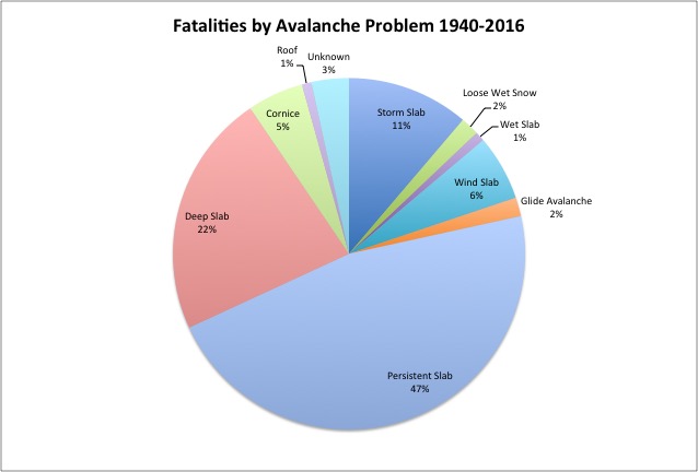
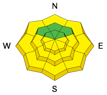
The cornices along the mid and upper elevation ridgelines have become enormous and unruly this year. With enhanced warming, they will continue to be exceptionally dangerous and unstable. Remember that they will break well back beyond the apex of the ridgeline. It's best to approach any ridgeline with caution or with a spotter who can see where the snow ends and the earth begins. These cornices have gained enough mass to potentially trigger an avalanche on the slope below. Cornice-fall and cornice-related avalanches account for roughly 5% of our avalanche fatalities. Glide avalaches just under 2%.
|
| type | aspect/elevation | characteristics |
|---|
|

|
LIKELIHOOD
 LIKELY
UNLIKELY
SIZE
LARGE
SMALL
TREND
INCREASING DANGER
SAME
DECREASING DANGER
|
|
description
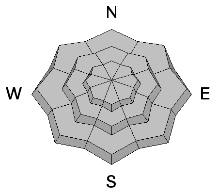
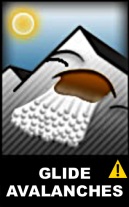
Glide avalanches are challenging to predict, but tend to release during periods of rapidly warming temperatures that both enhance the slow downhill glide rate of the entire snowpack and allow for snow melt to percolate down to the ground interface. They can release without warning anytime - day or night - and produce large, catastrophic avalanches and impressive debris piles. Glide releases are rare in the Ogden area mountains, but some have been noted north of Snowbasin and north of Ben Lomond. Click on the 'i' next the to info-graphic for more info. |
 |
weather We'll have mostly sunny skies today with temps warming to near 50 at 8500' and near freezing along the ridgelines. Northwest winds will blow 15mph. Temps will continue to warm each day - reaching 40°F at ridgetop level by tomorrow afternoon/evening. A weak disturbance quickly moves through on Thursday, but this is only a pause as ridgetop temps spiral even toward the mid to upper 40s by the weekend. |
general announcements
|