25th Annual Black Diamond Fall Fundraising Party
Thursday, September 13; 6:00-10:00 PM; Black Diamond Parking Lot
25th Annual Black Diamond Fall Fundraising Party
Thursday, September 13; 6:00-10:00 PM; Black Diamond Parking Lot
| Advisory: Ogden Area Mountains | Issued by Evelyn Lees for Tuesday - December 20, 2016 - 7:15am |
|---|

|
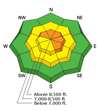
bottom line The avalanche danger Is CONSIDERABLE today for triggering a hard wind slab on an upper elevation slopes facing northwest through southeast. These hard wind slabs can be triggered along the ridgelines or in open bowls, and the danger is MODERATE at the mid elevations where the wind has also drifted the snow. There is also a CONSIDERABLE danger of triggering a deep slide of all the storm snow on an upper elevation slope.
|
 |
special announcement Once again this winter, our partners at the Wasatch Mountain Club are matching WMC member donations to the Utah Avalanche Center. If you are a WMC member and value avalanche forecasting and education, please send a check made out to the Utah Avalanche Center to the WMC at 1390 South 1100 East #103, Salt Lake City, UT 84105 |
 |
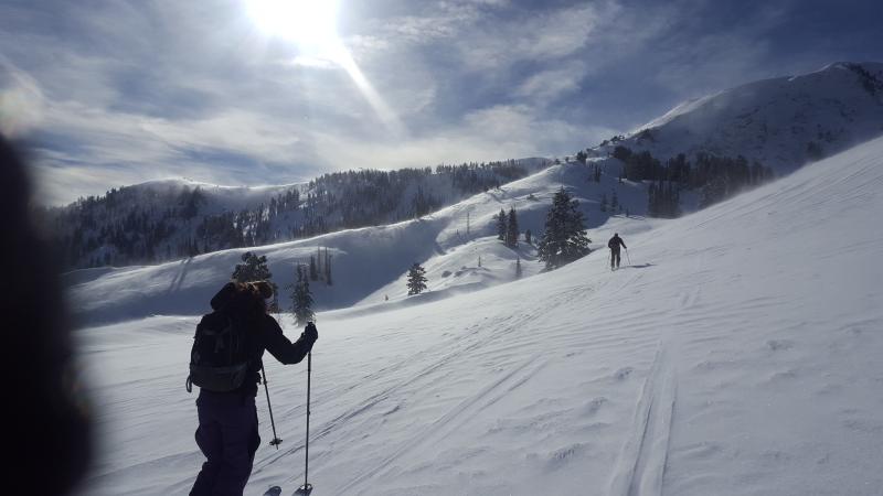
current conditions Skies are overcast in the Ogden area mountains this morning and temperatures mild – in the mid 20s to low 30s. The southwesterly winds have been strongest in the Ogden area mountains over the past 24 hours. Yesterday, they averaged 30 to 50 mph along the high ridge lines, with gusts into the 60s. This morning they have decreased a bit - most stations are averaging 10 to 15 mph, with the highest peaks 20 to 30 mph. Between the wind hammered ridgelines and open bowls to the sun crusted southerly facing slopes, there is still a bit of powder left on shady wind sheltered slopes, mostly at the mid elevations. Wind affected snow. Kory Davis photo
|
 |
recent activity Yesterday, people avoided the new hard wind slabs on steep slopes. Explosive work in the Cottonwoods and Ogden area mountains triggered wind slabs and several larger slab avalanches taking out the storm snow, failing on a shallow layer of facets. Yesterday's observations from the Ogden area mountains:
|
| type | aspect/elevation | characteristics |
|---|

|
|
LIKELIHOOD
 LIKELY
UNLIKELY
SIZE
 LARGE
SMALL
TREND
 INCREASING DANGER
SAME
DECREASING DANGER
|
|
description
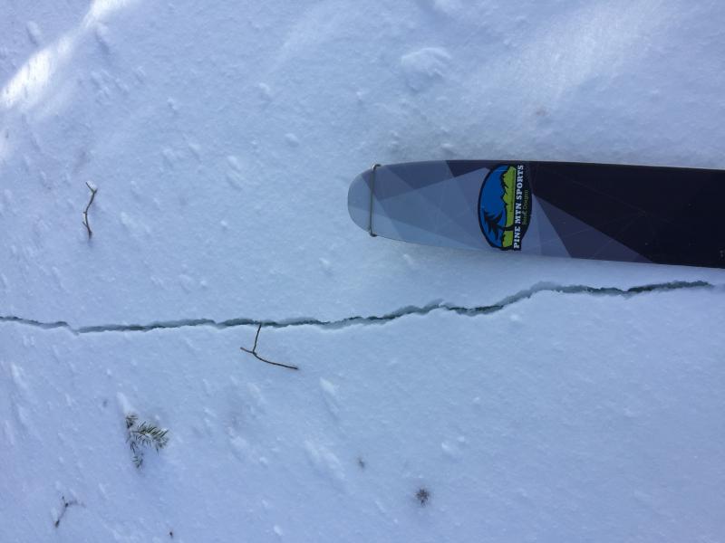
Yesterday’s wind slabs are still sensitive to the weight of a person. Scattered along ridgelines and in open bowls, most of these are hard slabs – a slab avalanche that will break above you, not at your feet. Slope cuts are NOT effective on these. If winds increase again this afternoon where you are, expect additional drifting of the snow and a new sensitive wind slabs. Cracking of a wind slab
|
| type | aspect/elevation | characteristics |
|---|

|
|
LIKELIHOOD
 LIKELY
UNLIKELY
SIZE
 LARGE
SMALL
TREND
 INCREASING DANGER
SAME
DECREASING DANGER
|
|
description
Deeper slides were triggered in the Ogden area mountains with explosives yesterday. These indicate there are still a few places where a larger slide could be triggered, taking out all the snow from last weekend’s storm. This would be most likely on an upper elevation, northwest through easterly facing slope that has also been wind loaded. |
 |
weather Both the wind and clouds will increase this afternoon ahead of a very weak cold front slated to cross northern Utah late tonight. The southwesterly winds will increase this afternoon to 30 mph averages, with 40 - 50 mph averages along the higher ridge lines and gusts in the 50s to 60s. Temperatures will warm into the mid 30s at 8,000’ and to near freezing along the high ridge lines’. A trace to a few inches of snow is possible tonight, mostly north of I-80. The next chance for snow looks to be around Christmas Day |
general announcements
|


 This information does not apply to developed ski areas or highways where avalanche control is normally done. This advisory is from the U.S.D.A. Forest Service, which is solely responsible for its content. This advisory describes general avalanche conditions and local variations always exist.