25th Annual Black Diamond Fall Fundraising Party
Thursday, September 13; 6:00-10:00 PM; Black Diamond Parking Lot
25th Annual Black Diamond Fall Fundraising Party
Thursday, September 13; 6:00-10:00 PM; Black Diamond Parking Lot
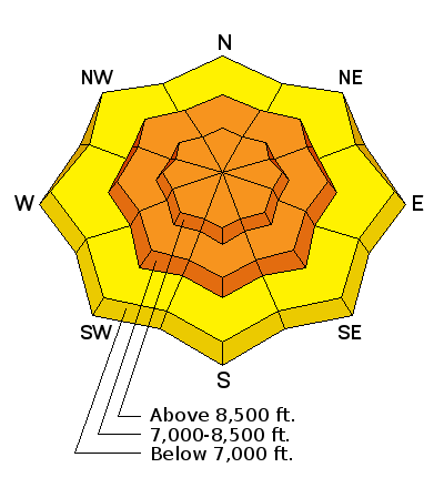
| Advisory: Ogden Area Mountains | Issued by Paige Pagnucco for Saturday - December 17, 2016 - 5:14am |
|---|

|
bottom line The avalanche danger is CONSIDERABLE today in the Ogden mountains. Yesterday's strong winds and high precipitation rates created dangerous avalanche conditions. Careful snowpack evaluation, cautious route finding, and conservative decision making are essential as you travel in the backcountry today. Avoid slopes steeper than 30 degrees as well as locally connected terrain as the snowpack still needs time to adjust to the added weight of the new snow. In addition to wind and storm snow slabs, avalanches could break deeper in the snowpack on buried layers of weak facets. Avoid avalanche runout zones and other terrain traps, like gullies, where you could be caught by an avalanche coming from above you. If you want to ride the steep slopes, head to one of our world class resorts today.
|
 |
special avalanche bulletin Dangerous avalanche conditions still exist in the backcountry across the mountains of Central and Northern Utah, with large and potentially deadly human triggered avalanches likely on upper elevation slopes steeper than about 30 degrees. Backcountry travelers should and stay off and out from under steep slopes and avoid avalanche runout zones. Careful snowpack evaluation, cautious route-finding and conservative decision making will be essential for safe travel in the backcountry this weekend. |
 |
special announcement Discount lift tickets for Alta, Snowbird, Brighton, Solitude, Sundance, Snowbasin, Powder Mountain, and Beaver Mountain are now available, donated by the resorts to benefit the Utah Avalanche Center. Details and order information here. |
 |
current conditions What a storm that was! Rain, wind, thunder, lightning, ice pellets, graupel and, oh yeah ...snow! Most people chose to stay indoors yesterday but those that did venture out found improving riding conditions as the day progressed with the snow getting lighter and lighter. You'll likely find decent cold snow riding conditions today in sheltered, low angle terrain. The atmospheric river has moved to the east and arctic air has taken up residence in the Ogden area mountains. This morning is very cold with temperatures hovering around zero at 8000'. The winds are blowing 5 to 10 mph out of the northwest with gusts in the teens on the ridges. The 8900' Monte Cristo weather station received 1.2" of SWE (snow water equivalent) in the past 24 hours while Ben Lomond, one of if not the wettest spot in the state, received 2.4" of SWE in the past 24 hours. |
 |
recent activity Avalanche reduction teams in the Ogden area reported widespread small to medium sized, new snow and soft and hard wind slabs resulting from control work.(There was also one very large, deep hard slab.) These occured mostly near ridges and rockbands at mid and high elevations. No avalanche activity has been reported from the Ogden area backcountry. |
| type | aspect/elevation | characteristics |
|---|

|

|
LIKELIHOOD
 LIKELY
UNLIKELY
SIZE
 LARGE
SMALL
TREND
 INCREASING DANGER
SAME
DECREASING DANGER
|
|
description
The south west winds were cranking yesterday until the front rolled through around midday. Post frontal passage wind direction changed to north west and speeds dropped dramatically. Winds slabs will continue to be a major concern today at the mid and upper elevations as the snowpack continues to adjust to the added weight. Avoid the lee of ridges and terrain features and watch for smooth, rounded, pillowy surfaces. These wind slabs may be hidden under a blanket of lighter density new snow. The strong winds also built large cornices along ridgelines and exposed subridges. These could still be very sensitive today so best to stay well back. |
| type | aspect/elevation | characteristics |
|---|

|

|
LIKELIHOOD
 LIKELY
UNLIKELY
SIZE
LARGE
SMALL
TREND
INCREASING DANGER
SAME
DECREASING DANGER
|
|
description
In non-wind loaded areas you may still trigger storm slab avalanches as the new snow rests on a variety of potential weak sliding surfaces. |
| type | aspect/elevation | characteristics |
|---|

|
|
LIKELIHOOD
LIKELY
UNLIKELY
SIZE
 LARGE
SMALL
TREND
 INCREASING DANGER
SAME
DECREASING DANGER
|
|
description
There are still a variety of weak layers in the snowpack that could cause persistent slab avalanches. Isolated slopes have a layer of weak facets at the ground while many other slopes have weak layers in the middle of the snowpack. These weak layers are still tenuous and reactive to added weight. Failure at these layers could potentially result in deep and destructive, large avalanches.Though the chances of triggering a persistent slab are small, the consequence of getting caught in an avalanche of this nature could be catastrophic. Avoid steep, mid and high elevation terrain that has not avalanched this year.
(Persistent slab avalanche - pc:K. Davis) |
 |
weather The storm system will continue to exit the area today. A cold airmass will be left in its wake and remain entrenched across the region into early next week. There might be light snowfall in the mountains today and winds will be generally light to moderate out of the north to north west. Expect and be prepared for frigid air in the mountains today - bundle up, bring a thermos of hot tea and watch for frostbite. Be sure to cover up exposed skin surfaces. The cold snap will last through the weekend with temperatures expected to start warming by Monday. |
| general announcements Remember your information can save lives. If you see anything we should know about, please help us out by submitting snow and avalanche conditions. You can also call us at 801-524-5304, email by clicking HERE, or include #utavy in your tweet or Instagram. To get help in an emergency (to request a rescue) in the Wasatch, call 911. Be prepared to give your GPS coordinates or the run name. Dispatchers have a copy of the Wasatch Backcountry Ski map. Backcountry Emergencies. It outlines your step-by-step method in the event of a winter backcountry incident. If you trigger an avalanche in the backcountry, but no one is hurt and you do not need assistance, please notify the nearest ski area dispatch to avoid a needless response by rescue teams. Thanks.
EMAIL ADVISORY If you would like to get the daily advisory by email you will need to subscribe here. DAWN PATROL Hotline updated daily by 5-530am - 888-999-4019 option 8. TWITTER Updates for your mobile phone - DETAILS Utah Avalanche Center mobile app - Get your advisory on your iPhone along with great navigation and rescue tools. Lost or Found something in the backcountry? - http://nolofo.com/ To those skinning uphill at resorts: it is critical to know the resort policy on uphill travel. You can see the uphill travel policy for each resort here. Benefit the Utah Avalanche Center when you shop from Backcountry.com or REI: Click this link for Backcountry.com or this link to REI, shop, and they will donate a percent of your purchase price to the UAC. Both offer free shipping (with some conditions) so this costs you nothing! Benefit the Utah Avalanche Center when you buy or sell on ebay - set the Utah Avalanche Center as a favorite non-profit in your ebay account here and click on ebay gives when you buy or sell. You can choose to have your seller fees donated to the UAC, which doesn't cost you a penny.
|


 This information does not apply to developed ski areas or highways where avalanche control is normally done. This advisory is from the U.S.D.A. Forest Service, which is solely responsible for its content. This advisory describes general avalanche conditions and local variations always exist.