25th Annual Black Diamond Fall Fundraising Party
Thursday, September 13; 6:00-10:00 PM; Black Diamond Parking Lot
25th Annual Black Diamond Fall Fundraising Party
Thursday, September 13; 6:00-10:00 PM; Black Diamond Parking Lot
| Advisory: Ogden Area Mountains | Issued by Drew Hardesty for Tuesday - December 13, 2016 - 6:36am |
|---|

|
bottom line Avalanche conditions are still very complicated in the Ogden Mountains. There is a possibility of human triggered avalanches today; mainly in upper-elevation wind drifted terrain. These avalanches, with the help of our persistent weak layer could break to the ground. The chances of that are slim, but if you were to find the sweet spot large un-survivable avalanches could be triggered. More than likely these wind slabs will fail on NSF (Near Surface Facets) that formed prior to last weekends storm. Skiing the South side of the compass is usually a safe bet but with current conditions these slopes are just as dangerous as the North. With more snow coming this weekend get familiar with the snow surface in the Ogden Mtns. There is still great riding conditions on low angle sheltered terrain, why push it when more cold snow is on the way this weekend. If you need to push the limits and ski the steep and deep head to one of our world class resorts! Forecast written by Kory Davis and approved by Drew Hardesty
|
 |
special announcement Discount lift tickets for Alta, Snowbird, Brighton, Solitude, Sundance, Snowbasin, Powder Mountain, and Beaver Mountain are now available, donated by the resorts to benefit the Utah Avalanche Center. Details and order information here. These make a great holiday gift and all proceeds go towards paying for avalanche forecasting and education! Fireside Chat - This Wednesday December 14th 7-8:30pm @ Black Diamond retail store: Matt McKee from UDOT and Evelyn Lees from the Utah Avalanche Center. Matt will review UDOT's new Avalanche Explosives Work Backcountry Closure Procedures for Provo, Little and Big Cottonwood Canyons and answer questions. Evelyn will discuss the current early winter snow pack and take a look at the concerns of buried crusts in the snowpack if there is time. Take this simple backcountry survey here. Help out my pal Jay Whitacre - he's getting his PhD on risk, decision-making and technology. Thanks - Snowbasin will be doing control work in Strawberry this morning - please avoid entering into this area until they have it open for the public.
Come join your local Avalanche Community to talk to friends and meet new ones at Gear:30 on Friday December 16th. |
 |
current conditions Skies are partly to mostly cloudy this morning with temperatures cooling off through the night. The winds are moderate out of the Southwest at 10-20 and are blowing 25-30 along the high peaks. Snow surface conditions are a mixed bag of melt crusts on South aspects and wind crusts on all aspects and elevations. Most of the cream we enjoyed Sunday has diminished but good powder can be found in protected areas. Large Natural and explosive triggered avalanches were observed in the Ogden area Saturday night into Sunday morning. This has now subsided. The new snow is starting to settle but certain areas could still avalanche with the right trigger. Last weekends storm totals! Ogden mountains: 36"/4.5" SWE
|
 |
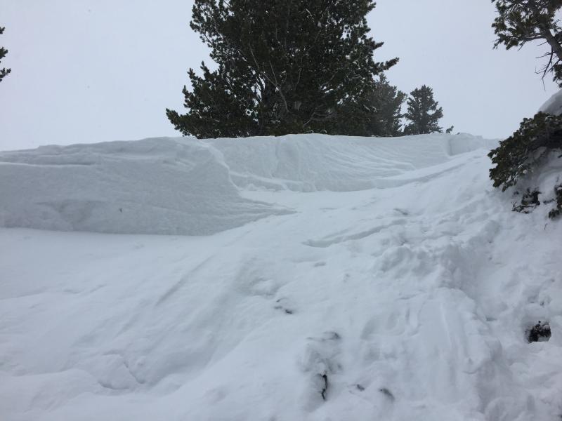
recent activity Avalanche viewing subsided yesterday with no new reports. In closed areas at resorts, Ski Patrols produced D2 avalanches, mainly within the new snow on all aspects mainly on higher elevation slopes. This does not discount the awesome natural cycle we saw in the Ogden Mtns. Avalanche viewing is still top notch at Ogden Ski areas with large (D2 and D3) avalanches viewable from the comforts of a controlled area. No new avalanche activity was reported in the Ogden Backcountry. On Saturday Night (12/10), high elevation N-NE terrain saw a couple avalanches breaking down to the ground mainly on smooth summer surfaces and a gauntlet of other avalanches breaking in the 2-3ft range on buried Near Surface Facets. The complexity of these avalanches over the past couple days is not to be taken lightly:
Photos of the new, mid-pack, and deeper releases in order: (Falk SLC, Davis Ogden Explosive and Natural)
|
| type | aspect/elevation | characteristics |
|---|

|
|
LIKELIHOOD
 LIKELY
UNLIKELY
SIZE
 LARGE
SMALL
TREND
 INCREASING DANGER
SAME
DECREASING DANGER
|
|
description
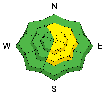
Lingering and developing wind drifts may be found on a variety of aspects and elevations. There is still plenty of snow available for wind transport today. Upper elevation SE-N will be most suspect but swirling and terrain driven winds can load slopes on all aspects of mid to upper elevation terrain. Yesterday small wind pockets were easy to trigger on test slopes. These wind drifted areas will only grow throughout the day. Cornices will be weak today. Keep your distance. Not only can they trigger other avalanches, but rolling down the hill with them can crush you. |
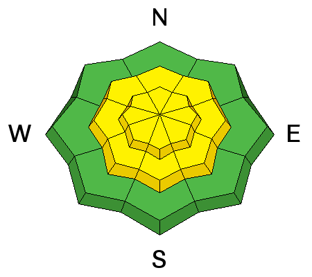
| type | aspect/elevation | characteristics |
|---|

|
|
LIKELIHOOD
LIKELY
UNLIKELY
SIZE
LARGE
SMALL
TREND
 INCREASING DANGER
SAME
DECREASING DANGER
|
|
description
|
| type | aspect/elevation | characteristics |
|---|

|
|
LIKELIHOOD
LIKELY
UNLIKELY
SIZE
 LARGE
SMALL
TREND
INCREASING DANGER
SAME
DECREASING DANGER
|
|
description
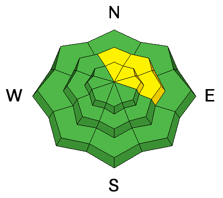
On Saturday, two slides broke to the ground in the backcountry with a few more pulling out naturally in the Ogden mountains early Sunday morning - a warning that the depth hoar is active once again, overloaded by the new snow. These avalanches could be products of smaller human triggered avalanches stepping down to weak snow from November on the ground. These avalanches will be large and most likely un-survivable. The trouble here is that the warning signs are not obvious anymore - cracking and collapsing and natural activity won't be warning signs for this problem right now. Lots of snow analysis is required for entering the suspect terrain - or - best of all - avoid this habitat altogether or choose lower angle slopes. |
 |
weather Today we have temps near 20 degrees with NW winds becoming W 10-20 mph at lower elevation and on ridges 20-30mph. We can expect more precipitation Wednesday hopefully in the form of snow to start than possibly becoming rain at mid elevations. This storm should produce 3-6” of new snow. More snow in the forecast for the weekend. |
| general announcements Remember your information can save lives. If you see anything we should know about, please help us out by submitting snow and avalanche conditions. You can also call us at 801-524-5304, email by clicking HERE, or include #utavy in your tweet or Instagram. To get help in an emergency (to request a rescue) in the Wasatch, call 911. Be prepared to give your GPS coordinates or the run name. Dispatchers have a copy of the Wasatch Backcountry Ski map. Backcountry Emergencies. It outlines your step-by-step method in the event of a winter backcountry incident. If you trigger an avalanche in the backcountry, but no one is hurt and you do not need assistance, please notify the nearest ski area dispatch to avoid a needless response by rescue teams. Thanks.
EMAIL ADVISORY If you would like to get the daily advisory by email you will need to subscribe here. DAWN PATROL Hotline updated daily by 5-530am - 888-999-4019 option 8. TWITTER Updates for your mobile phone - DETAILS UDOT canyon closures: LINK TO UDOT, or on Twitter, follow @UDOTavy, @CanyonAlerts or @AltaCentral Utah Avalanche Center mobile app - Get your advisory on your iPhone along with great navigation and rescue tools. Powderbird Helicopter Skiing - Blog/itinerary for the day Lost or Found something in the backcountry? - http://nolofo.com/ To those skinning uphill at resorts: it is critical to know the resort policy on uphill travel. You can see the uphill travel policy for each resort here. Benefit the Utah Avalanche Center when you shop from Backcountry.com or REI: Click this link for Backcountry.com or this link to REI, shop, and they will donate a percent of your purchase price to the UAC. Both offer free shipping (with some conditions) so this costs you nothing! Benefit the Utah Avalanche Center when you buy or sell on ebay - set the Utah Avalanche Center as a favorite non-profit in your ebay account here and click on ebay gives when you buy or sell. You can choose to have your seller fees donated to the UAC, which doesn't cost you a penny.
|


.jpg)


 This information does not apply to developed ski areas or highways where avalanche control is normally done. This advisory is from the U.S.D.A. Forest Service, which is solely responsible for its content. This advisory describes general avalanche conditions and local variations always exist.