25th Annual Black Diamond Fall Fundraising Party
Thursday, September 13; 6:00-10:00 PM; Black Diamond Parking Lot
25th Annual Black Diamond Fall Fundraising Party
Thursday, September 13; 6:00-10:00 PM; Black Diamond Parking Lot
| Advisory: Moab Area Mountains | Issued by Eric Trenbeath for Monday - January 15, 2018 - 6:25am |
|---|

|
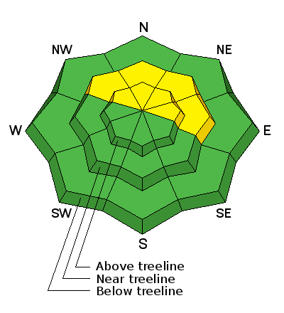
bottom line The avalanche danger is MODERATE and heightened avalanche conditions exist on steep, northerly facing aspects that have more than about a foot of snow. A persistent slab problem exists in these areas where snow from the last storm cycle is overlying weak, sugary faceted snow on the ground. Even a shallow avalanche could prove injurious due to exposed rocks and trees.
|
 |
special announcement This advisory marks our first official danger rating for the season. Field observations taken since the last storm cycle have revealed that there is enough snow cover to create an avalanche hazard in some areas. Snow cover remains very thin, and backcountry travelers are advised to exercise caution due to an abundance of barely covered obstacles. We've scheduled our annual Backcountry 101 avalanche course for Feb 2,3. For more information or to register go here. We've also scheduled a Motorized Backcountry 101 for snowmobiles and snowbikes. For more information or to register go here. |
 |
current conditions
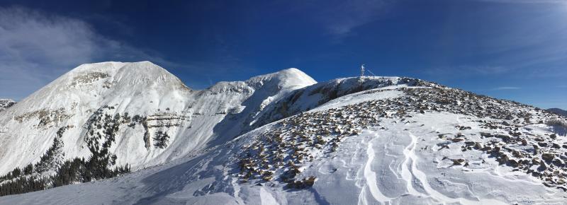
The combination of sunshine, and snow from last week prompted folks to get out in the mountains over the weekend and push their luck on the thin snow cover. I made a trip up to Pre Laurel Peak on Saturday but kept my skins on for much of the descent. Overall coverage ranges from 10" at the Geyser Pass Trailhead to up to 20" in drifted areas right around treeline and above. In between, sun exposed slopes that had no snow on the ground prior to the last storm cycle have 6" or less, and many wind exposed, upper elevation slopes show bare rocks. Actual turning on skis or snowboards is not recommended, and snowmobiling off of the roads is asking for a damaged machine. Prior to the December 21 storm most of the terrain was still dry ground. The exception was sheltered, north facing slopes below treeline, and some scattered, protected areas in the alpine where snow had collected in gullies or depressions. Snowfall History: Dec. 21- 10" Jan. 7 - 4" Jan. 9 - 2" Jan. 10 - 2" Jan. 11 - 4" New snow totals in Gold Basin. Snow totals at the Geyser Pass Trailhead, (9600') Wind, temperature, and humidity on Pre Laurel Peak (11,700')
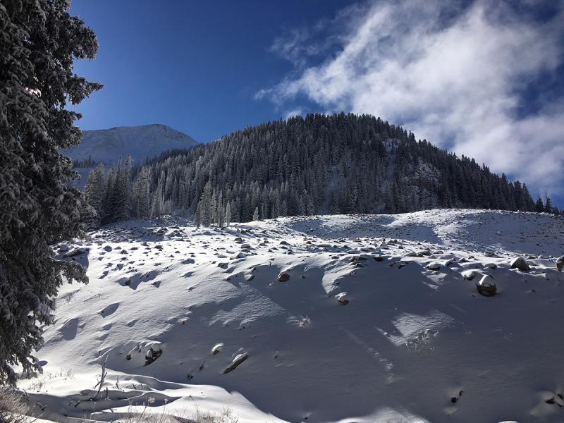
Coverage remains thin, and it's going to take at least another good storm to make travel conducive in this kind of terrain.
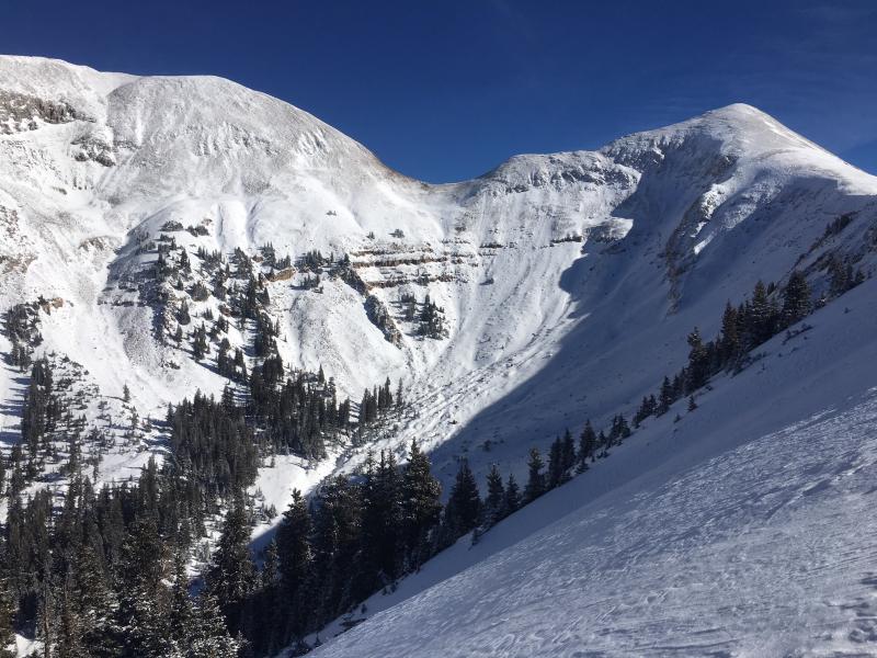
This foreground slope gives the appearance of decent coverage and there is 12-18" of drifted snow here. But it is extremely variable and can quickly go down to 6" or less. Note rocks, and the highly featured surfaces on the sunny slopes in the distance. |
| type | aspect/elevation | characteristics |
|---|

|
|
LIKELIHOOD
 LIKELY
UNLIKELY
SIZE
 LARGE
SMALL
TREND
 INCREASING DANGER
SAME
DECREASING DANGER
|
|
description
Since the last storm cycle, the underlying snowpack has been demonstrating it's inability to support the load, and collapsing and cracking over small areas has been a regular occurrence over the last several days. What this means is that we have a developing persistent slab problem where weak, sugary, faceted snow near the ground is creating an unstable base. In my travels into the high country over the weekend, I determined that there are areas with enough snow to produce an avalanche. These areas are primarily on slopes that face NW-N-E above about 10,500' where there is more than about a foot of snow. The test results below illustrate the problem, and it is only going to worsen when more snow load is added. |
 |
weather A brief disturbance will brush by on Tue-Wed likely bringing only some clouds to our area. By the weekend models are starting to agree on what could be a significant storm system.
|
| general announcements Support the UAC through your daily shopping. When you shop at Smith's, or online at REI, Backcountry.com, Patagonia, NRS, Amazon, eBay a portion of your purchase will be donated to the FUAC. See our Donate Page for more details on how you can support the UAC when you shop. Benefit the Utah Avalanche Center when you buy or sell on eBay - set the Utah Avalanche Center as a favorite non-profit in your eBay account here and click on eBay gives when you buy or sell. You can choose to have your seller fees donated to the UAC, which doesn't cost you a penny This information does not apply to developed ski areas or highways where avalanche control is normally done. This advisory is from the U.S.D.A. Forest Service, which is solely responsible for its content. This advisory describes general avalanche conditions and local variations always occur. |