25th Annual Black Diamond Fall Fundraising Party
Thursday, September 13; 6:00-10:00 PM; Black Diamond Parking Lot
25th Annual Black Diamond Fall Fundraising Party
Thursday, September 13; 6:00-10:00 PM; Black Diamond Parking Lot
| Advisory: Moab Area Mountains | Issued by Eric Trenbeath for Saturday - December 31, 2016 - 6:42am |
|---|

|
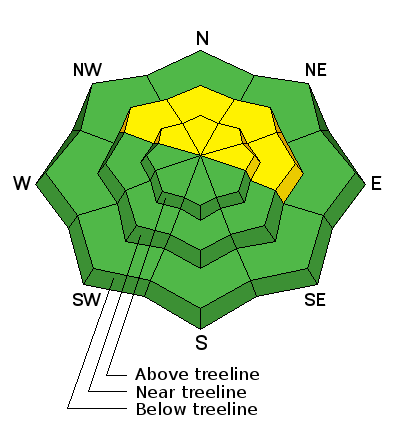
bottom line The avalanche danger is MODERATE on steep, upper-mid to upper elevation terrain that has a NW-N-E aspect, particularly in areas where there are deposits of wind drifted snow. Suspect the lee sides of ridge crests and terrain features such as sub-ridges and beneath rocky outcrops. Elsewhere, the avalanche danger is generally LOW.
|
 |
current conditions Yesterday was another mild, sunny day in the mountains. Today should see a few clouds as a Pacific storm system tracks south of the UT/CO border. Westerly winds are light this morning and it's 18 degrees at 10,000'. Good settled powder can still be found in sheltered locations, but wind and sun exposed slopes have sustained some damage. Base depth in Gold Basin is 45" and the season total is 108" for 169% of normal. Reed Kennard was out yesterday and sent in this observation. Dave Garcia and I were out and about on Friday, digging holes and having a good look around. For a full report from our travels go here. For a full list of recent observations go here. Storm totals and temperature in Gold Basin.(10,000') Wind, temperature and humidity on Pre Laurel Peak.(11,700') Snow totals, temperature and snow/water equivalent at the Geyser Pass Trailhead. (9600')
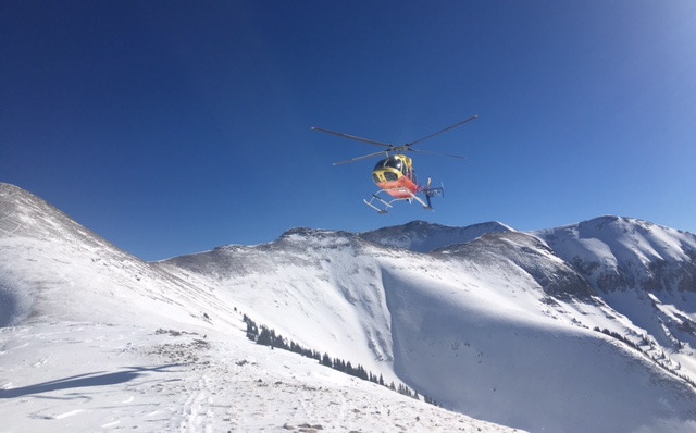
Bluebird skies and not a breath of wind on Friday made for perfect flying conditions. A big thanks to Classic Helicopters and Bego Gerhart from Grand County Search and Rescue for delivering our rescue sled to the top of Pre Laurel Peak! |
 |
recent activity In our travels Friday we noticed a couple slides from the Christmas storm. One came off of the observers left side of Gravel Pit lanes (NE Face of Tukno) initiating below the chutes and then spilling over the cliffs to run the full length of Tele Gold. This slide was about 2' deep, 175' wide and ran for about 800'. We also observed a crown of similar depth below the saddle in Talking Mountain Cirque but it had blown in to the degree that other dimensions were unmeasurable. I also received a report of a significant slide in Dark Canyon. |
| type | aspect/elevation | characteristics |
|---|

|

|
LIKELIHOOD
 LIKELY
UNLIKELY
SIZE
 LARGE
SMALL
TREND
 INCREASING DANGER
SAME
DECREASING DANGER
|
|
description
You still may be able to trigger an old wind slab in upper elevation, wind exposed terrain, primarily on NW-NE-E aspects. Best tip is to suspect smooth, rounded, "fat" looking areas of wind drifted snow. Likely areas to find slabs are down slope from leeward ridge crests, and beneath terrain features such as sub-ridges or rocky buttresses. Though stubborn, if triggered they also have the potential to step down into a deeper persistent weak layer. |
| type | aspect/elevation | characteristics |
|---|

|
|
LIKELIHOOD
LIKELY
UNLIKELY
SIZE
 LARGE
SMALL
TREND
 INCREASING DANGER
SAME
DECREASING DANGER
|
|
description
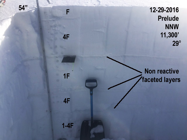
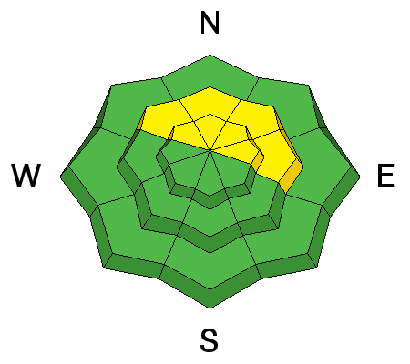
Snowpits dug yesterday showed an overall stabilization and strengthening of the snowpack. Weak layers on northerly aspects, though still present, were no longer reactive under stability tests, and a facet/crust weak layer that was very reactive on southerly aspects last week has broken down. This is good news, but with the continued presence of weak layers, I would still perform a stability analysis before jumping on to any steep slope with a NW-NE-E aspect. For a full report and snowpit profile go here.
|
 |
weather A Pacific storm system will pass south of the UT/CO border today bringing a few clouds to the mountains. A chance of snow develops by tomorrow as a closed low moves southward out of northern California. An unsettled pattern continues into next week followed by a rush of arctic air and subsequent drop in temperatures. Today A 20 percent chance of snow. Mostly sunny, with a high near 25. Northwest wind around 10 mph. Tonight A 50 percent chance of snow, mainly after 9pm. Mostly cloudy, with a low around 11. Southwest wind 10 to 15 mph. New snow accumulation of less than one inch possible. New Year's Day Snow. High near 23. Breezy, with a southwest wind 20 to 25 mph, with gusts as high as 40 mph. Chance of precipitation is 80%. New snow accumulation of 3 to 7 inches possible. Sunday Night Snow likely. Cloudy, with a low around 13. Windy, with a southwest wind 25 to 30 mph, with gusts as high as 45 mph. Chance of precipitation is 70%. New snow accumulation of 3 to 5 inches possible. Monday Snow likely. Mostly cloudy, with a high near 19. Breezy, with a west southwest wind around 25 mph, with gusts as high as 40 mph. Chance of precipitation is 60%. |