25th Annual Black Diamond Fall Fundraising Party
Thursday, September 13; 6:00-10:00 PM; Black Diamond Parking Lot
25th Annual Black Diamond Fall Fundraising Party
Thursday, September 13; 6:00-10:00 PM; Black Diamond Parking Lot
| Advisory: Moab Area Mountains | Issued by Eric Trenbeath for Friday - November 18, 2016 - 8:00am |
|---|
 |
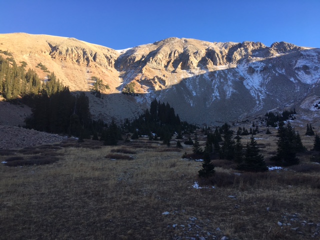
special announcement Finally, some snow that look like it might just stick around! Thursday's storm delivered 9" of medium density snow to the Geyser Pass Trailhead, and I'd expect to find up to a foot up high. The new snow fell on mostly dry ground, so if it would just keep coming, we could avoid the beginnings of a depth hoar snow pack. It looks like we may get another shot of snow on Monday. I'll keep you posted. In the mean time, keep track of snow and weather obs on the links below. Snow depth and temperature at Geyser Pass Trailhead. (9600') Winds, temperature and humidity on Pre Laurel Peak. (11,700')
This is what things looked like in Talking Mountain Cirque on Wednesday, Nov 16 prior to Thursday's storm. |
 |
weather Friday Sunny, with a high near 28. Blustery, with a northwest wind 15 to 25 mph, with gusts as high as 40 mph. Friday night Mostly clear, with a low around 16. Breezy, with a west wind 15 to 20 mph, with gusts as high as 35 mph. Saturday Sunny, with a high near 37. Breezy, with a south southwest wind 15 to 20 mph, with gusts as high as 35 mph. Saturday Night Partly cloudy, with a low around 26. Breezy, with a south southwest wind 15 to 20 mph, with gusts as high as 30 mph. Sunday A 10 percent chance of snow after 11am. Mostly sunny, with a high near 39. South southwest wind around 15 mph, with gusts as high as 30 mph. Sunday Night A 40 percent chance of snow. Mostly cloudy, with a low around 26. Breezy. Monday Snow likely. Mostly cloudy, with a high near 33. Chance of precipitation is 70%. Monday Night Snow. Cloudy, with a low around 21. Tuesday A chance of snow, mainly before 11am. Partly sunny, with a high near 31. Tuesday Night Mostly clear, with a low around 23. Wednesday Sunny, with a high near 34. Wednesday Night Partly cloudy, with a low around 23. Breezy. Thanksgiving Day Mostly sunny, with a high near 32. |