25th Annual Black Diamond Fall Fundraising Party
Thursday, September 13; 6:00-10:00 PM; Black Diamond Parking Lot
25th Annual Black Diamond Fall Fundraising Party
Thursday, September 13; 6:00-10:00 PM; Black Diamond Parking Lot
| Advisory: Logan Area Mountains | Issued by Toby Weed for Thursday - April 12, 2018 - 7:21am |
|---|

|
bottom line MODERATE: Heightened avalanche conditions will develop in the backcountry. A potent storm will cause rising danger of wind slab and storm snow avalanches as new snow accumulates and is drifted on steep mid and upper elevation slopes.
|
 |
special announcement Lift tickets for Snowbasin remaining. The tickets are discounted almost 50%. Details and order information here. All proceeds from these go towards paying for avalanche forecasting and education! |
 |
current conditions A potent cold front will bring much colder temperatures, rain turning to snow, and strong west winds to the Logan Zone today. The storm could produce significant snowfall in the mountains, with 6 to 10 inches possible at 8500' by evening, and more on the way tonight. Rapid accumulation and drifting from strong westerly winds will cause heightened avalanche conditions and rising danger at mid and upper elevations in the backcountry.
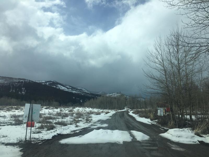
There is still plenty of snow up high, but getting there is an issue. Please do your best to limit resource damage. Stay on roads and avoid riding over bare ground, melted out meadows, and sage brush. It is possible to bring your trailer up the Tony Grove Road to the first overlook where you can park close to the retreating snow. |
 |
recent activity Other than loose wet activity in steep terrain with last weekend's storm no significant avalanches were reported in the Logan Zone recently. |
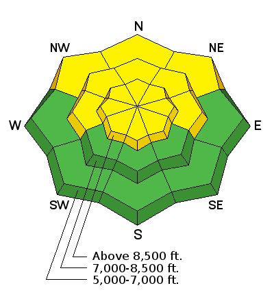
| type | aspect/elevation | characteristics |
|---|

|
|
LIKELIHOOD
 LIKELY
UNLIKELY
SIZE
 LARGE
SMALL
TREND
 INCREASING DANGER
SAME
DECREASING DANGER
|
|
description
The avalanche danger will rise at mid and upper elevations as today's fresh snow accumulates and is drifted into lee slope deposition zones. Wind slab and storm snow avalanches will become increasingly possible as snow accumulates and drifts grow deeper this afternoon and evening.
|
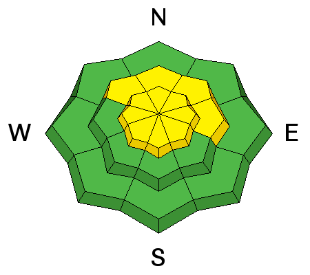
| type | aspect/elevation | characteristics |
|---|

|
|
LIKELIHOOD
LIKELY
UNLIKELY
SIZE
LARGE
SMALL
TREND
 INCREASING DANGER
SAME
DECREASING DANGER
|
|
description
Temperatures stayed well above freezing at all mountain stations again last night, and the snow surface is only superficially frozen this morning. Rapidly dropping temperatures will help to set up the saturated snow, but rain and wet new snow this morning will cause heightened wet avalanche conditions. Natural and triggered loose wet avalanches (or sluffs) entraining saturated surface snow are possible.
|
 |
weather The National Weather Service has issued a Winter Weather Advisory for the Logan Zone. A cold and potent Pacific storm system will advance east across the Great Basin today through Friday. High pressure aloft will return for the weekend.
|
| general announcements Episode 7 of the UAC Podcast "Mastery and False Mastery - An Interview with 'Big' Don Sharaf" is live. With a snow career spanning over 30 years, Don has enough mileage in the mountains to have learned a thing or two, including the profound value of humility when staring into the face of the dragon. Listen in on our conversation about the idea of mastery and if such a thing can exist in the avalanche world. Check it out on the UAC blog, ITunes, Stitcher, or wherever you get your podcasts. The UAC has new support programs with Outdoor Research and Darn Tough. Support the UAC through your daily shopping. When you shop at Smith's, or online at Outdoor Research, REI, Backcountry.com, Darn Tough, Patagonia, NRS, Amazon, eBay a portion of your purchase will be donated to the FUAC. See our Donate Page for more details on how you can support the UAC when you shop. Benefit the Utah Avalanche Center when you buy or sell on eBay - set the Utah Avalanche Center as a favorite non-profit in your eBay account here and click on eBay gives when you buy or sell. You can choose to have your seller fees donated to the UAC, which doesn't cost you a penny Check it out on ITunes, Stitcher, the UAC blog, or wherever you get your podcasts. Now is a great time to practice companion rescue techniques with your backcountry partners. Here's our rescue practice video. EMAIL ADVISORY: If you would like to get the daily advisory by email you will need to subscribe here. Remember your information can save lives. If you see anything we should know about, please help us out by submitting snow and avalanche observations. You can also call us at 801-524-5304, email by clicking HERE, or include #utavy in your Instagram. This advisory is from the U.S.D.A. Forest Service, which is solely responsible for its content. This advisory describes general avalanche conditions and local variations always occur. |