25th Annual Black Diamond Fall Fundraising Party
Thursday, September 13; 6:00-10:00 PM; Black Diamond Parking Lot
25th Annual Black Diamond Fall Fundraising Party
Thursday, September 13; 6:00-10:00 PM; Black Diamond Parking Lot
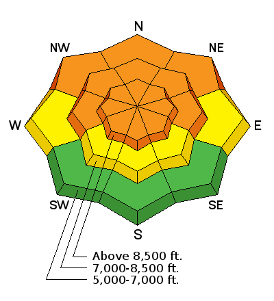
| Advisory: Logan Area Mountains | Issued by Toby Weed for Saturday - April 7, 2018 - 7:00am |
|---|

|
bottom line Significant rain in the mountains will cause dangerous avalanche conditions and CONSIDERABLE danger in the backcountry. The danger of wet avalanches will increase as rainfall intensifies and the rain-snow line rises in elevation during the day today. The danger of wind slab and storm snow avalanches will also increase at upper elevations, as heavy new snow accumulates and is drifted by intensifying southwest wind.
|
 |
special announcement Lift tickets for Snowbasin and Powder Mountain remaining. The tickets are discounted almost 50%. Details and order information here. All proceeds from these go towards paying for avalanche forecasting and education! |
 |
current conditions Significant rain is expected in the mountains today, with the rain-snow line climbing to the highest elevations in the Logan Zone. Thunder storms are possible. Rain will change back to snow up high tonight and southwest winds will intensify. Wet avalanches entraining saturated snow are likely today, and large, long running natural avalanches will be increasingly possible as rainfall increases this afternoon and evening.
|
 |
recent activity No reports from the backcountry, but natural loose wet avalanches entraining very wet new snow likely occurred in steep terrain yesterday... |
| type | aspect/elevation | characteristics |
|---|

|
|
LIKELIHOOD
 LIKELY
UNLIKELY
SIZE
 LARGE
SMALL
TREND
 INCREASING DANGER
SAME
DECREASING DANGER
|
|
description
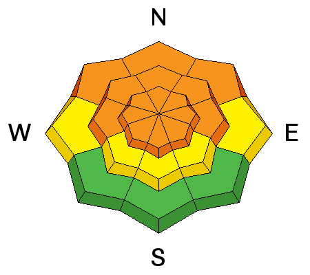
Natural and triggered loose wet avalanches (or sluffs) entraining rain-saturated snow are likely on steep snow-covered slopes at all elevations today.
|
| type | aspect/elevation | characteristics |
|---|

|
|
LIKELIHOOD
 LIKELY
UNLIKELY
SIZE
 LARGE
SMALL
TREND
INCREASING DANGER
SAME
DECREASING DANGER
|
|
description
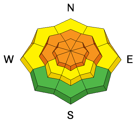
Significant rainfall on a still layered snowpack will cause an increasing danger of wet slab (or deep slab) avalanches in areas plagued by buried persistent weak layers made up of sugary faceted snow.
|
| type | aspect/elevation | characteristics |
|---|

|
|
LIKELIHOOD
 LIKELY
UNLIKELY
SIZE
 LARGE
SMALL
TREND
INCREASING DANGER
SAME
DECREASING DANGER
|
|
description
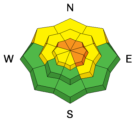
Accumulating snow and drifting from increasing southwest winds will cause rising danger of wind slab and storm snow avalanches on upper elevation slopes. Dangerous wind slab and cornice fall conditions could develop tonight. |
 |
weather A moist, warm, and increasingly windy Pacific storm will impact the Logan Zone this weekend. Abundant rain will fall in Cache Valley and in the mountains of the Logan Zone, even at upper elevations. Southwest winds will increase significantly in the mountains this afternoon and tonight, and several inches of snow is likely at upper elevations tonight and tomorrow.
|
| general announcements Episode 7 of the UAC Podcast "Mastery and False Mastery - An Interview with 'Big' Don Sharaf" is live. With a snow career spanning over 30 years, Don has enough mileage in the mountains to have learned a thing or two, including the profound value of humility when staring into the face of the dragon. Listen in on our conversation about the idea of mastery and if such a thing can exist in the avalanche world. Check it out on the UAC blog, ITunes, Stitcher, or wherever you get your podcasts. The UAC has new support programs with Outdoor Research and Darn Tough. Support the UAC through your daily shopping. When you shop at Smith's, or online at Outdoor Research, REI, Backcountry.com, Darn Tough, Patagonia, NRS, Amazon, eBay a portion of your purchase will be donated to the FUAC. See our Donate Page for more details on how you can support the UAC when you shop. Benefit the Utah Avalanche Center when you buy or sell on eBay - set the Utah Avalanche Center as a favorite non-profit in your eBay account here and click on eBay gives when you buy or sell. You can choose to have your seller fees donated to the UAC, which doesn't cost you a penny Check it out on ITunes, Stitcher, the UAC blog, or wherever you get your podcasts. Now is a great time to practice companion rescue techniques with your backcountry partners. Here's our rescue practice video. EMAIL ADVISORY: If you would like to get the daily advisory by email you will need to subscribe here. Remember your information can save lives. If you see anything we should know about, please help us out by submitting snow and avalanche observations. You can also call us at 801-524-5304, email by clicking HERE, or include #utavy in your Instagram. This advisory is from the U.S.D.A. Forest Service, which is solely responsible for its content. This advisory describes general avalanche conditions and local variations always occur. |


