25th Annual Black Diamond Fall Fundraising Party
Thursday, September 13; 6:00-10:00 PM; Black Diamond Parking Lot
25th Annual Black Diamond Fall Fundraising Party
Thursday, September 13; 6:00-10:00 PM; Black Diamond Parking Lot
| Advisory: Logan Area Mountains | Issued by Toby Weed for Wednesday - March 22, 2017 - 7:13am |
|---|

|
bottom line Below freezing temperatures tonight will slow the melt and begin to stabilize saturated snow. Heightened wet avalanche conditions exist today on steep slopes in the backcountry. Cornice-fall, loose wet, wet slab, and glide avalanches are possible, most likely during the heat of the day. Evaluate snow and terrain carefully. Stay off of and out from under large cornices, glide cracks, and steep slopes with warmth-softened wet snow.
|
 |
special announcement Discount lift tickets for Beaver Mountain, Snowbasin, Powder Mountain, and the Central Wasatch resorts are donated by the resorts to benefit the Utah Avalanche Center. Details and order information here. |
 |
current conditions Temperatures stayed well above freezing last night at most stations and rain and a little heavy snow fell in the mountains. The Tony Grove Snotel at 8400' reports 35 °F and 99" of total snow, with 145% of average SWE (Snow Water Equivalent). A 15 mph southwest wind is blowing at the 9700' CSI Logan Peak weather station and it's 30 °F. A couple inches of snow is possible and temperatures will drop below freezing tonight, but today heightened wet avalanche conditions exist in steep terrain.
|
 |
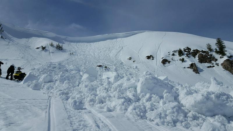
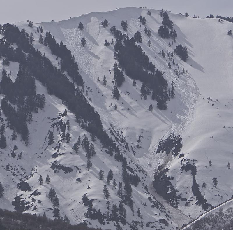
recent activity A large cornice fall avalanche Sunday on Cornice Ridge could have been human triggered. The cornice "thundered" as it collapsed and ran down the bowl below.
Extrordinarily large cornices are unstable due to several days of unseasonably warm weather.
Yesterday we could see recent large wet avalanches off Mitton Peak, Rattlesnake Canyon, in the Wrellsville Mountain Wilderness.... Cornice fall triggered wet slabs up high. Then below, overrunning snow pulled out a glide avalanche to the rocks.
|
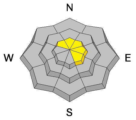
| type | aspect/elevation | characteristics |
|---|

|

|
LIKELIHOOD
 LIKELY
UNLIKELY
SIZE
 LARGE
SMALL
TREND
 INCREASING DANGER
SAME
DECREASING DANGER
|
|
description
Triggered and natural loose wet avalanches are possible on steep slopes.
|
| type | aspect/elevation | characteristics |
|---|

|
|
LIKELIHOOD
LIKELY
UNLIKELY
SIZE
LARGE
SMALL
TREND
 INCREASING DANGER
SAME
DECREASING DANGER
|
|
description
Glide and wet slab avalanches avalanches are possible. |
| type | aspect/elevation | characteristics |
|---|

|
|
LIKELIHOOD
LIKELY
UNLIKELY
SIZE
LARGE
SMALL
TREND
INCREASING DANGER
SAME
DECREASING DANGER
|
description
|
 |
weather (from the NWS): A strong and significantly colder Pacific storm system will move east across the Great Basin through Thursday, followed by a return of high pressure for the end of the work week. |
| general announcements Do you buy groceries at Smiths? When you register your Smith’s rewards card with their Community Rewards program, they will donate to the Utah Avalanche Center whenever you make a purchase. It's easy, only takes a minute, and doesn't cost you anything. Details here. If you sign up for AmazonSmile and designate the Utah Avalanche Center as your favorite charity, they will donate a portion of everything you spend to the UAC. It doesn't cost you a penny and we'd really appreciate the help. Your information can save lives. If you see anything we should know please help us out by submitting snow and avalanche observations. You can call us at 801-524-5304, email by clicking HERE, or include @utavy in your Instagram. In the Logan Area you can reach me at 435-757-7578 We will update this advisory regularly on Monday, Wednesday, Friday, and Saturday mornings by about 7:30. This advisory is from the U.S.D.A. Forest Service, which is solely responsible for its content. This advisory describes general avalanche conditions and local variations always exist. |