25th Annual Black Diamond Fall Fundraising Party
Thursday, September 13; 6:00-10:00 PM; Black Diamond Parking Lot
25th Annual Black Diamond Fall Fundraising Party
Thursday, September 13; 6:00-10:00 PM; Black Diamond Parking Lot
| Advisory: Logan Area Mountains | Issued by Toby Weed for Wednesday - March 8, 2017 - 7:05am |
|---|


|
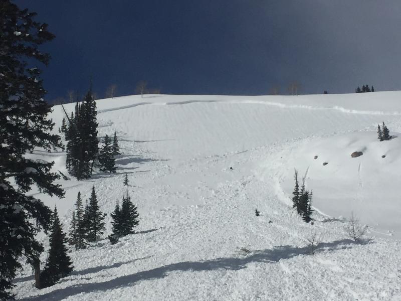
bottom line Dangerous conditions exist on drifted upper elevation slopes, triggered wind slab and cornice fall avalanches are likely. Today and tomorrow, rapid warming will cause heightened wet avalanche conditions. Carefully evaluate snow and terrain, make conservative choices, and stay off of and out from under drifted slopes, large cornices and steep terrain with saturated fresh snow.
|
 |
special announcement Discount lift tickets for Beaver Mountain, Snowbasin, Powder Mountain, and the Central Wasatch resorts are donated by the resorts to benefit the Utah Avalanche Center. Details and order information here. |
 |
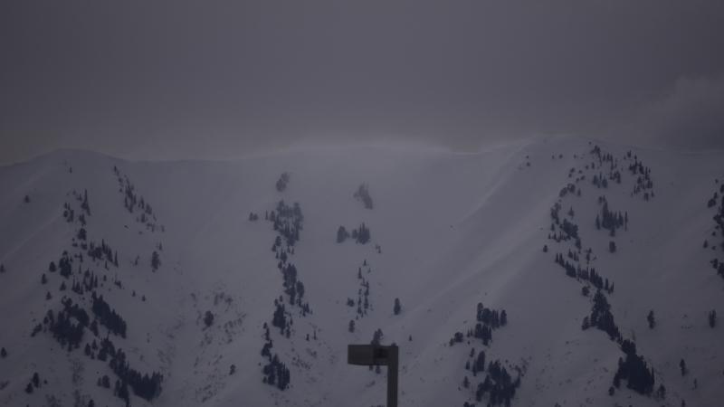
current conditions Westerly wind subsided a bit but continued to drift snow, and temperatures rose steadily overnight. This morning the Tony Grove Snotel at 8400' reports 28 F and about two feet of snow, with 3.3" SWE (Snow Water Equivalent) since the storm started Sunday afternoon. There's 130" of total snow at the site with 174% of average SWE. It's 22 F at the 9700' CSI Logan Peak weather station, and there's a 20 mph southwest wind. The UDOT Hwy 89 Logan Summit reports 15 to 20 mph west winds overnight, with 43 mph gusts. Dangerous avalanche conditions exist on drifted upper elevation slopes, and today seasonal and solar warming will create heightened wet avalanche conditions as the fresh snow is initially warmed. |
 |
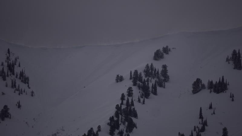
recent activity Yesterday, I could see fresh cornice fall and wind slab avalanches on the east side of the Wellsville Range.
A rider triggered a good sized avalanche Friday afternoon near Gibson Basin just north of the ID/UT state line.
|
| type | aspect/elevation | characteristics |
|---|

|
|
LIKELIHOOD
 LIKELY
UNLIKELY
SIZE
 LARGE
SMALL
TREND
 INCREASING DANGER
SAME
DECREASING DANGER
|
|
description
Strong westerly winds in the past couple days and overnight formed fresh wind slabs and enlarged already huge ridge-top cornices.
Yesterday, drifting off Wellsville Range was visible from Logan. |
| type | aspect/elevation | characteristics |
|---|

|
|
LIKELIHOOD
 LIKELY
UNLIKELY
SIZE
LARGE
SMALL
TREND
 INCREASING DANGER
SAME
DECREASING DANGER
|
|
description
Rapidly warming temperatures today and tomorrow will cause heightened wet avalanche conditions. Triggered and natural loose wet avalanches entraining significant piles of moist fresh snow are possible on slopes steeper than about 30 degrees. Watch for signs of wet instability like roller balls, pin-wheels and natural sluffs under trees or rock outcroppings. If the snow is wet and sloppy or sticky you should avoid being on or under steep slopes. |
 |
weather A mild westerly flow aloft will remain in place across the region through the upcoming weekend and into early next week. Today, snow showers before noon and 1 to 3 inches of snow possible, a high temperature of 8500' of 37 F, and a 17 mph west wind is expected. Tonight will be mostly cloudy, with a low temperature of 29 F and 16 to 22 mph west wind. Tomorrow will be mostly cloudy, with a high temperature of 42 F and 17 to 26 mph west wind, gusting to 40 mph. |
| general announcements Do you buy groceries at Smiths? When you register your Smith’s rewards card with their Community Rewards program, they will donate to the Utah Avalanche Center whenever you make a purchase. It's easy, only takes a minute, and doesn't cost you anything. Details here. If you sign up for AmazonSmile and designate the Utah Avalanche Center as your favorite charity, they will donate a portion of everything you spend to the UAC. It doesn't cost you a penny and we'd really appreciate the help. Your information can save lives. If you see anything we should know please help us out by submitting snow and avalanche observations. You can call us at 801-524-5304, email by clicking HERE, or include @utavy in your Instagram. In the Logan Area you can reach me at 435-757-7578 We will update this advisory regularly on Monday, Wednesday, Friday, and Saturday mornings by about 7:30. This advisory is from the U.S.D.A. Forest Service, which is solely responsible for its content. This advisory describes general avalanche conditions and local variations always exist. |