25th Annual Black Diamond Fall Fundraising Party
Thursday, September 13; 6:00-10:00 PM; Black Diamond Parking Lot
25th Annual Black Diamond Fall Fundraising Party
Thursday, September 13; 6:00-10:00 PM; Black Diamond Parking Lot
| Advisory: Logan Area Mountains | Issued by Toby Weed for Tuesday - February 21, 2017 - 5:33am |
|---|

|
bottom line Dangerous conditions exist at upper and mid elevations, natural avalanches are possible and triggered wind slabs likely on drifted slopes. Storm slab avalanches involving heavy new snow are possible in sheltered terrain. Wet sluffs entraining saturated surface snow could occur on steep slopes at low and mid elevations. Evaluate snow and terrain carefully, make cautious decisions, and avoid travel on or under steep drifted slopes.
|
 |
special announcement Discount lift tickets for Beaver Mountain, Snowbasin, Powder Mountain, and the Central Wasatch resorts are donated by the resorts to benefit the Utah Avalanche Center. Details and order information here. |
 |
current conditions It could be raining a little at 8400' this morning. The Tony Grove Snotel reports 4 inches of snow and 1.1" of SWE (Snow Water Equivalent) in the past 24 hours. There was a bit more than a foot of heavy new snow up at the lake yesterday, and the station reports 2.3" SWE in the last 48 hrs. It's 35 F and there's 111" of total snow containing 165% of average SWE. It's 28 F at the CSI Logan Peak weather station at 9700', and 30 mph south-southwest wind is howling on the mountain top, gusting to 64 mph. |
 |
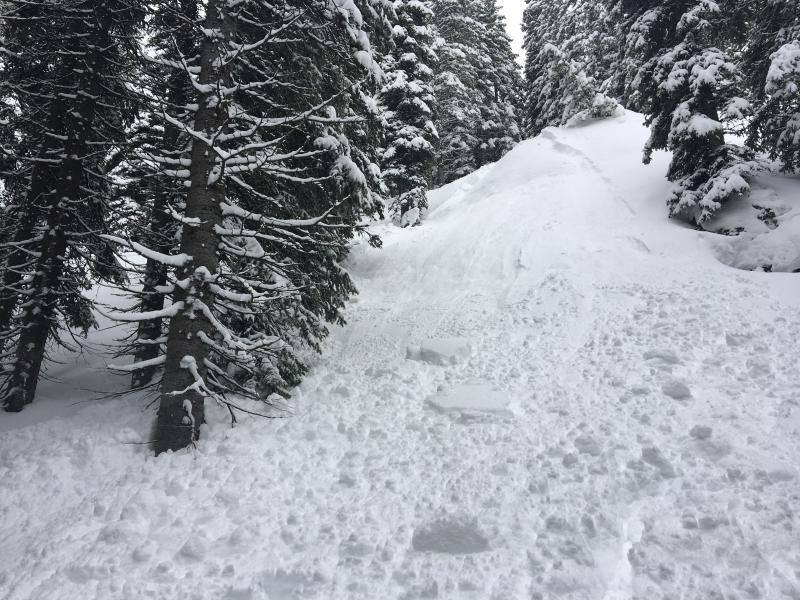
recent activity
I intentionally triggered this storm slab on a very steep test slope above the Tony Grove Campground. |
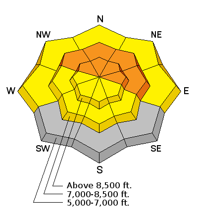
| type | aspect/elevation | characteristics |
|---|

|
|
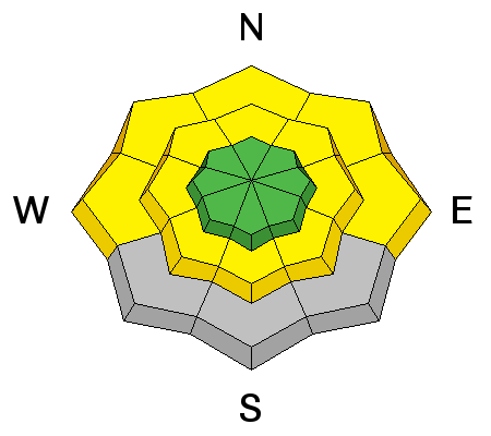
LIKELIHOOD
 LIKELY
UNLIKELY
SIZE
 LARGE
SMALL
TREND
 INCREASING DANGER
SAME
DECREASING DANGER
|
description
|
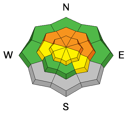
| type | aspect/elevation | characteristics |
|---|

|
|
LIKELIHOOD
 LIKELY
UNLIKELY
SIZE
LARGE
SMALL
TREND
INCREASING DANGER
SAME
DECREASING DANGER
|
|
description
Triggered soft slab avalanches involving heavy storm snow are possible at upper and mid elevations. Storm slab avalanches may fail on a density change within the new snow or up to 2 feet deep on faceted snow above the solid and slick 2/10 rain-crust. |
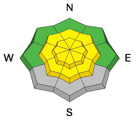
| type | aspect/elevation | characteristics |
|---|

|
|
LIKELIHOOD
LIKELY
UNLIKELY
SIZE
LARGE
SMALL
TREND
 INCREASING DANGER
SAME
DECREASING DANGER
|
|
description
Wet sluffs entraining significant piles of saturated surface snow are possible on steep low and mid elevation slopes facing any direction, most likely to occur during midday warmth. Freezing temperatures tonight will solidify the saturated snow, so we shouldn't have to worry about wet avalanches tomorrow. |
 |
weather A mild and strong southwest flow will prevail today. A cold front tonight will usher in a period of cold unsettled weather lasting through the end of the week. |
| general announcements Any time is a great time to practice companion rescue techniques with your partners. Companion Rescue Practice Video Do you buy groceries at Smiths? When you register your Smith’s rewards card with their Community Rewards program, they will donate to the Utah Avalanche Center whenever you make a purchase. It's easy, only takes a minute, and doesn't cost you anything. Details here. If you sign up for AmazonSmile and designate the Utah Avalanche Center as your favorite charity, they will donate a portion of everything you spend to the UAC. It doesn't cost you a penny and we'd really appreciate the help. Your information can save lives. If you see anything we should know please help us out by submitting snow and avalanche observations. You can call us at 801-524-5304, email by clicking HERE, or include @utavy in your Instagram. In the Logan Area you can reach me at 435-757-7578 We will update this advisory regularly on Monday, Wednesday, Friday, and Saturday mornings by about 7:30. This advisory is from the U.S.D.A. Forest Service, which is solely responsible for its content. This advisory describes general avalanche conditions and local variations always exist. |