25th Annual Black Diamond Fall Fundraising Party
Thursday, September 13; 6:00-10:00 PM; Black Diamond Parking Lot
25th Annual Black Diamond Fall Fundraising Party
Thursday, September 13; 6:00-10:00 PM; Black Diamond Parking Lot
| Advisory: Logan Area Mountains | Issued by Toby Weed for Monday - January 16, 2017 - 7:09am |
|---|


|
bottom line Heightened avalanche conditions exist in the backcountry, and triggered persistent slab and cornice-fall avalanches are possible. Evaluate the snow and terrain carefully. Avoid ridge-top cornices, drifted terrain, and steep rocky slopes with thin overall snow cover.
|
 |
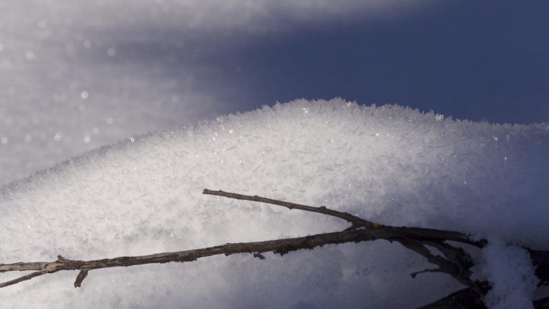
current conditions The Tony Grove Snotel at 8400' reports 16 degrees F with 93 inches of total snow containing 168% of average SWE (Snow Water Equivalent). It's 14 degrees F at the CSI Logan Peak weather station at 9700', and 18 mph north-northwest wind. Observers report numerous natural avalanches across the zone from last week's wild storm. But everyone is also apparently finding good snow stability, with no word of triggered avalanches. Feathery surface hoar is widespread at all elevations and on slopes facing all directions.
Surface hoar is widespread in the Logan Zone |
 |
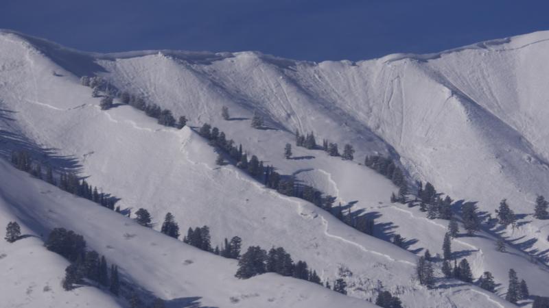
recent activity List of notable activity from last week's natural avalanche cycle:
Large natural avalanches from last week in the Wellsville Range above Mendon and in Wood Camp Hollow.
|
| type | aspect/elevation | characteristics |
|---|

|
|
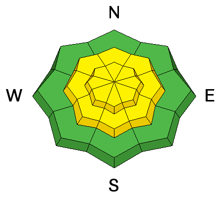
LIKELIHOOD
 LIKELY
UNLIKELY
SIZE
 LARGE
SMALL
TREND
 INCREASING DANGER
SAME
DECREASING DANGER
|
|
description
Persistent slab avalanches, failing on buried weak layers, are possible. Large natural avalanches stepping into old snow were common during last week's storm. Weak layers of faceted snow exist above and below rain-crusts at mid and lower elevations. The snow is weakest in rocky terrain where it's thin or shallow. Remotely triggered avalanches are unlikely but still possible. |
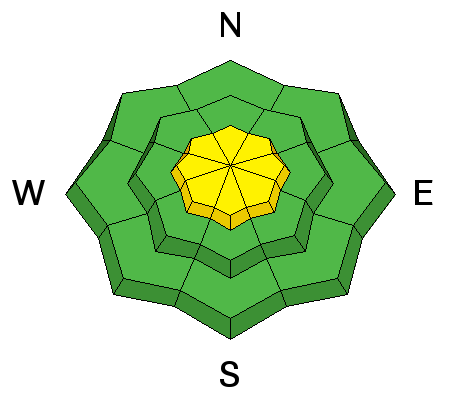
| type | aspect/elevation | characteristics |
|---|

|
|
LIKELIHOOD
LIKELY
UNLIKELY
SIZE
 LARGE
SMALL
TREND
INCREASING DANGER
SAME
DECREASING DANGER
|
description
|
 |
weather High pressure aloft will settle over the Great Basin for the first half of the week. A return to an active weather pattern will occur late in the week. It'll be sunny in the mountains with a high at 8500' of 27 F, and moderate north wind becoming light from the northeast in the afternoon. It'll be mostly clear tonight, with continued light north wind and a low temperature of 16 F. Same tomorrow, with a daytime high temperature of 33 F. The next round of Pacific storminess will affect the zone starting Wednesday night, lasting into the weekend. |
| general announcements Any time is a great time to practice companion rescue techniques with your partners. Companion Rescue Practice Video The National Avalanche Center just released their Avalanche Problems Explained video... Not all avalanches are made the same. As a result, travel and decisions in avalanche terrain are influenced by the kind of avalanche you expect to encounter. Watch HERE Discount lift tickets for Beaver Mountain, Snowbasin, Powder Mountain, and the Central Wasatch resorts are donated by the resorts to benefit the Utah Avalanche Center. Details and order information here. Your information can save lives. If you see anything we should know please help us out by submitting snow and avalanche observations. You can call us at 801-524-5304, email by clicking HERE, or include @utavy in your Instagram. In the Logan Area you can reach me at 435-757-7578 We will update this advisory regularly on Monday, Wednesday, Friday, and Saturday mornings by about 7:30. This advisory is from the U.S.D.A. Forest Service, which is solely responsible for its content. This advisory describes general avalanche conditions and local variations always exist. |