25th Annual Black Diamond Fall Fundraising Party
Thursday, September 13; 6:00-10:00 PM; Black Diamond Parking Lot
25th Annual Black Diamond Fall Fundraising Party
Thursday, September 13; 6:00-10:00 PM; Black Diamond Parking Lot
| Advisory: Logan Area Mountains | Issued by Toby Weed for Saturday - January 14, 2017 - 7:01am |
|---|


|
bottom line Heightened avalanche conditions exist in the backcountry, and you could trigger avalanches on many slopes. Pockets of more dangerous conditions may be found on drifted upper elevation slopes, with cornice falls and sizable triggered avalanches likely. Avoid drifted slopes, and let the new snow stabilize before venturing into steep terrain.
|
 |
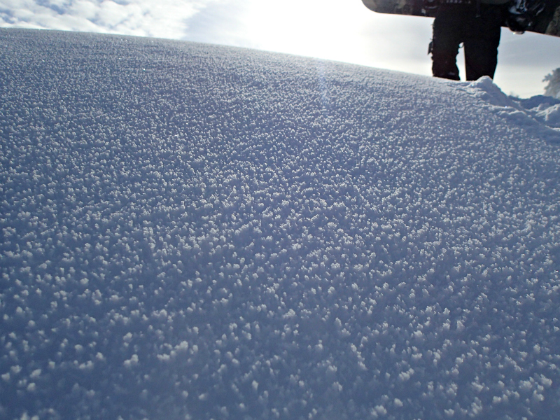
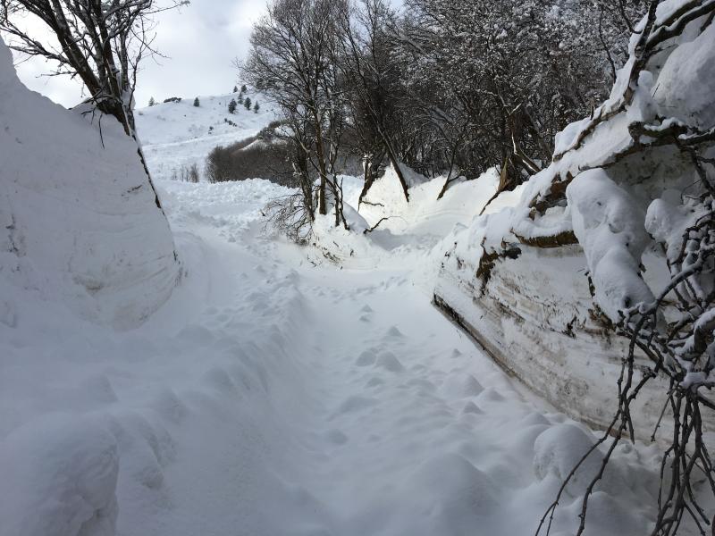
current conditions The Tony Grove Snotel at 8400' reports 24 degrees F with 98 inches of total snow containing 175% of average SWE (Snow Water Equivalent). Over 10 inches of SWE arrived in the past week. It's 19 degrees F at the CSI Logan Peak weather station at 9700', and the wind sensor is encased by ice and is not working. Winds at the UDOT Hwy 89 Logan Summit are calm at 5:00 am. Observers in the Central Bear River Range report numerous natural avalanches from the Wednesday/Thursday natural avalanche cycle, but reasonably good stability at upper and mid elevations. Rime is on the snow surface on open slopes at upper elevations.
Rime on the snow surface in the Bear River Range and avalanche debris in the Wellsville Range. 1/13/2017 |
 |
recent activity
Mitton Peak Avalanche, 1/13/2017 |
| type | aspect/elevation | characteristics |
|---|

|
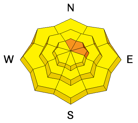
|
LIKELIHOOD
 LIKELY
UNLIKELY
SIZE
 LARGE
SMALL
TREND
 INCREASING DANGER
SAME
DECREASING DANGER
|
|
description
Persistent slab avalanches, failing on buried weak layers, are possible on many slopes.
|
| type | aspect/elevation | characteristics |
|---|

|
|
LIKELIHOOD
LIKELY
UNLIKELY
SIZE
 LARGE
SMALL
TREND
 INCREASING DANGER
SAME
DECREASING DANGER
|
description
|
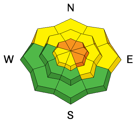
| type | aspect/elevation | characteristics |
|---|

|
|
LIKELIHOOD
 LIKELY
UNLIKELY
SIZE
LARGE
SMALL
TREND
 INCREASING DANGER
SAME
DECREASING DANGER
|
|
description
Solar warming may cause a heightened danger of loose wet avalanches on sheltered sunny slopes. |
 |
weather High pressure aloft will settle over the Great Basin for the weekend and the first half of next week, followed by a return to an active weather pattern late in the week. |
| general announcements Any time is a great time to practice companion rescue techniques with your partners. Companion Rescue Practice Video The National Avalanche Center just released their Avalanche Problems Explained video... Not all avalanches are made the same. As a result, travel and decisions in avalanche terrain are influenced by the kind of avalanche you expect to encounter. Watch HERE Discount lift tickets for Beaver Mountain, Snowbasin, Powder Mountain, and the Central Wasatch resorts are donated by the resorts to benefit the Utah Avalanche Center. Details and order information here. Your information can save lives. If you see anything we should know please help us out by submitting snow and avalanche observations. You can call us at 801-524-5304, email by clicking HERE, or include @utavy in your Instagram. In the Logan Area you can reach me at 435-757-7578 We will update this advisory regularly on Monday, Wednesday, Friday, and Saturday mornings by about 7:30. This advisory is from the U.S.D.A. Forest Service, which is solely responsible for its content. This advisory describes general avalanche conditions and local variations always exist. |