25th Annual Black Diamond Fall Fundraising Party
Thursday, September 13; 6:00-10:00 PM; Black Diamond Parking Lot
25th Annual Black Diamond Fall Fundraising Party
Thursday, September 13; 6:00-10:00 PM; Black Diamond Parking Lot
| Advisory: Abajo Area Mountains | Issued by Drew Hardesty for Sunday - March 4, 2018 - 7:22am |
|---|

|
bottom line Many areas have LOW avalanche danger. Areas of MODERATE, however, exist in localized terrain for triggering an avalanche 1-2' deep. These would be more likely on heavily wind loaded areas on slopes facing west to north to east at the mid and upper elevations. The danger for new snow avalanches may rise to MODERATE for shallow natural and human triggered sluffs and pockets of wind slab. Remember that risk is inherent in mountain travel and safe travel protocols save lives: carry and know how to use rescue equipment, put only one person on a slope at a time, and have a plan. The best and safest conditions exist on low angle shady sheltered slopes with no overhead hazard.
|
 |
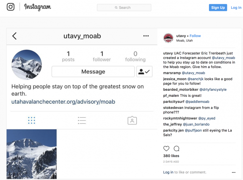
special announcement UAC Moab (La Sals/Abajos) forecaster Eric Trenbeath and I are on a short exchange through Sunday. He'll be taking my shifts in the UAC - Salt Lake office this weekend. I'll have forecasts up for the La Sals through Sunday and for the Abajos on Saturday and Sunday. If anything needs my attention or if there are pertinent snow, weather, or avalanche observations, please submit an observation or email or call me directly: [email protected] or 801.842.8519. Thanks - Episode 6 of the UAC podcast "A Conversation with Tom Kimbrough" is live. We explore ideas about lifetime exposure to risk and what role Buddhism has played in his life as a climber, skier, and soon-to-be octogenarian. We talk about what has changed over the years in snow science and the role of mentorship in the world of avalanche forecasting and other professions and pursuits. Check it out on ITunes, Stitcher, the UAC blog. The UAC Marketplace is still open. Our online marketplace still has deals on skis, packs, airbag packs, beacons, snowshoes, soft goods and much more. INSTAGRAM! We now have a UAC-Moab Instagram page. You can find it here....but better yet follow us on your smartphone. Confused? Ask a teenager.
|
 |
current conditions The storm in on the horizon and we should see rapidly dropping temperatures, winds shifting to the west and a few inches of snow this morning. Currently, temps are in the upper 20s at the mid elevations with 1-3' on the ground Many areas have been winds stripped to the ground. Southelry winds up high were 30mph gusting to 50 but are now 20 gusting to 50. Local pro avalanche observer Kevin Dressel and I toured into the upper North Creek, the Jackson Ridge and No Name Peak on Friday and our report can be found here. Wind, temperature and humidity on Abajo Peak (11,000') Snow totals at Buckboard Flat (8924') Snow totals at Camp Jackson (8858') A quick look at the Camp Jackson snotel site below to see how we're doing as compared to last year and the average year. It should come as no surprise that we are just at 37% of average in the Abajo mountains. See image below to compare this lean year against last year's banner season. Still, we found excellent travel and riding conditions in the sun and wind sheltered terrain. Depths range from 1-3'.
|
 |
recent activity None. Your information to us helps to save lives. Reports of avalanches, cracking, collapsing or any other information makes a difference. It's easy to do, even from your smartphone. Thanks - |
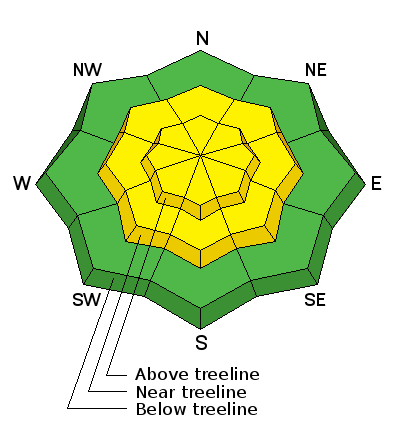
| type | aspect/elevation | characteristics |
|---|

|

|
LIKELIHOOD
 LIKELY
UNLIKELY
SIZE
 LARGE
SMALL
TREND
 INCREASING DANGER
SAME
DECREASING DANGER
|
|
description
Hard wind drifts are scattered across the landscape and are best described as stubborn. They do have a nasty habit of breaking well above you as you travel from down across the taper of the tear-drop shape of wind drift. Listen for low collapsing or drum-like sounds but these - nor cracking - may be evident.
|
| type | aspect/elevation | characteristics |
|---|

|
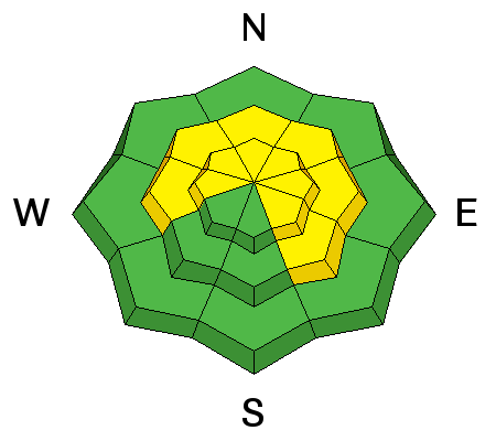
|
LIKELIHOOD
LIKELY
UNLIKELY
SIZE
 LARGE
SMALL
TREND
INCREASING DANGER
SAME
DECREASING DANGER
|
|
description
Avalanches stepping into old early season snow 1-2' deep remains far and away the most significant and unsurvivable avalanche problem. The poor structure has gone mostly dormant in the past week, but additional stress of wind loading is rarely a good thing. For now, I'd put this firmly in the Low Probability - High Consequence regime. Potential triggers include cornice fall, people or snowmobiles "catching air" and landing hard in the starting zone...or just finding a thin weak spot on the slope. Even though no avalanches, cracking or collapsing is present...and snow tests show a fairly dormant structure, it's enough to keep a conservative approach. With benign weather later this week, this problem may become completely dormant. |
| type | aspect/elevation | characteristics |
|---|

|
|
LIKELIHOOD
 LIKELY
UNLIKELY
SIZE
LARGE
SMALL
TREND
 INCREASING DANGER
SAME
DECREASING DANGER
|
|
description
This will be a conservative call as we're not expecting more than a few inches of new snow in the Abajos, but I expect the new snow to bond poorly to the hard old wind and sun crusts and sluff naturally and with provocation on the steepest slopes. Shallow wind drifts may also be possible on steep lee wind loaded slopes, more likely on terrain with an easterly component. Fortunately, these new snow issues are well managed with ski cuts and observations on test slopes. Remember however that terrain choices either amplify or diminish consequences of even small slides. |
 |
weather Frontal passage is due this morning with 2-4" expected in the mountains. Temperatures at 10,000' may drop as low as the low teens overnight but slowly start to rebound over the course of the week. Winds will remain gusty with the wind shift from south to west to northwest, with gusts along the ridgelines into the 40s. Skies should start to clear overnight with high pressure moving in for the week. Another storm perhaps on tap for next weekend. |
| general announcements The UAC has new support programs with Outdoor Research and Darn Tough. Support the UAC through your daily shopping. When you shop at Smith's, or online at Outdoor Research, REI, Backcountry.com, Darn Tough, Patagonia, NRS, Amazon, eBay a portion of your purchase will be donated to the FUAC. See our Donate Page for more details on how you can support the UAC when you shop. Benefit the Utah Avalanche Center when you buy or sell on eBay - set the Utah Avalanche Center as a favorite non-profit in your eBay account here and click on eBay gives when you buy or sell. You can choose to have your seller fees donated to the UAC, which doesn't cost you a penny This information does not apply to developed ski areas or highways where avalanche control is normally done. This advisory is from the U.S.D.A. Forest Service, which is solely responsible for its content. This advisory describes general avalanche conditions and local variations always occur. |