25th Annual Black Diamond Fall Fundraising Party
Thursday, September 13; 6:00-10:00 PM; Black Diamond Parking Lot
25th Annual Black Diamond Fall Fundraising Party
Thursday, September 13; 6:00-10:00 PM; Black Diamond Parking Lot
| Advisory: Abajo Area Mountains | Issued by Eric Trenbeath for Thursday - January 5, 2017 - 6:49am |
|---|

|
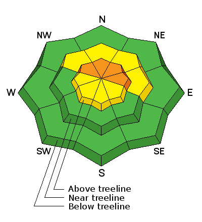
bottom line The avalanche danger is MODERATE today but could rise to CONSIDERABLE as wind and accumulating new snow combine to create dangerous avalanche conditions in steep, upper elevation terrain, on slopes that have a NW-N-E aspect. Be alert to changing conditions and look for signs of instability such as cracking in the snow surface. Avoid slopes with recent deposits of wind drifted snow. Out of the wind zone at mid elevations the danger will remain MODERATE. Low elevations offer mostly LOW danger.
|
 |
special announcement |
 |
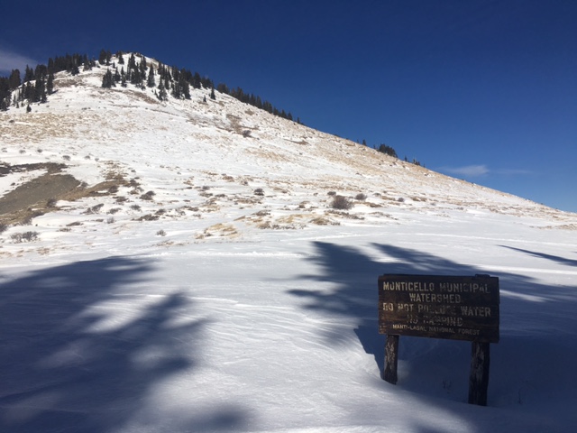
current conditions Snow has not yet begun to fall but the forecast is for 5-9" of snow today and the same tonight. The Abajo Peak wind sensor is down this morning but regionally, winds have been steady out of the southwest at 20-30 mph with gusts into the 40's in upper elevations. Snow conditions remain thin and the surface in exposed locations is beginning to look like a moonscape. Many south facing slopes have been stripped to the ground. For real time weather data click on the links below: Winds, temperature and humidity on Abajo Peak. Snow totals at Camp Jackson.
Still pretty thin up on south facing slopes above North Creek Pass.
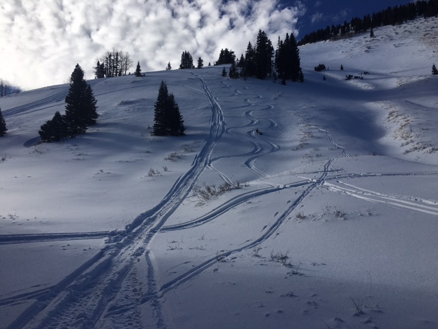
Winter hungry folks are still finding enough snow to slide around on however. |
| type | aspect/elevation | characteristics |
|---|

|

|
LIKELIHOOD
 LIKELY
UNLIKELY
SIZE
 LARGE
SMALL
TREND
 INCREASING DANGER
SAME
DECREASING DANGER
|
|
description
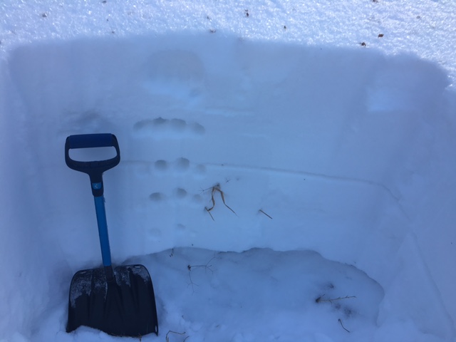
Wind and accumulating new snow will cause the avalanche danger to rise over the next 24 hours. Here are some problems to be aware of. -Wind Slabs: Wind drifted snow will accumulate on the lee sides of ridge crests and terrain features, in upper elevation, wind exposed terrain. They are recognizable as smooth, rounded pillows of snow that may crack when when weight is applied. A triggered wind slab has the potential to break down into buried weak layers creating a deeper and more dangerous avalanche. -Persistent Slab: The underlying snowpack is very weak, and several inches of faceted, sugar snow exist at the ground level. This upside down set up creates an unstable base for a load of snow on top, and in some isolated areas, the additional weight of a rider could trigger an avalanche down to this buried weak layer. you are most likely to encounter this problem on steep, upper elevation, north facing terrain where wind deposited snow has drifted over top of this weak structure.
Photo illustrates the current, weak snowpack structure. Note the weak, sugary layer of faceted snow at the bottom of the snowpack. This makes an unstable base for future snow loads. |
 |
weather Today Snow showers. The snow could be heavy at times. Widespread blowing snow. Widespread fog, mainly after 9am. High near 26. Wind chill values as low as -10. Very windy, with a west wind 30 to 40 mph, with gusts as high as 65 mph. Chance of precipitation is 90%. Total daytime snow accumulation of 5 to 9 inches possible. Tonight Snow showers, mainly before 3am. The snow could be heavy at times. Widespread blowing snow before midnight. Widespread fog, mainly before 11pm. Low around 8. Windy, with a west northwest wind 30 to 35 mph decreasing to 20 to 25 mph after midnight. Winds could gust as high as 55 mph. Chance of precipitation is 90%. New snow accumulation of 5 to 9 inches possible. Friday A 30 percent chance of snow showers before 11am. Mostly sunny, with a high near 16. Wind chill values as low as -10. Blustery, with a north northwest wind 15 to 20 mph decreasing to 10 to 15 mph in the afternoon. Winds could gust as high as 35 mph. Friday Night Mostly clear, with a low around 9. West southwest wind 10 to 15 mph. Saturday Partly sunny, with a high near 24. West southwest wind around 15 mph, with gusts as high as 30 mp |