25th Annual Black Diamond Fall Fundraising Party
Thursday, September 13; 6:00-10:00 PM; Black Diamond Parking Lot
25th Annual Black Diamond Fall Fundraising Party
Thursday, September 13; 6:00-10:00 PM; Black Diamond Parking Lot
| Advisory: Abajo Area Mountains | Issued by Eric Trenbeath for Thursday - December 22, 2016 - 7:23am |
|---|

|
bottom line The avalanche danger is MODERATE this morning but will likely rise to CONSIDERABLE later in the day on steep, wind exposed slopes in upper elevation terrain. Watch for fresh drifts, and recently formed wind slabs on the lee sides of ridge crests and terrain features, and look for signs of instability such as cracking or collapsing in the snow pack. Triggered wind slabs will also have the potential to step down into buried weak layers causing a deeper, and more dangerous persistent slab avalanche. Timing will be everything toady, and staying alert to changing conditions will be paramount.
|
 |
special announcement |
 |
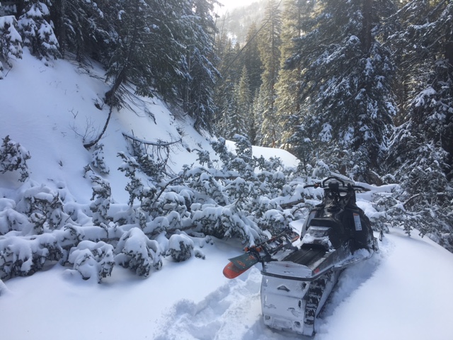
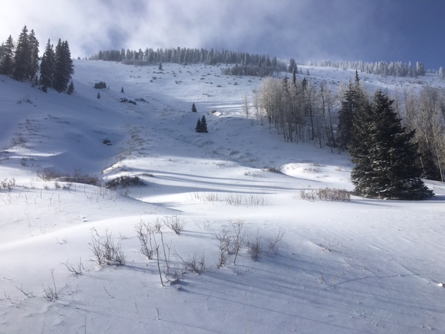
current conditions We look to be poised for another round of snow. A closed low moving in off the coast of southern California is spreading moisture across the Southwest and we should see snowfall beginning mid-day and continuing through the night. With 6-10" in the forecast, timing will be everything today and you will need to be alert to signs of rising avalanche danger. It's still pretty thin coverage with a lot of grass and bushes poking out, even up high. Less than a foot of snow total exists on the ground at the Dalton Springs Trailhead, and by large, travel off the road is still not advisable. Strong winds also impacted the area during the storm, and numerous trees are down across the road up to North Creek Pass.
After making it around and over numerous down trees in the North Creek Road, this finally shut me down.
Still pretty thin up there.
But that didn't stop Todd and Randy from going for it! |
 |
weather Today Snow showers. The snow could be heavy at times. Widespread blowing snow, mainly after noon. High near 32. South southeast wind around 15 mph, with gusts as high as 25 mph. Chance of precipitation is 90%. Total daytime snow accumulation of 6 to 10 inches possible. Tonight Snow showers. The snow could be heavy at times. Areas of blowing snow. Low around 23. Breezy, with a southwest wind 15 to 20 mph, with gusts as high as 35 mph. Chance of precipitation is 90%. New snow accumulation of 8 to 12 inches possible. Friday A 50 percent chance of snow. Partly sunny, with a high near 30. Breezy, with a west wind 5 to 10 mph becoming southwest 15 to 20 mph in the afternoon. New snow accumulation of less than one inch possible. Friday Night Snow likely, mainly after 11pm. Mostly cloudy, with a low around 24. Windy, with a south southwest wind 25 to 30 mph, with gusts as high as 50 mph. Chance of precipitation is 60%. New snow accumulation of 1 to 3 inches possible. Saturday Snow. High near 30. Windy, with a south wind 30 to 35 mph, with gusts as high as 55 mph. Chance of precipitation is 80%. |