25th Annual Black Diamond Fall Fundraising Party
Thursday, September 13; 6:00-10:00 PM; Black Diamond Parking Lot
25th Annual Black Diamond Fall Fundraising Party
Thursday, September 13; 6:00-10:00 PM; Black Diamond Parking Lot
| Advisory: Abajo Area Mountains | Issued by Eric Trenbeath for Wednesday - December 7, 2016 - 7:33am |
|---|

|
bottom line Due to low snow cover, the avalanche danger is generally LOW in the Abajo Mountains. Be alert to areas of wind drifted snow at upper elevations along leeward ridge crests and terrain features. The snow pack is very shallow and weak at this time, and future snow loads will cause the danger to increase.
|
 |
special announcement |
 |
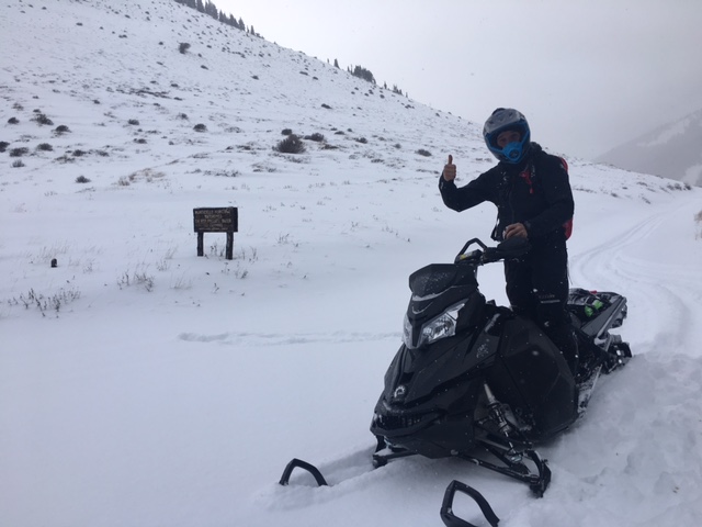
current conditions Snow cover in the Abajo Mountains is still quite thin and there isn't enough snow to recreate on beyond the road. The storm last week brought the first significant snow laying down about a foot in the upper elevations on top of about 6" of existing snow. There is only a few inches of snow on the ground at the trailheads and in the lower elevations.
Forest Service volunteer Chris Jacobson tops out at North Creek Pass. Pretty low snow up there.
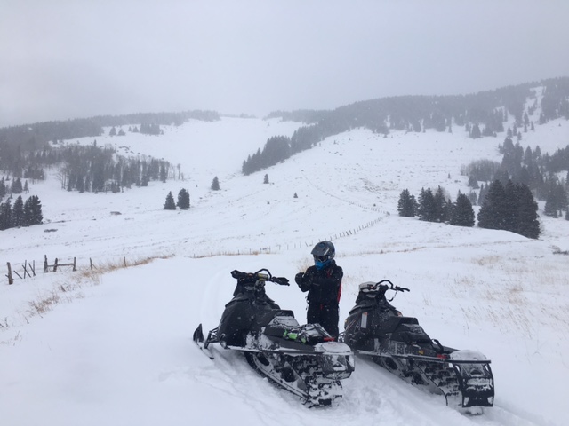
On the backside near Robinson Pasture. Snow here was even thin on the road so we turned around. Wind, temperature and humidity on Abajo Peak. Snow totals at Camp Jackson. |
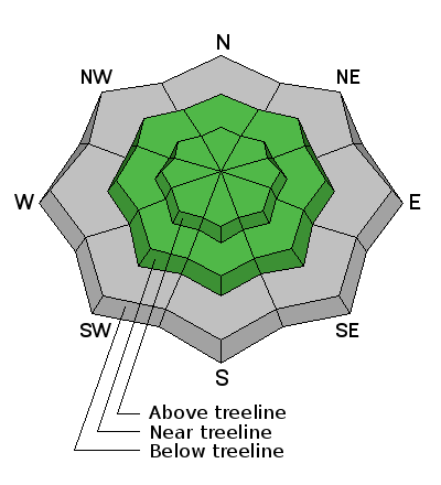
| type | aspect/elevation | characteristics |
|---|

|
|
LIKELIHOOD
 LIKELY
UNLIKELY
SIZE
 LARGE
SMALL
TREND
 INCREASING DANGER
SAME
DECREASING DANGER
|
|
description
There isn't currently enough snow to pose much of an avalanche danger, but be alert to wind drifted snow along leeward ridge crests and terrain features at upper elevations. Of note is the current snow pack structure. The weak shallow now is already deteriorating, and this doesn't bode well for future snow loads.
Chris Jacobson digs out weak, faceted grains, or "sugar snow" out from the bottom of the existing shallow snow pack. This makes an unstable base for future snow loads. |
 |
weather Today Mostly sunny, with a high near 14. Wind chill values as low as -30. Breezy, with a north northwest wind 15 to 20 mph. Tonight Partly cloudy, with a low around 10. North northwest wind 10 to 15 mph. Thursday Mostly sunny, with a high near 28. West southwest wind 10 to 15 mph. Thursday Night A 20 percent chance of snow. Mostly cloudy, with a low around 16. Breezy, with a west southwest wind 15 to 20 mph, with gusts as high as 30 mph. Friday A 20 percent chance of snow before 11am. Partly sunny, with a high near 32. Breezy, with a west southwest wind 15 to 20 mph, with gusts as high as 30 mph. |