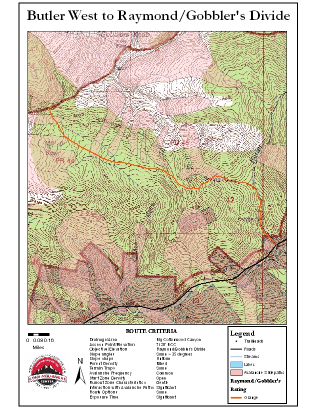
Route Name
Butler West to Raymond/Gobbler's Divide
Route Rating
Orange
Route Description
Butler West to Raymond/Gobbler’s Divide: Ascend as with the Circle Awl tour (8 miles up the canyon on the north side of the road) to the ridgeline and drop into upper Mill A Basin. Continue north and west through the aspens, splitting the difference between the slide paths emanating off both Raymond and Gobbler’s. One reaches the destination after three and a half miles and 2500’ elevation gain. A very experienced ski party suffered one fatality and serious injuries here in 1995. Caution too is advised in the narrow stretch above the Butler Fork trailhead. Dogs are not allowed in the watershed of BCC.
Printable Map
Route Map


