Observation: Rocky Point

Observation Date
4/14/2016
Observer Name
mark white
Region
Salt Lake » Big Cottonwood Canyon » Rocky Point
Location Name or Route
Alta perimeter
Weather
Sky
Obscured
Precipitation
Moderate Snowfall
Wind Direction
Northwest
Wind Speed
Moderate
Weather Comments
Periods of heavy graupel, thunder and lightning, with moderate ridge top winds fro the W-NW
Snow Characteristics
New Snow Depth
6"
New Snow Density
High
Snow Surface Conditions
Dense Loose
Snow Characteristics Comments

The new snow was mostly graupel with actual snow starting around 4pm. the first inch or so was highly saturated, the underlying old snow was damp and saturated down low, mostly unsupportable, the surface of the old snow was getting a shallow refreeze up high by the time I left but just the top inch or so, you could still shove the basket end of your pole in a foot or so into the old isothermal snow.

Comments

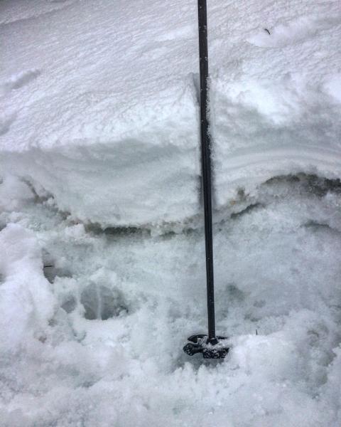
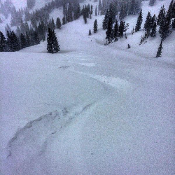
Waited for the front to come through and decided to head to Rocky Point, So Long area. There was about an inch of new snow when we arrived which at the end of the day added up to 6 or 7 inches at about 10,000ft. We did experience some minor collapsing while breaking trail and the new snow was not bonding very well to the old saturated snow at mid-elevations, on steep slopes you could get the new snow moving and it would entrain everything down to the wet bed surface and move fairly fast. The new snow seemed to bond a little better at higher elevations because of the shallow refreeze on the old surface. I would not be surprised if we hear of wet slab activity from today if anyone was getting in steeper terrain. Thinking hazard will be on the decline with cold temps but the east winds might make for wind slabs in strange places.

Photos; snow layering wet facets under the new, wet activity, traxs filling in faster than you can make them

Today's Observed Danger Rating
Moderate
Tomorrows Estimated Danger Rating
Moderate