Observation: Cottonwood Ridgeline

Observation Date
1/17/2016
Observer Name
Meisenheimer
Region
Salt Lake » Little Cottonwood Canyon » Cottonwood Ridgeline
Location Name or Route
Flagstaff to Days Fork Ridge
Weather
Sky
Clear
Wind Direction
Northwest
Wind Speed
Strong
Weather Comments
Strong winds in the am till about 2:30pm then completly died off.
Snow Characteristics
New Snow Depth
12"
New Snow Density
High
Snow Surface Conditions
Powder
Wind Crust
Melt-Freeze Crust
Snow Characteristics Comments

Upside down conditions made skiing interesting and added a scary feel to the snowpack.

Red Flags
Red Flags
Recent Avalanches
Heavy Snowfall
Wind Loading
Cracking
Poor Snowpack Structure
Red Flags Comments
Lots of red flags....
Avalanche Problem #1
Problem
Persistent Weak Layer
Trend
Same
Problem #1 Comments

The slab seems to be stiff and stubborn. However, I don't think anyone dared to test the theory. The northerly facing terrain looked and felt scary today. I saw no tracks on any of the shady slopes. When I arrived at Alta around 11:20am there were no tracks down any of the south facing terrain, when I left (5:00pm) people starting to tease the steeper (generally south) terrain without incident.

Twelve inches of new snow sits on top of Friday/Saturdays' low density snow making the snow feel slabby and dangerous. At the very least you could easily trigger a storm slab within the new snow that could be 1-2' deep and a few hundred feet wide.

Even though cracking or collapsing was not in your face today, I would continue to avoid the steep northerly facing slopes for at least a few days. There is plenty of old weak snow on the shady slope to remain suspect.

Avalanche Problem #2
Problem
Wind Drifted Snow
Trend
Decreasing Danger
Problem #2 Comments

Wind was ripping out of the west and created deep drifts along the high terrain. Wind loaded slopes sounded hollow and were very loaded up. I would guess this instability will settle out much sooner than the persistent slab issue.

Comments

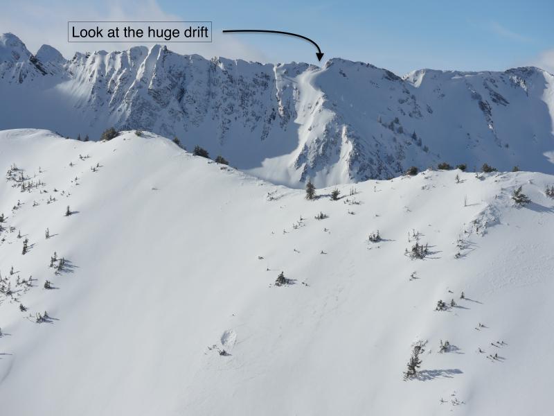
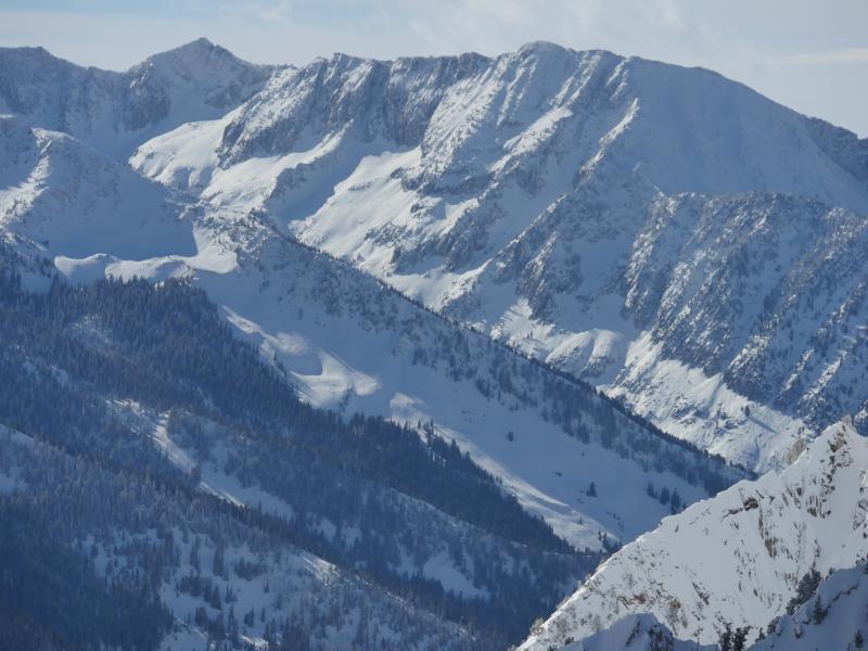
Check out the massive wind drift in Cardiff. Winds cross loading sub ridges and terrain features. Pretty rare to see all the south facing terrain untracked in upper LCC.

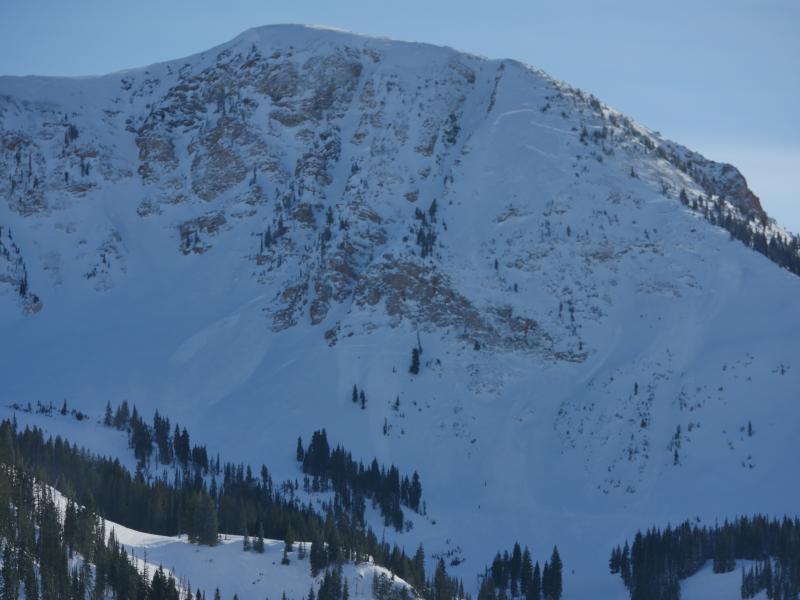
Control results from the shoulder.

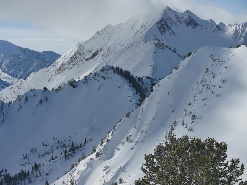
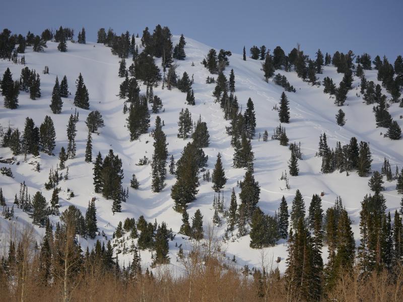
Tracks from today - people started slow this morning and generally stuck to very conservative terrain. I saw two natural avalanches that probably happened in the overnight hours. One in Jaws and the other in north facing upper Silver Fork. Both avalanches ran down to the flats and had significant debris piles. I would assume Jaws was a repeat.

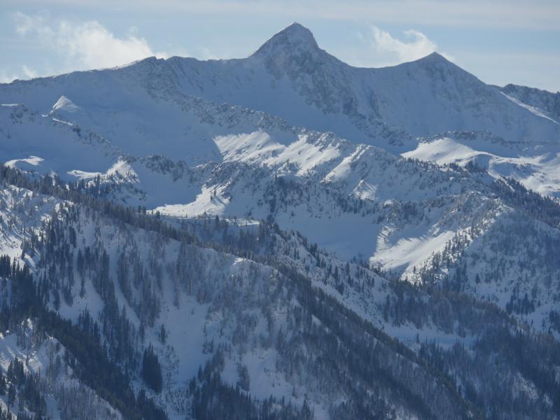
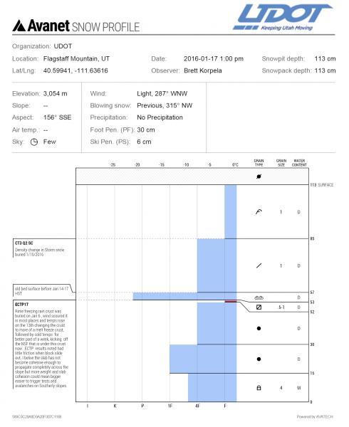
Pit profile from UDOT on the south facing terrain. Pit location was just off the ridge in Emma one. They did get full propagation in the pit.

Today's Observed Danger Rating
High
Tomorrows Estimated Danger Rating
Considerable