
Snow pack averaged 35 to 55 cm deep, scattered thin wind slabs cracked under foot, but didn't propagate. Even at this elevation, the snow pack seemed to be changing a bit with the warmer temperatures. On snow pit tests, once the the wind slab slid off, ECT didn't work - no slab - the snow just mushed down.
Seemed the snow near the ground was warming and becoming moist in places. While another 24 hours of warm temperatures is better than cold, it still won't be able to solve our weak facet problem.

Also looked at snow at lower elevations:
5,200', north facing - very patchy, wet, unfrozen; will be strong when it cools and freezes.
6,800', north facing - damp again throughout the whole pack; will be strong when cools.
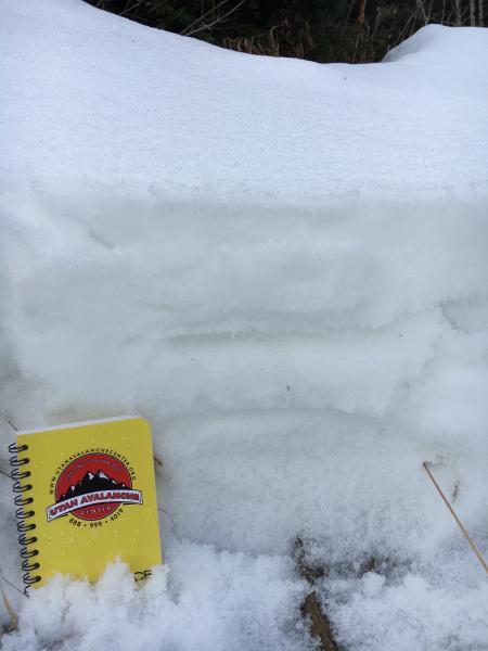
7,400', north facing - Photo Below. A bit more layering; but the whole "pack" moist. Basal facets are warm, rounding and moist. Good news. Will be stronger when they cool. Just uncertain as to what elevation the snow pack warming is occurring.
Sure sign it rained.


