Observation: Patsy Marly

Observation Date
3/23/2015
Observer Name
Evelyn
Region
Salt Lake » Little Cottonwood Canyon » Grizzly Gulch » Patsy Marly
Location Name or Route
Patsy Marley
Weather
Sky
Overcast
Precipitation
Light Snowfall
Wind Direction
West
Wind Speed
Moderate
Weather Comments
Mostly overcast skies, with a few breaks. Winds were gusty, not steady.
Snow Characteristics
New Snow Depth
5"
New Snow Density
Medium
Snow Surface Conditions
Powder
Snow Characteristics Comments

Dense powder, with imbedded layers of small graupel.

Red Flags
Red Flags
Wind Loading
Cracking
Red Flags Comments
Localized cracking in wind drifts and sensitive cornices. Seemed mostly on high elevation ridge lines.
Avalanche Problem #1
Problem
Persistent Weak Layer
Trend
Same
Problem #1 Comments

Winds drifts and sensitive cornices along the higher ridge lines. Up to 18" deep in a few spots, 8 to 12" deep more the average. Erratic loading pattern - as of 3 pm, NW ridge line of Patsy Marley had way more drifting than the slopes above Twin Lakes side. Will be definitely need to keep an eye on the wind where ever you are tomorrow.

Avalanche Problem #2
Problem
Wet Snow
Trend
Increasing Danger
Problem #2 Comments

Any sun breaks tomorrow will heat the new snow fast. With only a few new inches, shallow wet sluffs are all that are expected, especially on steep slopes, if pushed. May happen tomorrow, may wait a few days - just depends when the sun comes out.

Snow Profile
Aspect
North
Elevation
10,000'
Comments

Mostly, new snow instabilities strengthen and settles out fast. I can't help but be a bit suspicious of the poor bonding below the ice crust. ECT - no propagation, CT12. This issue is pretty limited to northerly facing, upper elevation slopes, and will need more snow (that we probably won't get). My current theory is the thinner the crust, the greater the chance of any slide breaking out below it. But I didn't test my theory with too many pits.

Photos Below:

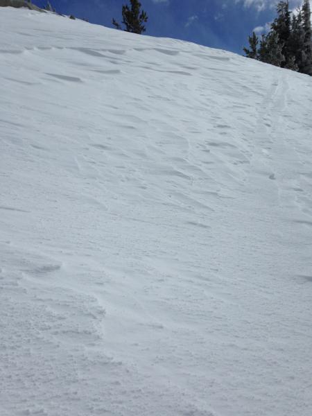
First photo - when you find a patch where the wind has scoured away all the new snow, down to ice, it's time to look for where that snow has gone.

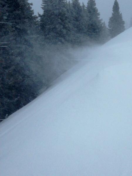
Second photo - wind drifting snow

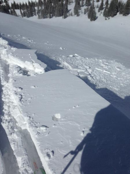
Third photo - Cracky soft cornice along the ridge line.

Today's Observed Danger Rating
Moderate
Tomorrows Estimated Danger Rating
Moderate