Observation Date
4/1/2014
Observer Name
Ted Scroggin
Region
Uintas » Bear River Ranger District » Gold Hill
Location Name or Route
GoldHill
Weather
Sky
Broken
Precipitation
Moderate Snowfall
Wind Direction
Southwest
Wind Speed
Moderate
Weather Comments
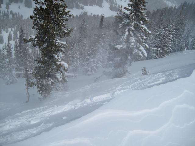
On again off again snow showers, some fairly heavy at times and moderate to gusty southwest winds on the ridge tops. The brief periods of sunshine allowed for some visibility in the area and did not notice any recent avalanche activity.
Snow Characteristics
New Snow Depth
6"
New Snow Density
Medium
Snow Surface Conditions
Powder
Wind Crust
Melt-Freeze Crust
Damp
Snow Characteristics Comments
Looks like around 6-8" in the Gold Hill area, at times it rode more like 10-12" from the wind moving snow around. A great time of the year to be out moving around the hills with nice fresh snow and good supportable snow. It did not take long for the sun to glop-up the new snow on the sunny aspects, while nice powder is still on the high north facing slopes.
Red Flags
Red Flags
Wind Loading
Cracking
Red Flags Comments
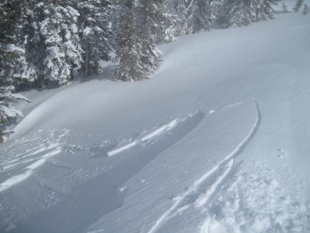
Fairly strong winds on the ridge tops today moving lots of snow around creating fresh wind drifts. Some of these wind slabs were getting a little on the unmanageable size in the more exposed terrain. Stomping around on the ridgelines where the winds were quite strong for a time this afternoon, some of the wind slabs were breaking out up to 2' in depth. Although shallow and only involving the new snow, in steep terrain these could start to pack a little punch and pile up the snow.
Avalanche Problem #1
Problem
Persistent Weak Layer
Trend
Same
Problem #1 Comments
With each passing wave of weather, the winds ramp-up and increase the avalanche hazard in the higher terrain as was the case today. The hazard is most pronounced on east and northeast facing slopes due to the winds from the southwest.
Avalanche Problem #2
Problem
New Snow
Trend
Increasing Danger
Problem #2 Comments
I went with new snow issues as the second avalanche problem, although isolated, I still think there are some lurking places where a deeper slab could still be triggered. With periods of sun, wind and snow, any new snow will quickly take on heat and both damp and dry sluffing is possible.
Comments
Fresh wind slabs were the big issue I found today along the high ridgelines. With new snow and strong winds, some of these slabs were approaching the unmanageable size breaking up to 2' in depth. Only involving the new snow, but in steep terrain these could quickly get out of hand and pile-up the snow.
Today's Observed Danger Rating
Considerable
Tomorrows Estimated Danger Rating
Moderate