Sign Up for the Utah Snow and Avalanche Workshop (USAW) on December 7th!

Observation: La Sal Mountains

Observation Date
12/22/2013
Observer Name
Trenbeath
Region
Moab » La Sal Mountains
Location Name or Route
Laurel Highway-Gold Basin
Weather
Sky
Scattered
Wind Direction
Northwest
Wind Speed
Light
Weather Comments
Perfect winter day. High temps in the teens, Sun with scattered clouds.
Snow Characteristics
New Snow Depth
5"
New Snow Density
Low
Snow Surface Conditions
Powder
Wind Crust
Snow Characteristics Comments

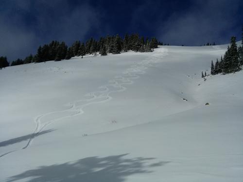
Surprisingly refreshed out there with 4"-6" new over the course of three days. Wind crust at exposed, upper elevations, other wise, nice dusting on buried wind/sun crusts. Excellent conditions in sheltered areas with new snow on top of old re-crystallized powder. Cold temps and scattered clods kept snow good on south aspects.

Red Flags
Red Flags
Poor Snowpack Structure
Red Flags Comments
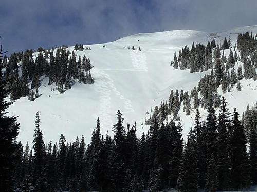
The snowpack structure is widely variable. In wooded areas, on shady, sheltered, mid-upper mid elevation slopes where the snow pack is less than 30" deep, it is almost entirely faceted. In areas where the pack is deeper, it is much more stratified with varying layers of strength and weakness. Persistent slab still remains over buried depth hoar, but it is stuborn to release. Mid and upper level facets exist sandwhiched between hard wind slabs and consolidated snow.
Avalanche Problem #1
Problem
New Snow
Trend
Same
Problem #1 Comments

Persistent slabs on mid-upper elevation NW-E facing slopes remain the primary concern though they are currently stubborn to release.

Snow Profile
Aspect
Northeast
Elevation
11,400'
Slope Angle
25°

Dust on crust on south aspects. One more day to get it!

Today's Observed Danger Rating
Moderate
Tomorrows Estimated Danger Rating
Moderate
Coordinates