Observation: Brighton Perimeter

Observation Date
1/1/2026
Observer Name
Maushund, Lais
Region
Salt Lake » Big Cottonwood Canyon » Brighton Perimeter
Location Name or Route
Hidden Canyon
Weather
Sky
Overcast
Precipitation
Moderate Snowfall
Wind Direction
Southwest
Wind Speed
Moderate
Weather Comments
A stormy, overcast day day up at Brighton, with the cloud deck dropping below 10,100' at times. Moderate snowfall (S2) of snow hovering just below freezing. Snow line varied between 7800-8000' feet up Big Cottonwood Canyon. Light SW winds below 9600', with moderate ridgeline winds near 10,000'.
Snow Characteristics
New Snow Depth
5"
New Snow Density
Medium
Snow Surface Conditions
Powder
Dense Loose
Snow Characteristics Comments

We came to the area to get eyes on the avalanche in Hidden Canyon above Brown Spot that Public Observer Chester reported to us yesterday, that likely ran on Tuesday on a NE-facing slope near 10,100 feet (see his ob HERE). A huge thanks to Brighton Snow Safety Director Malia Bowman for welcoming us for a visit. Getting near the flank of the slide, we observed previous wind loading from earlier in the day as well as active transport building notable wind slabs in the start zone. While we weren't able to get into the crown of the slide, we approached from below from a safe distance and were able to poke into the snow on a comparable aspect, at a slightly lower elevation.

HS varied 40-55cm, with 4-5 inches of fresh new snow falling throughout our day. On a NNW-facing slope near 9700', we were not able to get full propagation, but were able to initiate a fracture on weak snow below the CERC in snowpack tests.

Red Flags
Red Flags
Recent Avalanches
Wind Loading
Poor Snowpack Structure
Avalanche Problem #1
Problem
Persistent Weak Layer
Problem #1 Comments

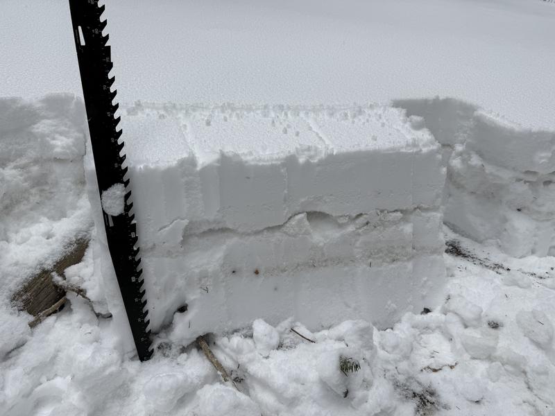
Spatial variability of the supportability of the Christmas Eve Rain Crust (CERC) is the main question with the PWL. In many areas—the majority, from what I've observed in the Salt Lake zone—the crust is stout, supportable, and unlikely to allow for a rider to trigger a persistent slab avalanche on the weak snow below. However, there are areas—like where this avalanche was triggered above Brown Spot—where the supportability of the crust varies, and it's still possible to trigger a large slide on the PWL. The characteristics of this terrain are steep, northerly (NW-N-NE) terrain, typical below ridgelines near rocks where the snowpack may be thinner. While we weren't able to get close enough to inspect the crown, we were able to glass to see that the original slide likely broke near the ground on weak, old snow. There were many tracks on other parts of the slope, so we cannot say for certain if it was remotely triggered, triggered by a skier/rider, etc.

There also are facets developing below the CERC, which will be something to keep an eye on.

Avalanche Problem #2
Problem
Wind Drifted Snow
Problem #2 Comments

We observed active wind loading near ridgeline with sensitive, shallow slabs.

Snow Profile
Aspect
Northwest
Elevation
9,700'
Comments

SnowPilot profile will not populate due to website issues.

Today's Observed Danger Rating
Moderate
Tomorrows Estimated Danger Rating
Moderate
Coordinates