Went into the field with a few main questions: where was the rain line, how was the new dense snow bonding to the old snow surface, and how was the spatial variability and overall distribution of the crust above 10,000' where we traveled.
The first thing we noted was the rain line, which consistently transitioned from more translucent to less translucent snow around 7800 to 8000'. It appeared to drop around 11AM. That said, we also observed the snow surface becoming damp and slushy around 8800'.
Along the ridgelines, transport was obvious. Northeasterly facing aspects were actively loading and were reactive to small ski cuts. At upper elevations, it was easy to kick off shallow wind slabs failing 6 to 10" deep at the new snow old snow interface. In shovel shear tests, the new snow consistently failed at this interface and did not fail deeper on the crust layer. As the winds continued through the afternoon and into the evening, we assumed wind drifts would keep growing off the ridgelines and within terrain features, remaining sensitive.
On westerly aspects, ridgelines were either stripped to the crust or significantly shallower just a few hundred feet downslope. In some areas, the snowpack remained thin, with little to no windloading, and the crust was notably more supportable.
Finally, the spatial variability and crust distribution. We weren’t focused on propagation or test results within the crust itself, but rather its overall presence and layout across the terrain. A North to Northeast facing slope at 10,400' closely matched what Dave Kelly found near Sunset Peak: shallow wind drifted snow over last week’s storm snow, with a thinner Christmas crust just over 1" deep and mixed snow beneath, and dry faceted snow near the ground.
When we shifted to a West to Northwest facing slope around 10,300', we found a much shallower but more cohesive snowpack with minimal windloading. Here, the crust structure was stronger and more layered, showing a series of 2 to 3" crusts with old snow between them. This setup was distinctly different from the East and Northeast aspects.
Overall, this continues to highlight the large variability in crust distribution. Upper elevation, steep, rocky, polar-facing aspects remain the most suspect.
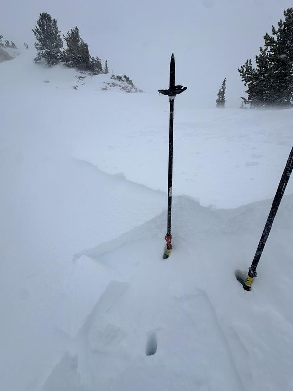
Shallow pockets of wind-drifted snow, North/Northeast/10400'
The generally shallower snowpack with more crust interfaces - NW - 10300'