Observation: Horse Creek

Observation Date
1/1/2026
Observer Name
Ryan Huels
Region
Moab » Horse Creek
Location Name or Route
Horse Ceek
Weather
Sky
Obscured
Wind Speed
Moderate
Weather Comments
Started my tour around noon and did not see a flake fall while I was out. Sky was foggy/overcast with light/moderate winds out of the S/SW with higher speeds up on ridge lines. Temperature was warm, right around freezing and previous snowfall was damp. Moisture expected to continue tonight into tomorrow morning hopefully leading to a few more inches of snowfall and then clear weather over the weekend. More chances for precipitation being next week into the first half of January. Hopefully some of the systems deliver and bring cooler temperatures because the mountains certainly need it.
Snow Characteristics
New Snow Depth
4"
New Snow Density
Medium
Snow Surface Conditions
Powder
Damp
Snow Characteristics Comments

Overall conditions are not great, but the new snow did soften things up if you are able to find places with an existing snowpack. 3-4” of dense new snow up above 10500’ in the Horse Creek drainage. Rain snow line appeared to be around 8000’-9000’ with only around 0.5” of snow at the winter parking lot. New snow was dense and damp resembling the type of snow you might see in April/May. Wild for this time of year. Underneath the new snow, the snowpack is very thin but supportable for travel and tuns on skis/boards and punchy on your feet. The recent rain and warm temps have created a supportable layer under the new snow that makes travel easy. Despite the feel of a spring like snowpack on top, digging down will show you that is not the case of the entire snowpack. It is still very thin out there and obstacles lurk just beneath the new snow.

Red Flags
Red Flags
Wind Loading
Poor Snowpack Structure
Red Flags Comments
SW winds transporting the new 2-4” of snow onto leeward N-NE aspects where we already have the presence of weak layers. Digging down into the snow on a W aspect reveled the presence of weak faceted layers in the snowpack. While I don’t feel the 2-4” is quite enough to tip the scale yet, continued snowfall and wind tonight may do so in certain areas on polar aspects which have weak faceted snow down below. My observed rating today was LOW with potential to rise to MODERATE tomorrow depending on snow totals tonight and tomorrow’s morning.
Avalanche Problem #1
Problem
New Snow
Trend
Increasing Danger
Problem #1 Comments

2-4” of damp and heavy new snow with potential for more tonight puts the first new load on our snowpack for the first time in quite a while.

Avalanche Problem #2
Problem
Wind Drifted Snow
Trend
Increasing Danger
Problem #2 Comments

SW winds continue tonight transporting new snow onto N-NE-E aspects.

Snow Profile
Aspect
West
Elevation
10,800'
Slope Angle
18°
Comments

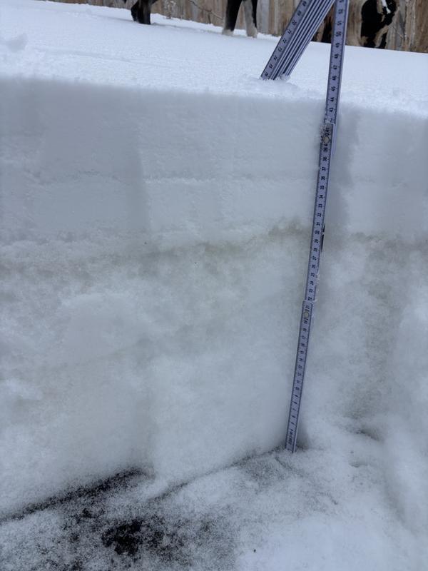
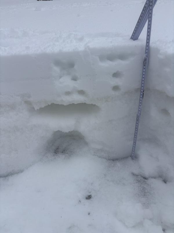
Snowpack on a W facing aspect in the trees at 10875 feet shows the pencil hard rain crust below our new snow that allows for supportable travel and turning. But below this are multiple, fist dense, weak layers that definitely could be a problem if we receive enough of a load to put a strain on them.

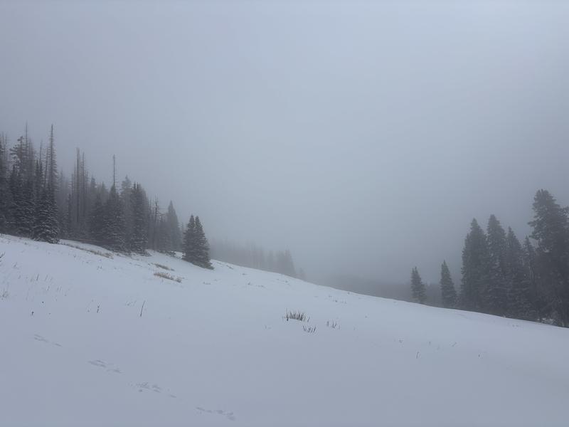
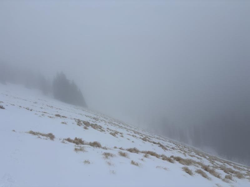
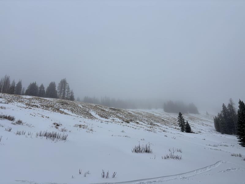
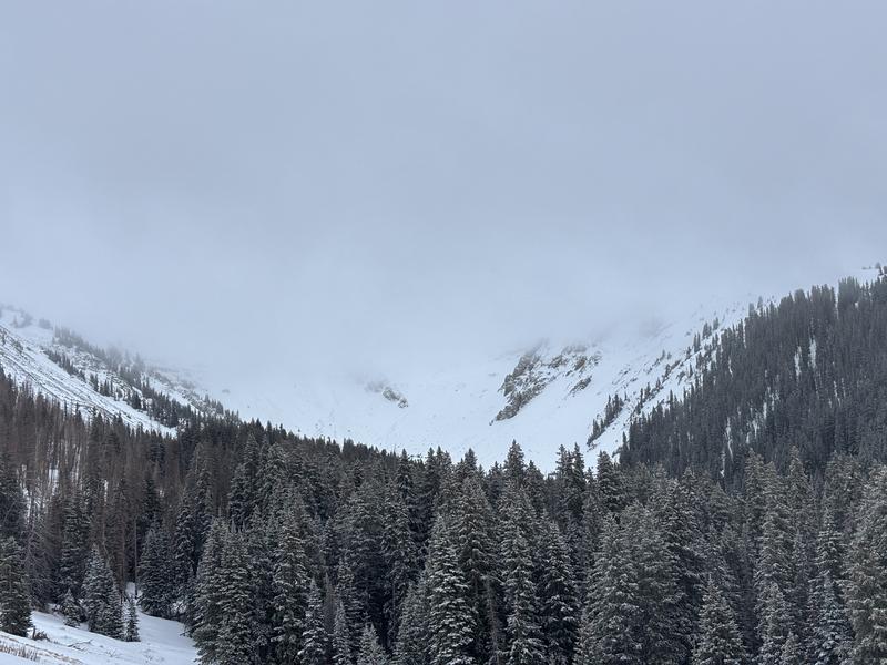
Snow on W, SW and S facing aspects show state of our snowpack with very thin conditions. And, a peek up into Horse Creek Basin revealed that even on northerly aspects rocks are quite obvious with thin conditions.

Today's Observed Danger Rating
Low
Tomorrows Estimated Danger Rating
Moderate
Snow Pilot URL