
I was pretty curious about this skier triggered avalanche from December 28, 2025 on Sunset Peak. With how hard it rained on the 25th I was pretty sure that the PWL while still in place wouldn't be impacted either naturally or by skiers right away. I thought the issue would be widespread from the highest elevations in the Wasatch to the lowest. What I found on this slope was a much thinner crust from the Christmas storm. It was approximately 1" (3cm thick) and the layers of dirty graupel and ice pellets underneath and around it were impressive. The early season facets, were dry, and 4-6mm in size formed a layer near the ground that was 10 cm (4") in thickness (photo below).
This avalanche failed on these facets near the ground. I was able to get propagation with extended column tests (ECTP 23 and 28 @10cm). I dug this snowpit in the flank of this slide in a slightly less steep zone 34° (see photo 2 below) that had opened up and cracked, but wasn't steep enough to slide further than an inch or two.
This avalanche has me curious about other zones with similar features in the Central Wasatch that are higher elevation, northerly facing slopes that may have received less rain in the Christmas Storm. The crust in this location was very firm and there were areas on this slope that were quite slick, but not nearly as slick as some of the crusts I have seen below 9,500. Some of the crusts at lower elevations have a distunguishable water ice layer.

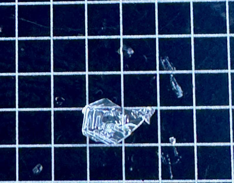
Photo of dry 4-6mm faceted snow (DH) where this avalanche failed 10cm from the ground
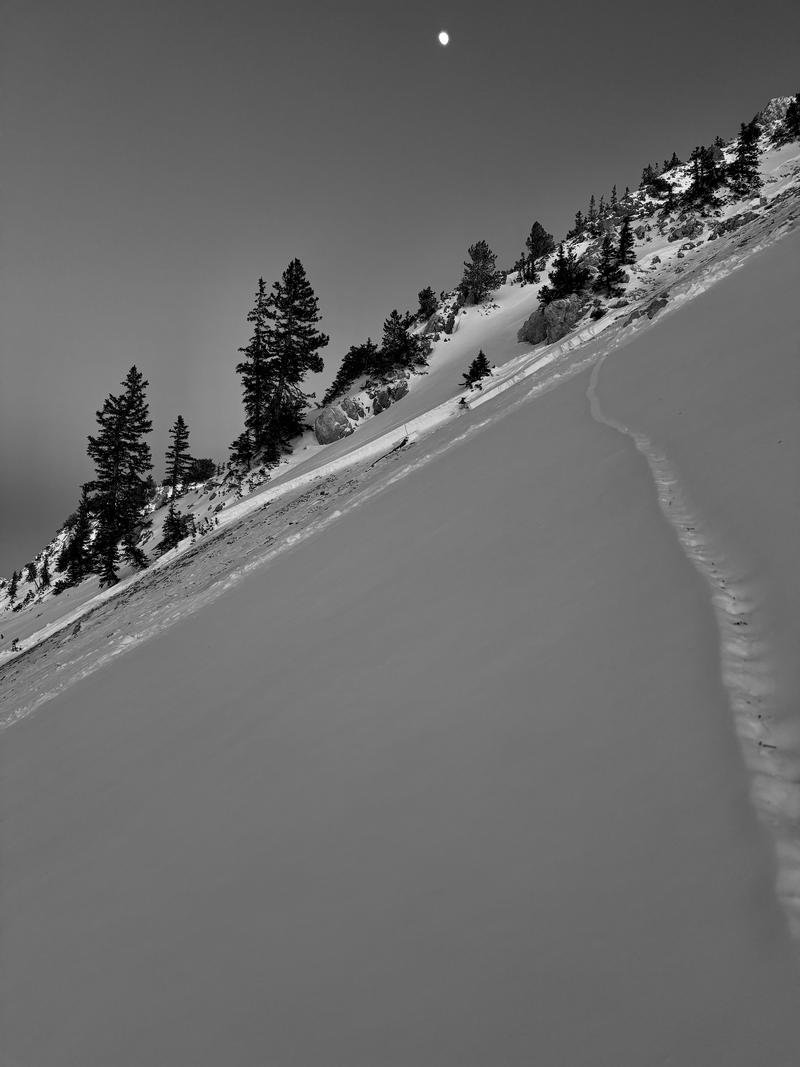
Photo of running crack on lower angle (34°) slope on the flank of this avalanche


