Donate Now to Our Year End Campaign!

Observation: Highline Trail, North

Observation Date
12/29/2025
Observer Name
Champion & Weed
Region
Logan » Southeast Idaho » Emigration Summit Area » Highline Trail, North
Location Name or Route
Emigration Summit North
Weather
Sky
Clear
Wind Direction
Northwest
Wind Speed
Light
Weather Comments
Beautiful bluebird day, clear skies, and cold temperatures.
Snow Characteristics
New Snow Depth
12"
New Snow Density
Low
Snow Surface Conditions
Powder
Wind Crust
Melt-Freeze Crust
Snow Characteristics Comments

Most places held 1 to 2 feet of fresh, low-density snow. Cold temps and a low sun angle hadn’t impacted it on many aspects. On the steeper, true south facing slopes, a thin sun crust had started to form, but anything less steep or shaded was still protected from the sun.

Winds hadn’t moved much snow. We found a bit of wind texture and some deposition on westerly aspects, though it wasn’t widespread. Most trees were still holding all of their new snow. In those zones protected from the wind, there was a bit of surface hoar on the surface.

A small amount of wind-texture on the snow surface on a west-facing slope, but much of the new snow is still in the trees.

Comments

Overall, a really pleasant day of travel. Temperatures kept the snow surface cool in most places. We noted zero signs of instability. No cracking, no collapsing. Even as we stepped into steeper terrain, we didn’t experience any sluffing.

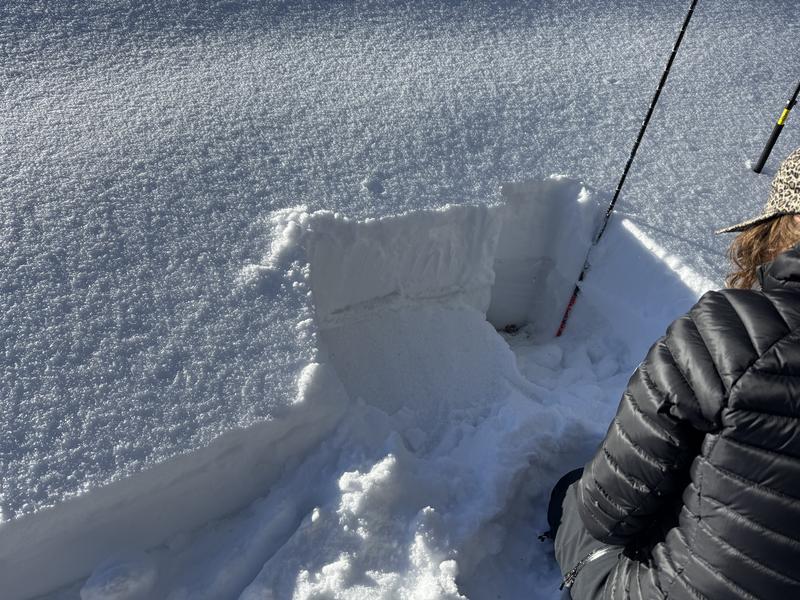
When we dug on both northwest and east-facing aspects, we found a generally similar setup. One to two feet of new, low-density snow sitting on top of a damp but supportable crust interface that extended to the ground. In some areas, the previous layering was still more visible, but the entire bottom of the snowpack was damp or wet. Right now, the supportable crust is acting as the primary interface, and we saw no signs of weakness below the new snow to old snow contact at this time.

Looking ahead, my main concern for the northern Bear River Range is the new snow to old snow interface and how cold evenings affect that boundary. Specifically, will weak snow start to form above the crust as overnight temperatures remain cold.

New snow sitting atop supportable crust - E Aspect - 8100'

Video
Today's Observed Danger Rating
Low
Tomorrows Estimated Danger Rating
Low
Coordinates