Donate Now to Our Year End Campaign!

Observation: Ben Lomond

Observation Date
12/27/2025
Observer Name
Derek DeBruin
Region
Ogden » Ben Lomond
Location Name or Route
Ben Lomond, west side
Weather
Weather Comments
Temp was just above freezing ca 5500ft at 0900. As forecast, temps did not warm throughout the day, and it certainly felt like the teens F in the mid elevations. Winds were fairly light in the AM and then really turned on around 1200, coming out of the northwest, moderate gusting to strong. The cloud ceiling was maybe 6000ft to start the day, with appreciable rime from overnight and throughout the day, with several centimeters on the most exposed and windward trees and rock bands. By 1500 the winds had cleared the clouds and rime, with the cloud ceiling hitting at least 9000ft, and above the summits by dusk. Around 1515 we picked up about 1cm of graupel in the span of 30 minutes, at which point precip rapidly abated to flurries.
Snow Characteristics
Snow Characteristics Comments

Snow surface was largely new snow--rimed forms and graupel--on bare ground. The snow line was as low as 5500ft or so, with 1cm or so accumulated that more or less persisted through end of day. Snow amounts gradually increased with elevation, with 10-15cm of HN on the west slopes of Ben Lomond in the mid-elevation band. Snow density decreased with elevation, but all of it was at least a bit moist.

There were pockets of old snow on protected N and NW slopes in drainages shaded by cliffs. The old snow was as crusty and layered as would be expected from repeated thermal and rain events. In many places it resembled firn and occasionally had even consolidated into alpine ice. The treed W/NW facing slopes below the summit held the only continuous old snow surface.

Comments

Old snow depths ranged 20-50cm, with a set up similar to yesterday's obs from the Powder Mountain periphery: wet throughout (where not frozen), multiple crusts, and facets of varying size and rounding mixed in. We did find snow depths up to 1m in a few deposition zones immediately below steep (50-60 degrees) gullies and cliffs, though these were the exception.

The ample wind regularly moved the surface snow, and there was a bit of spin drift. We didn't note any hard slab formation, though we were certainly on the fetch side of the mountain. There was some soft slab cohesion, but with new snow seeming to bond well to the underlying crust, we did not experience any reactivity under foot. However, we did not travel as high as the summit ridge line, so can't comment much about the upper elevations.

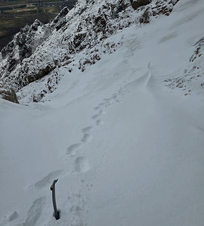
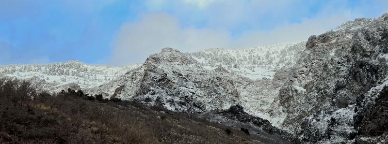
Pictured below are 1) snow surface around 8000ft with a bit of a wind lip visible and some wind-scoured surface and 2) upper elevation W facing slopes above mid elevation rocky terrain.

Today's Observed Danger Rating
None
Tomorrows Estimated Danger Rating
None
Coordinates