Donate Now to Our Year End Campaign!

Observation: Emigration Summit Area

Observation Date
12/18/2025
Observer Name
Champion & Talty
Region
Logan » Southeast Idaho » Emigration Summit Area
Location Name or Route
Emigration Summit Area
Weather
Sky
Overcast
Precipitation
Light Snowfall
Wind Direction
Southwest
Wind Speed
Light
Weather Comments
Generally a cool, overcast day. Skies were clear as we drove north, but as we got closer to Emigration Summit, clouds increased and conditions became overcast. At the beginning of the tour there was no precipitation, with calm to light winds. Around 1:30 PM, light snowfall began and southwest winds increased along the ridgetops. There was no measurable accumulation, with very light snowfall throughout.
Snow Characteristics
New Snow Depth
3"
New Snow Density
Medium
Snow Surface Conditions
Powder
Wind Crust
Rain-Rime Crust
Snow Characteristics Comments

A mixed bag of snow surfaces. Today we skied wind crust, ice crust, downed trees, and found a few soft turns. Along ridgelines, wind had a stronger impact on the snow surface, leaving a thin wind skin or exposing the rain crust just beneath the surface. In the trees, the snow surface was more consistent, with 3–8 cm of soft snow sitting on top of a supportable layer.

Snow surface texture 8000' N Aspect

At lower elevations, the snow surface was slightly less affected by wind, though the strength of the winds was still obvious. Debris on the snow surface and large downed trees were widespread, including along the Copenhagen Basin Road.

Large trees down across Copenhagen Basin Road

Red Flags
Red Flags
Wind Loading
Poor Snowpack Structure
Avalanche Problem #1
Problem
Persistent Weak Layer
Trend
Same
Problem #1 Comments

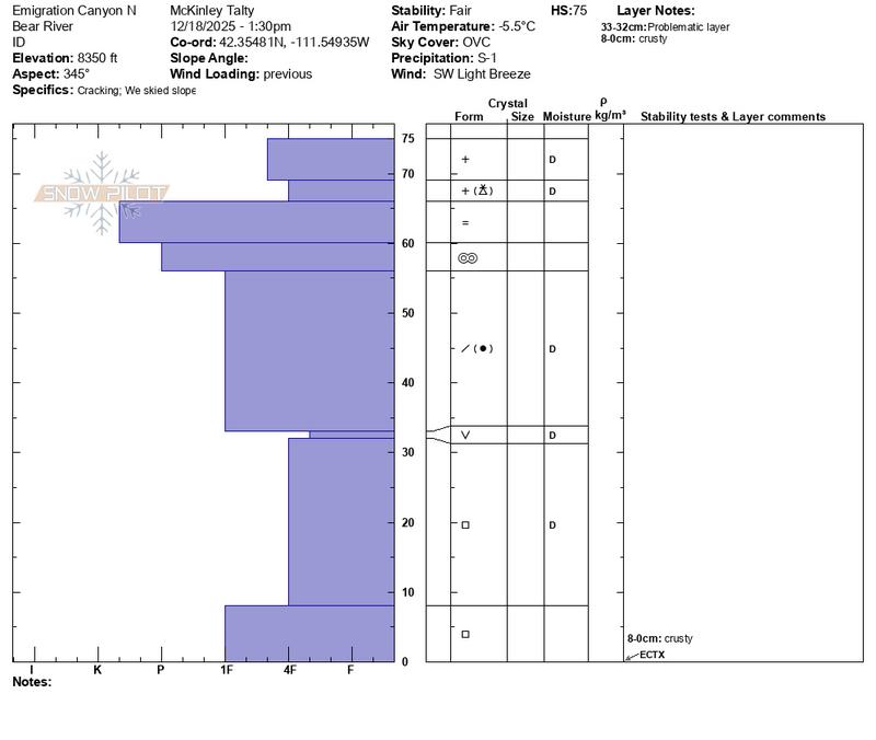
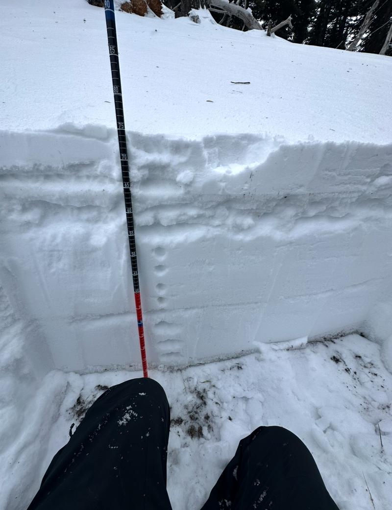
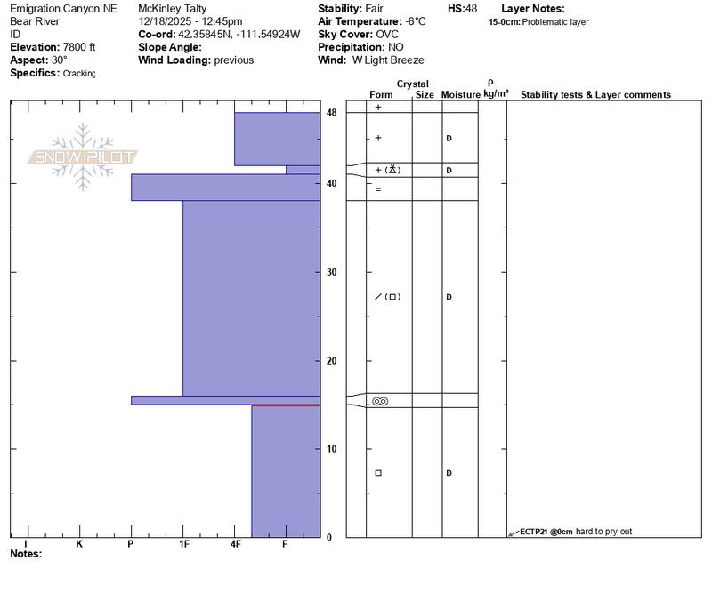
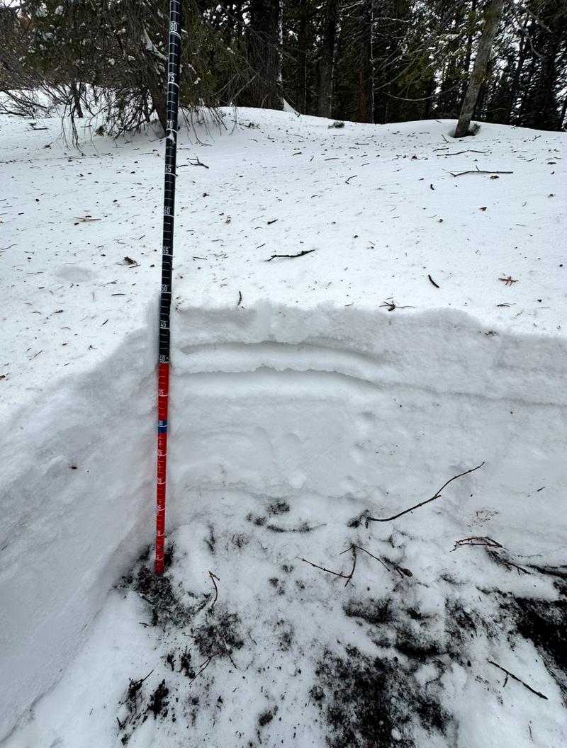
An obviously poor snowpack structure exists on most aspects that held snow from November. Recent storms and rain appear to have capped the weak layer for the time being, and overall sensitivity has decreased since Toby was here about a week ago. Test results either produced no failure on the facets (ECTX), or a collapse with propagation that required significant effort to initiate (ECTP21). In those cases, the failure was not clean.

This problem will likely become more active again with additional loading, particularly from water or wind.

Avalanche Problem #2
Problem
Wind Drifted Snow
Trend
Increasing Danger
Problem #2 Comments

I think the most likely place to trigger an avalanche today would have been a shallow wind slab running on the supportable crust, or in areas where snow was more deeply drifted. That said, the persistent weak layer will likely be the larger issue moving forward as we add more wind and snow.

Approx depth of shallow wind skin or shallow wind drifts - North aspect - 8300'

Comments

Today's Observed Danger Rating
None
Tomorrows Estimated Danger Rating
Moderate
Coordinates