Observation Date
12/17/2025
Observer Name
Torrey
Region
Salt Lake » Big Cottonwood Canyon » Days Fork
Location Name or Route
Days Fork
Weather
Sky
Overcast
Precipitation
Light Snowfall
Wind Direction
West
Wind Speed
Strong
Weather Comments
Overcast and windy this morning before the storm moved in early afternoon. Strong westerly winds along upper elevation ridges, at times working down in the drainage.
Snow Characteristics
New Snow Depth
2"
New Snow Density
High
Snow Surface Conditions
Powder
Melt-Freeze Crust
Damp
Snow Characteristics Comments
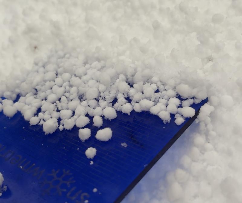
A layer of dust was noted on the snow surface before the arrival of the cold front. Large 8mm graupel improved riding conditions, especially on lower-angle slopes with supportable crust below. Pleasantly surprised. Despite the thin coverage, I found that south-facing slopes made for decent skiing with a supportable, pseudo-refrozen crust beneath and a bit of dense graupel above.
Red Flags
Red Flags
Wind Loading
Cracking
Poor Snowpack Structure
Avalanche Problem #1
Problem
Persistent Weak Layer
Trend
Same
Problem #1 Comments
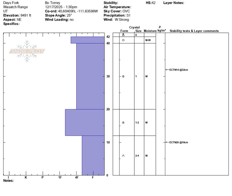
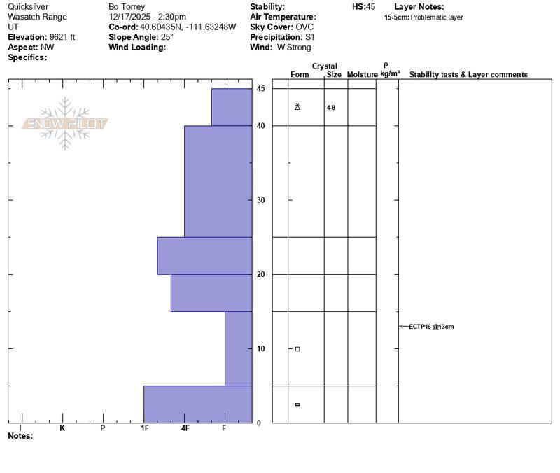
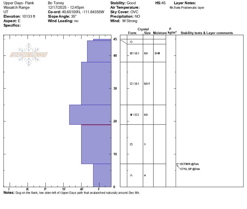
I traveled up the Flagstaff Ridge to look at slopes in Upper Days Fork and see how the snowpack was responding to the recent dry and warm conditions. During the early December storm cycle, each named ski run along the upper cottonwood ridgeline from Upper Days Hideaway Park avalanched at least once. Looking at the remaining snowpack in the Upper Days starting zone showed 4-6" of dry faceted snow remaining above a 2-4" basal ice on the ground. As snow reloads this (and similar) slope(s) I expect will avalanche again. Looking at the snowpack lower in the drainage on sheltered north-facing slopes around 9500' that did not avalanche showed a much different structure. There I found a snowpack that was moist to the ground. The weak layer near the ground was still reactive in some Extended Column Tests, but not all. While this moisture could facilitate strengthening if the weather remains active and the pack deepens, a return to cold, high-pressure conditions would likely weaken the snowpack further. Something to keep an eye on.
Avalanche Problem #2
Problem
Wind Drifted Snow
Trend
Increasing Danger
Problem #2 Comments
While snow available for transport was limited, strong winds drifted snow along upper ridges onto north and east aspects. These winds occasionally reached into sheltered terrain, despite visible snow transport, I did not observe any fresh, sensitive wind drifts as of 4 PM.
Comments
2-3" of Large ~8mm graupel fell with the arrival of the cold front early afternoon. Observed small graupel "waterfalls" in steep rocky terrain pouring over cliffs.
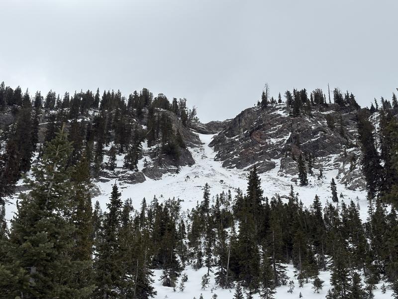
This chute avalanched naturally sometime during the early December cycle. Debris piles were observed lower in the track.
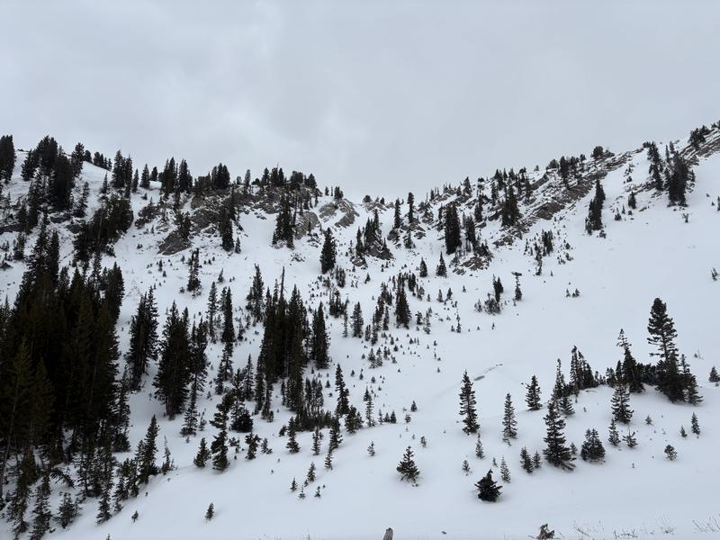
Most slopes in this photo had evidence of avalanche activity from early December.
Today's Observed Danger Rating
Low
Tomorrows Estimated Danger Rating
Moderate
Coordinates